In this post: The crashing seas and imposing rock columns at Bombo Headland Geological Site, south of Sydney on Australia’s east coast
This is the blog of Mark Wordsworm, the travelling worm. I’m a 40-year-old bookmark (give or take a few years) and I proudly boast my own Hallmark serial number, 95 HBM 80-1. You’ll probably want to read all about me and my Travelling Companion (the TC).
Today’s travel notes
This worm has crawled past Bombo Headland several times, on past journeys heading south out of Sydney. Never before have I stopped to see what goes on in the area. A few days ago, me and the TC detoured off the beaten track (namely, the M1) to spend a couple of nights in Wollongong. During our stay, we took the small coastal roads down to Kiama, and on the way we stopped to see the headland.
The book I’m in
The Between by Tananarive Due. The TC has only recently discovered this amazing author. Already, we’re more than half way into our second book of hers, and the TC has bought four more. Count ’em, four! Tananarive Due writes beautifully-composed horror. Get into one of her books as soon as you can.
Travel tips
Take a detour from the highways whenever time allows.
The photos
Me at Bombo Beach:
A short walk from the beach, the waves churn and crash between the rock formations at Bombo Headland Geological Site:
A still photo of the same spot captures the watery turmoil:
The tall, squared-off columns of rock are imposing. The rocky ground beneath the rocks is quite bare, and glares in the hard sunlight. Combined with the churning seas, the effect is a little threatening. Definitely eery.
The columns are made of basalt and have a distinctive hexagonal shape, formed during volcanic eruptions 270 million years ago. Basalt is a hard igneous rock that’s produced when lava cools rapidly.
If you walk around behind the rock towers, the scene is more tranquil. A shallow pool lies quiet in the sunlight:
The occasional wave bounces high enough to breach the gap in the rocks and refresh the pool:
The TC, bless her slightly wet cotton socks, posed in front of another gap. She waited patiently for that Internet-favourite shot with the waves crashing behind her:
Here’s the same Internet-famous spot, without the TC this time:
In this post: Join me on a crawl around the mountain huts of the Victorian High Country in Australia.
This is the blog of Mark Wordsworm, the travelling worm. I’m a 40-year-old bookmark (give or take a few years) and I proudly boast my own Hallmark serial number, 95 HBM 80-1. You’ll probably want to read all about me and my Travelling Companion (the TC).
Today’s travel notes
In our recent travels around the Victorian High Country, me and the TC visited several of the area’s well-known mountain huts. The huts vary from a basic four-walls-and-a-roof structure to quite a solid affair with furnishings. Most of them were built to offer shelter to walkers, cattle folk, and others who might be caught out by the unpredictable weather of the highlands. Some are named for the families who lived in them, like Lovick’s Hut.
The Phenomenon of Man by Pierre Teilhard de Chardin. I’m chewing my way through this momentous work, savouring it a piece at a time.
Travel tips
If at first you don’t spot the dunny (that’s Australian for toilet), take a walk and look again. Most campgrounds and picnic areas have a long-drop.
From the sublime to the ridiculous… a dunny on the Paradise Falls track:
Recommended accommodation
Camping is the best option for a trip around the Victorian High Country. It’s hard to predict where you’ll find yourself at the end of each day. Most likely, you won’t be anywhere near a hotel.
Luckily, the campgrounds are well laid out and most have a toilet, albeit a long-drop. Here are the campgrounds we stayed at.
Seven (count ‘em: 7) days camping in a row. That’s a record for yours truly:
Day 1 (18 February): The campground near Craig’s Hut. Elevation 1,450 metres. It was cold, even in the middle of the Australian summer. This worm recommends a thick book to cuddle up in.
Day 2 (19 February): A camping site on Mount Howitt. Elevation 1,600 metres. It was even colder that night, due to some wind and an early morning mist. The TC, bless her thick cotton socks, wore leggings, gloves, two T shirts, two soft jackets, and a large Dutch jacket, and huddled down into her sleeping bag.
Day 3 (20 February): Eaglevale campground near Dargo. Those who aren’t made of cardboard had a refreshing dip in the Wonangatta river.
Day 4 (21 February): Black Snake Creek campground, again on the banks of the Wonangatta River. The non-cardboard folks took another swim in the river.
Day 5 (22 February): Castleburn Creek campground on Dargo Road.
Day 6 (23 February): Hinnomunjie Bridge campground, on the far side of Omeo.
This worm recommends that you bring all your supplies when travelling the lesser-known roads of the high country. People in the know can snack off bush tucker, but beware: don’t eat anything unless you’re sure it’s good for humans. Some of our party were keen to try these Dianella berries. But not all Dianellas are edible!
The photos
Me at the Washington Winch on Nunniong Road near Moscow Villa Hut:
Yours truly is nicely in focus. That’s how I like it.
Ah, you want to know about the winch too?
The Washington Winch was powered by steam, and built in Seattle, USA, to haul timber up steep slopes.
Here’s the winch hook, which hangs above the track a few metres from the engine:
And now, on to those huts.
Craig’s Hut
If you’ve seen the movie, The Man from Snowy River, then you’ve had your breath taken away by the beauty of the mountain views from Craig’s Hut. Canny readers will spot yours truly on the window sill of the hut in the above photo. To find your breath again, read my separate blog post about Craig’s Hut and The Man from Snowy River.
Bindaree Hut
Pikes Flat Hut
Pike’s Flat Hut was one of the more dilapidated structures. It had horse feed inside, and thistles (an introduced weed in Australia) outside.
Bluff Hut
We stopped at Bluff Hut for lunch and a stroll. The hut was quite substantial, a place I could imagine myself sheltering in if the weather got bad.
Lovick’s Hut
Lovick’s Hut is another substantial, liveable structure.
Howitt Plains Hut
Wonangatta Hut near Bryce’s station
This hut had an attractive, sturdy sleeping platform.
Black Snake Creek Hut
This hut and the nearby camping area are on the banks of the Wonangatta River.
In this post: Craig’s Hut in Mount Buller — the hut was first built as a temporary set for the movie, The Man from Snowy River, and is now a serene place to visit in the Victorian High Country.
This is the blog of Mark Wordsworm, the travelling worm. I’m a 40-year-old bookmark (give or take a few years) and I proudly boast my own Hallmark serial number, 95 HBM 80-1. You’ll probably want to read all about me and my Travelling Companion (the TC).
Today’s travel notes
Craig’s Hut is one of several mountain huts that you can visit when touring the Victorian High Country, Australia. The huts are all different, some basic and some quite solid and well established. Most of them were built to offer shelter to walkers, cattle folk, and others who might be caught in the sometimes wild weather of the highlands. Some of the huts are named for the families who lived in them, like Lovick’s Hut and Fry’s Hut.
Perhaps the most famous of them all is Craig’s Hut, named after a character in the movie, The Man from Snowy River.
The book I’m in
Survive to Fight, by Billy Billingham. This worm is taking refuge in a good action from time to time, while also chewing my way through The Phenomenon of Man by Pierre Teilhard de Chardin.
Travel tips
You need a good thick book to protect you from the elements. It was cold in the high country, even in the middle of an Australian summer.
The photos
Me, the Worm from Snowy River, at dawn on the window sill of Craig’s Hut:
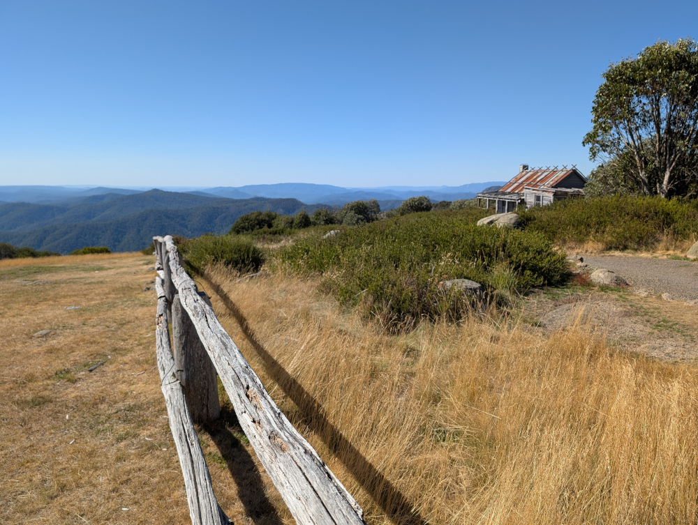
The hut was first built in 1981 for the movie, The Man from Snowy River, which was released in 1982. The movie is an Australian classic, based on a poem by Banjo Patterson. The poem, in turn, is based on the experiences of a real-life stockman named Jack Riley, with inspiration drawn from other mountain stockmen too. The hut was named for Jim Craig, the fictional main character of the movie.
As a temporary replica of a cattleman’s shelter created specifically for the movie, the first version of the hut wasn’t built to last. But it became a popular destination in the Victorian High Country trails. When the structure started to fall apart, it was rebuilt by volunteers at the initiative of the four-wheel driving community: the Mansfield Alpine 4WD Club. The new version of the hut was re-opened to the public in 1993.
In 1996, a bush fire destroyed the second version of the hut, and it was rebuilt by the local council and environmental organisations.
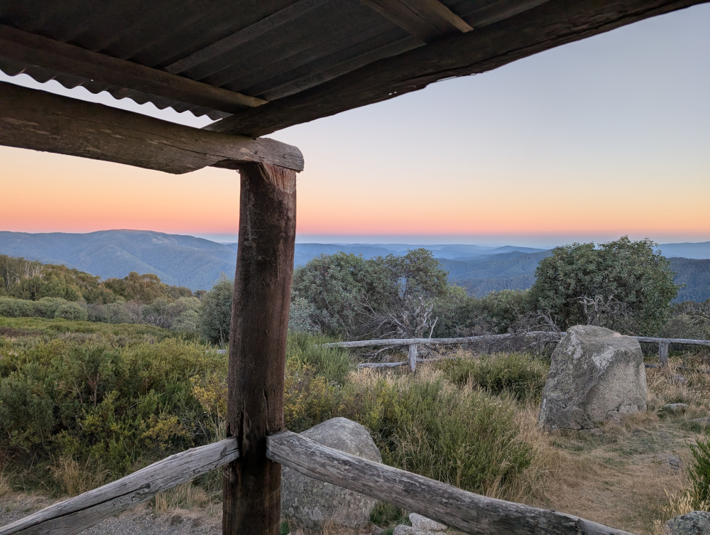
The hut stands high on a hill top in Clear Hills, in the Mount Buller region, overlooking the Alpine Ranges. The views are pretty decent. Hues and accents change throughout the day. Sunset and sunrise are especially gorgeous. This picture was taken from the veranda of the hut at dawn:
Inside Craig’s Hut:
Our route
Take note that the roads are closed for part of the year, due to snow and ice. You can’t get there by vehicle between June and November. The exact dates vary, depending on the weather. Before setting out, check the Parks Victoria web site for seasonal road closures.
We left the small town of Whitfield in convoy shortly after 9am and followed various tracks, primarily Burnt Top Track and Black Landing Road, to Craig’s Hut. It was easy, scenic driving for four-wheel-drive enthusiasts.
In mid morning, we took a break from driving to do the short walk (a few hundred metres) to Paradise Falls:
The trails in the Victorian High Country are surprisingly well supplied with dunnies. Dunny? That’s what the Aussies call a toilet! This one was near the walking track to Paradise Falls:
Here’s a taste of Burnt Top Track:
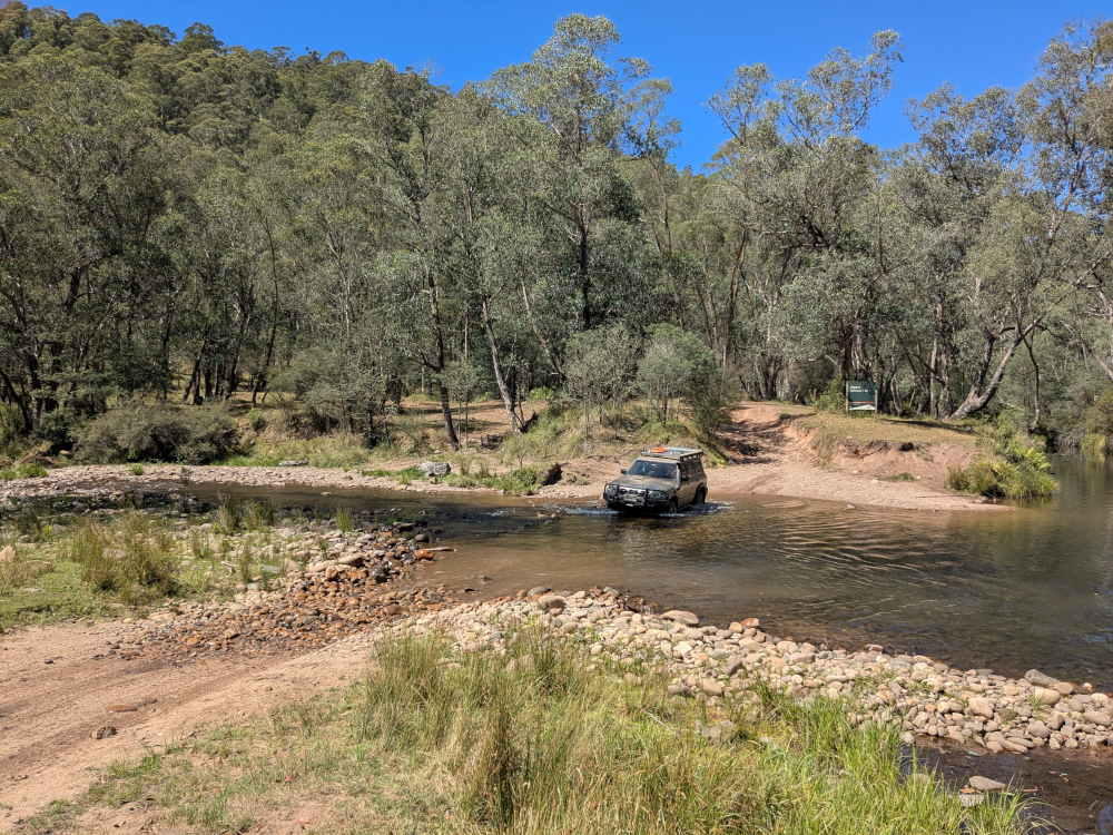
We crossed the King River at Pineapple Flat. The water level was low and, apart from a slightly tricky entry into the gully that leads into the river, the crossing was easy:
We reached Craig’s Hut at around 4:30pm.
Camping
We camped overnight in the campground near Craig’s Hut. The area was beautiful, tranquil, and, at an elevation of 1,450 metres, cold. The TC, bless her woollen socks, was shivering and shaking in her tent. Inside her sleeping bag, she wore thick socks, leggings, two shirts, two fleece jackets, a large padded jacket, and gloves.
Let’s finish off with one more photo of Craig’s Hut, taken soon after our arrival in the late afternoon:
In this post: The Big Koala, The Dog on the Tuckerbox, and a fearsome Fairy-wren, all near the New South Wales country town of Gundagai.
This is the blog of Mark Wordsworm, the travelling worm. I’m a 40-year-old bookmark (give or take a few years) and I proudly boast my own Hallmark serial number, 95 HBM 80-1. You’ll probably want to read all about me and my Travelling Companion (the TC).
Today’s travel notes
On our way to the Victorian High Country, me and the TC stopped for a short break in the country town of Gundagai. The town is a popular stopping place on one of the main routes to the border between New South Wales and Victoria.
Just outside the town, we met a big koala, a dog perched on a tucker box, and a bird that sits still for no-one.
“What’s a tucker box,” you ask? It’s a lunch box. Nowadays, Australians carry their food around in an esky rather than a tucker box. “Esky?” That’s a cool bag or ice box, named after “eskimo”.
The book I’m in
The Phenomenon of Man by Pierre Teilhard de Chardin. Yes, the TC is putting me in some heavy stuff. We’ll see how this turns out.
Travel tips
When driving the Australian highways, take a turnoff and see where it leads.
The photos
Me and the Big Koala near Gundagai:
It was, errm, interesting being so close to those claws. Yours truly survived by dint of keeping a low profile. That’s easy to do when you’re two-dimensional. Just turn sideways on.
There are “big somethings” dotted all around Australia. This worm has already met the Big Bogan at Nyngan and the Kurri Kurri Kookaburra. Now the Big Koala. No doubt the TC, bless her itchy feet, will go in search of more big somethings.
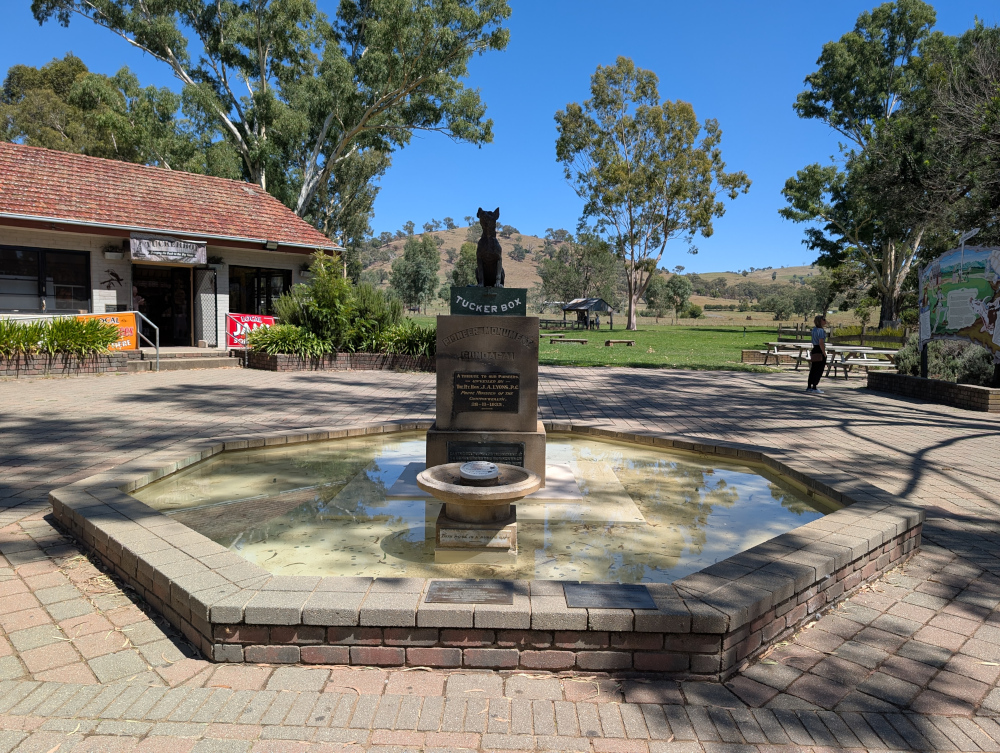
A few million steps from the Big Koala (a few million, that is, if you’re a small worm like yours truly) is the Dog on the Tuckerbox:
The plaque below the dog and the tucker box declares the statue to be a tribute to the pioneers of Australia, unveiled in 1932.
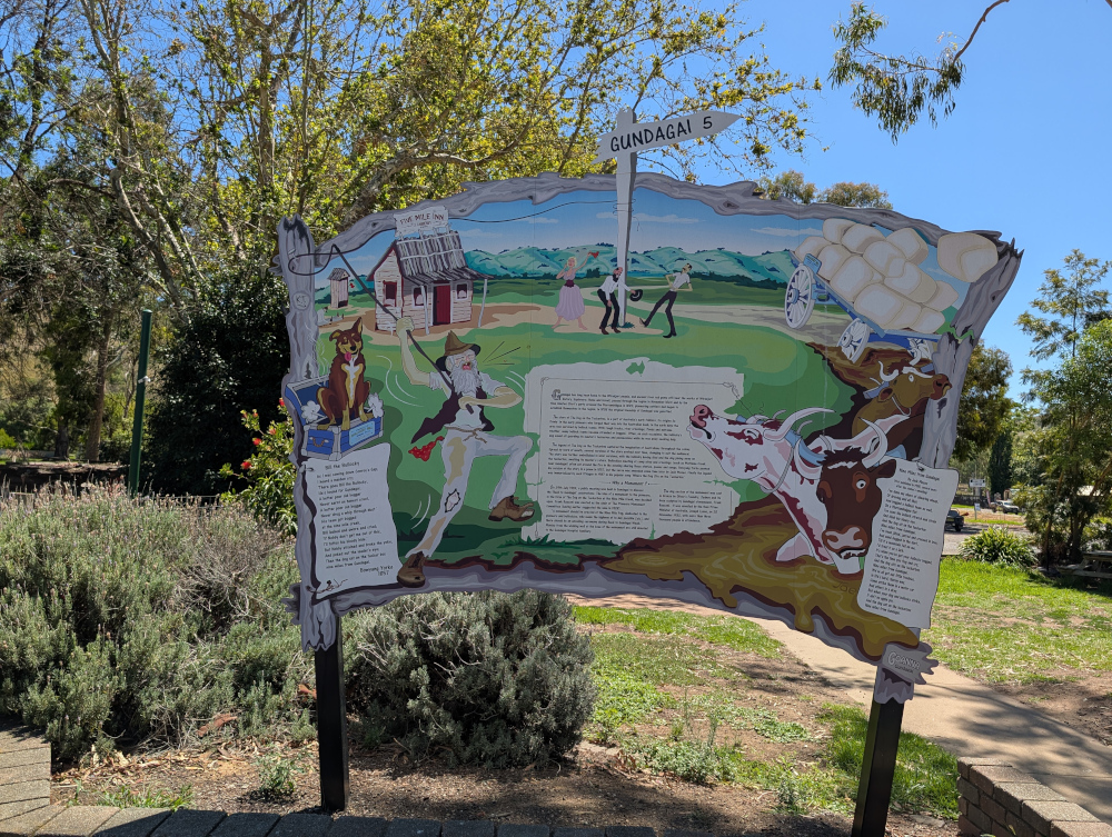
A rustic sign post tells the story:
Ironically, as far as I can tell, the dog that features as the hero of this monument was probably based on lyrics by Charlie ‘Bowyang’ Yorke, who wrote a far less clean poem than the two shown on the sign. In Charlie’s story, the dog did a poo on the cattleman’s tucker box.
I’ve used a more polite word than the original poem, to protect tender ears. You can probably guess the original word: it rhymes with “sat“, which is now used as a replacement in the poem.
What’s more, the dog chose his moment when the cattleman was battling through the hardest of times: his wagon was bogged, the axle snapped, the team of bullocks stuck, and rain starting. The unfortunate cattleman couldn’t even dry his trousers or boil a pot of tea.
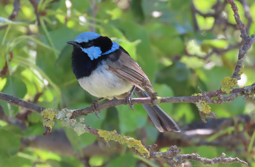
On to prettier things:
In using the word “pretty”, yours truly is of course referring to the lichen on the twigs, not to the beady-eyed creature perched above. That’s a baby dinosaur, known to some as a Superb Fairy-wren, and it eats people like me for breakfast. I stayed hidden in my book while the TC ooh-ed and aah-ed over the monster.
I’ll be back soon with more news about our trip to the Victorian High Country.
In this post: Billy Goat Bluff Track near Dargo in Victoria, Australia, plus some lovely country and a river to camp beside.
This is the blog of Mark Wordsworm, the travelling worm. I’m a 40-year-old bookmark (give or take a few years) and I proudly boast my own Hallmark serial number, 95 HBM 80-1. You’ll probably want to read all about me and my Travelling Companion (the TC).
Today’s travel notes
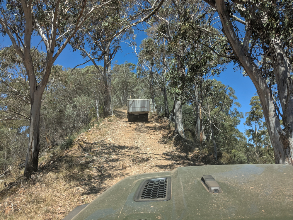
Me and the TC recently spent a week and a half in the Victorian High Country, a landscape of mountains and valleys in the state of Victoria, Australia. On 22 February, we tackled a well-known four-wheel driving track in the area: Billy Goat Bluff Track.
The book I’m in
Jericho’s Dead by William Hussey. This is the second in a series about Scott Jericho, an ex police detective and member of a fairground family who seems to attract serial killers and other nasties. Highly recommended.
Recommended accommodation
Black Snake Creek campground on the banks of Wonangatta River.
Travel tips
Although Billy Goat Bluff track has been graded and is relatively easy driving, many of the tracks in the Dargo area are challenging. Pick your route to and from Billy Goat Bluff with care.
The photos
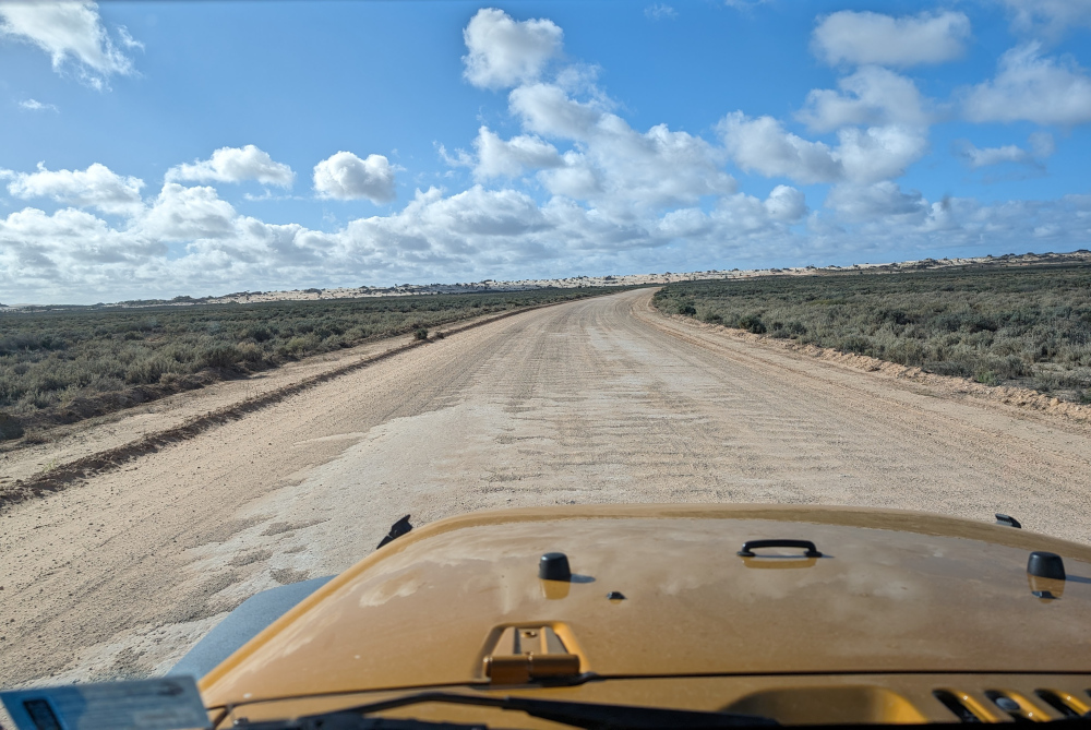
Crawling the tracks is what yours truly does best. So, let’s start with a video of part of Billy Goat Bluff Track, to give you and idea of what it’s like. The track was graded in late 2024. When we were there in February 2025, the driving was easy. But beware the steep drop-offs on both sides!
The TC, bless her cotton socks, talks about the Billy Goat Gruff track in the video. It’s actually Billy Goat Bluff. Rumour has it that the track got its name because to drive it, you need to be as agile as a goat.
The track features a steep gradient of 27%, climbing 1,200 metres over a distance of 7 kilometres.
The TC’s water bottle compressed as if it had been in a jet plane:
How long does it take? It took us less than two hours to drive the track. We started the track itself at soon after 9am and finished before 11am, with plenty of stops for photographs.
Here’s our convoy on the infamous ridge. Those edges give little margin for error or for passing an oncoming vehicle:
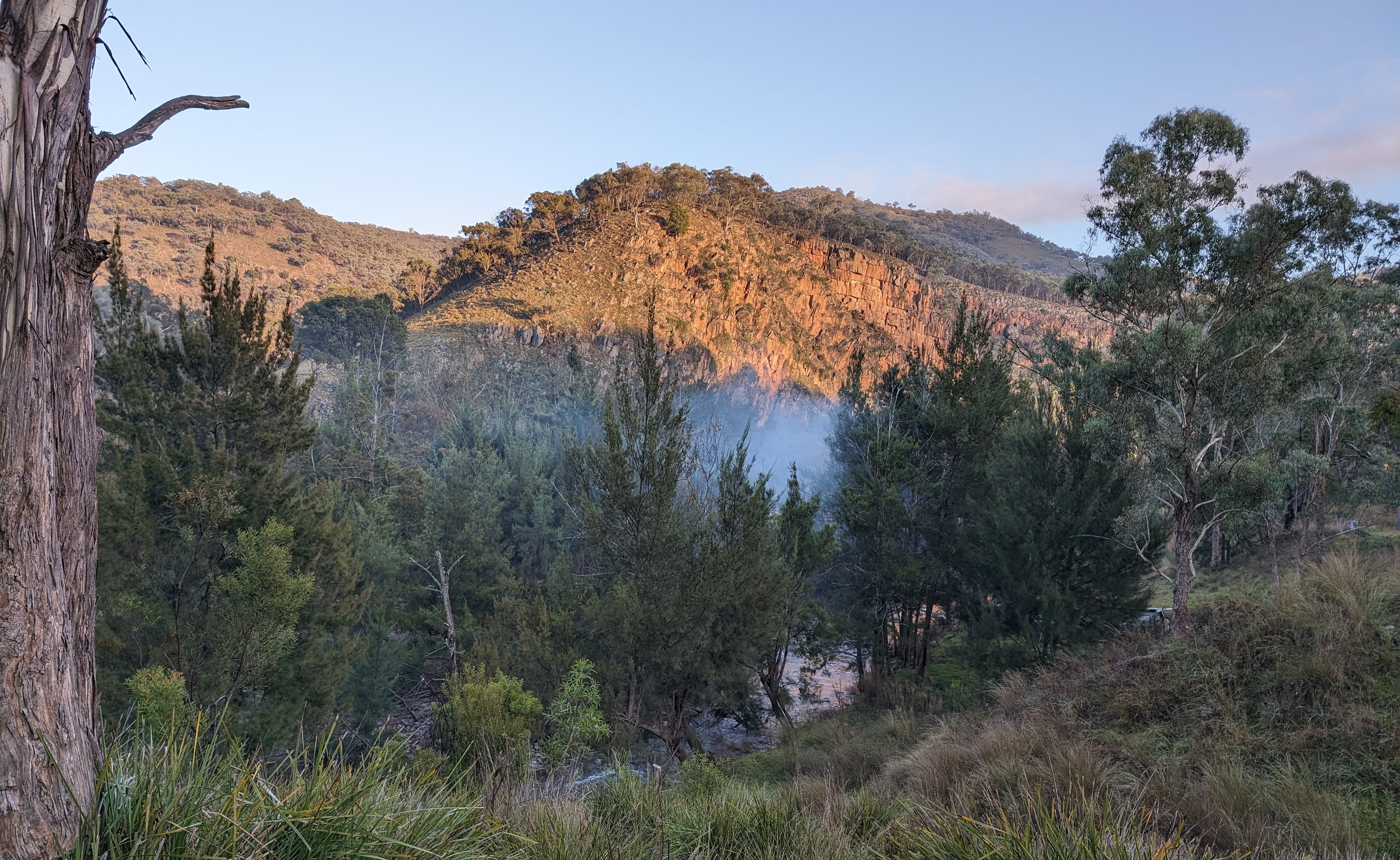
All round us, the peaks and valleys of the high country conspired to make us feel like insignificant worms on the face of the universe (oh wait, I am a worm, and decidedly not insignificant!):
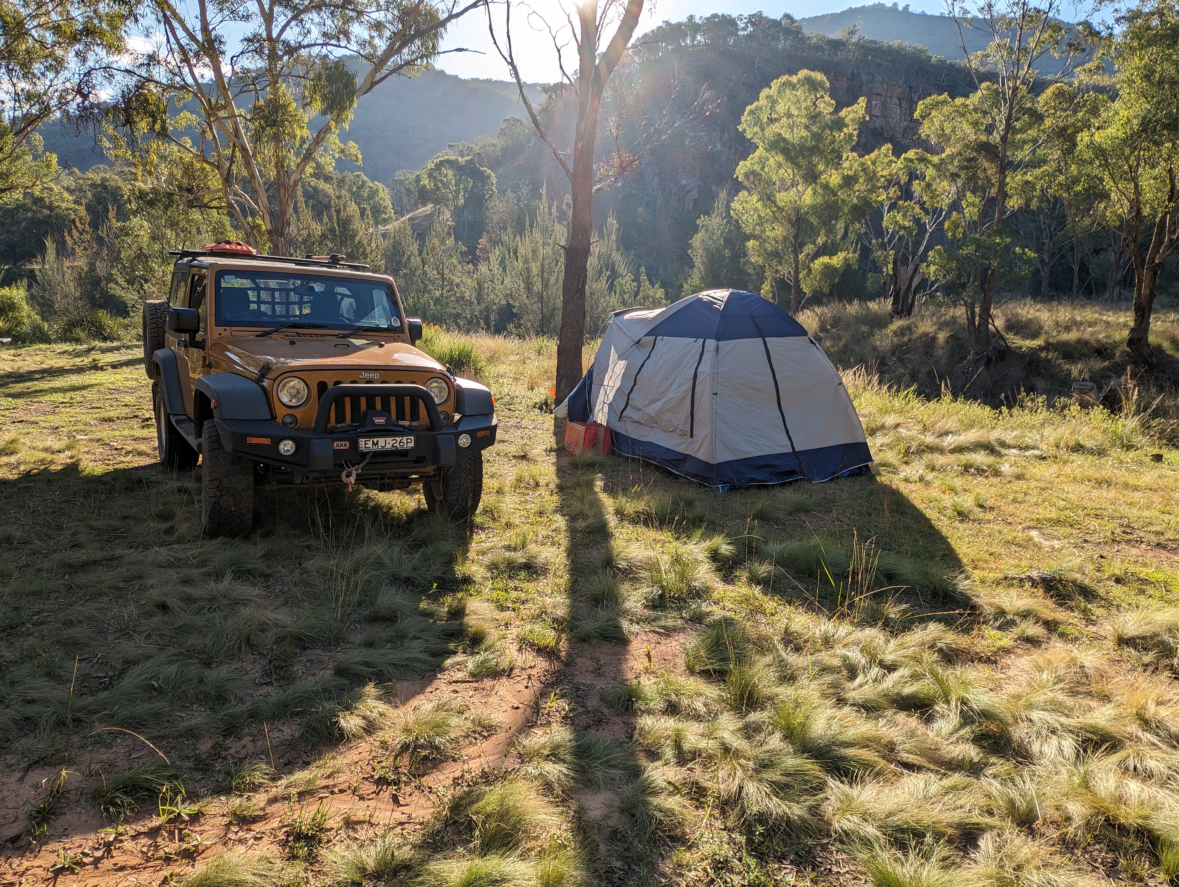
Getting there: On the night before the trail, we camped at Black Snake Creek campground on the banks of the Wonangatta River:
We left the campground at around 8.30am and followed Wonangatta Road northwards for half an hour or so, winding along the banks of the Wonangatta River until we joined Billy Goat Bluff Track.
The lovely Kingwill Bridge on Wonangatta Road:
In case your appetite for Billy Goat Bluff isn’t yet satiated:
After finishing Billy Goat Bluff, we took a short detour to visit Pinnacles Lookout in the Miowera region:
There I met my cousin Dilly the Butterfly:
We then explored some of the tracks around Dargo, which turned out to be much more of an adventure than planned. We helped some folks out of trouble, which meant that we were still on the tracks late at night:
We found our way safely to Castleburn Creek campground at midnight, rounding off another day of happy travelling.
Speaking to the locals in Dargo the next day, we heard that many people find themselves in trouble on these tracks. The maps are not up to date, and as a result people don’t know what’s in store for them. Take care out there on the tracks, make sure you’re in a capable vehicle, and travel with some mates to help if you do run into a tricky situation.
In this post: Meryla Flora Reserve, Morton National Park, and the Fitzroy Falls in New South Wales, Australia. Plus wombat poo, plant snot, a cicada husk, a predatory lyrebird, and a somewhat dark ending.
This is the blog of Mark Wordsworm, the travelling worm. I’m a 40-year-old bookmark (give or take a few years) and I proudly boast my own Hallmark serial number, 95 HBM 80-1. You’ll probably want to read all about me and my Travelling Companion (the TC).
Today’s travel notes
Me and the TC set out to explore some 4WD tracks around Meryla. We discovered that all the dirt tracks were closed to vehicles, due to environmental concerns and track repairs. It’s a beautiful area, so we drove around on the sealed roads instead, exploring parts of Meryla Flora Reserve and the Fitzroy Falls in Morton National Park.
The book I’m in
Machinehood, by S.B. Divya. This is the second book by this author that the TC has put me in, and I’m enjoying it just as much as I enjoyed the first (Meru). Divya has created an interesting and exciting mix of philosophy and science, resulting in an excellent SciFi story.
Travel tips
Take your own picnic, so that you can stop wherever you like to enjoy the scenery and the peace.
The photos
Me at Fitzroy Falls:
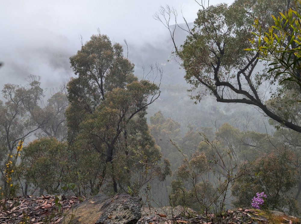
We started our explorations in Meryla Flora Reserve on one side of Morton National Park. The day was misty, which added to the beauty of the forests and valleys.
The TC, bless her cotton socks, was taking great care to avoid all the poo on the ground. A closer look through the camera lens revealed that it wasn’t poo:
Nor was it seaweed. We were far from the coast. No, it’s a type of cyanobacterium (Nostoc commune), fondly known as plant snot. People also call it star jelly, witch’s butter, and mare’s eggs. It’s found world-wide. The part that you see is a sheath made of jelly. The bacteria live inside the sheath, and can form large colonies.
So that’s what the TC was traipsing through. It’s a good thing she was careful, as plant snot is very slippery when it’s wet, as it was here. In long dry spells, it dries out and waits for rain.
To her delight, the TC did encounter some actual poo, perched neatly on a rock:
Poo-bearing rock is a fairly common sight in the Australian bush. Evidently wombats, the makers of these monuments, deposit their offerings on a rock as a mark of territory. He who poos highest has the most influence in terms of spreading scent and being seen.
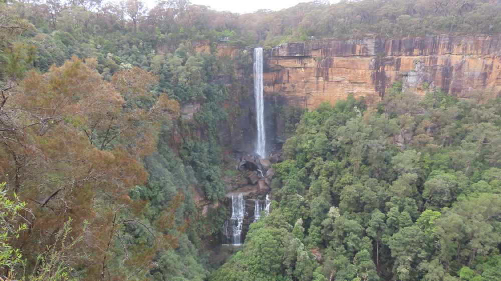
We left Meryla Flora Reserve and made our way to Fitzroy Falls, on the other side of Morton National Park. The waterfall is 81 metres high, formed by the Yarrunga Creek dropping into Kangaroo Valley. To get an idea of the scale, notice the people on viewing platforms on the left and right of the falls in this picture:
This is a view of the valley. The falls are off-camera on the left:
It’s worth walking along the trails on either side of the falls. This lovely old eucalypt, nicknamed The Knobbly Tree, is on the Western Rim Walking Track:
Of course, the TC insisted on a pic of yours truly cuddling up to the tree, in spite of the scary-looking spider webs that covered the bark:
Imagine the spider that lives in the hole sunken into that web. I’m sure this would be a case ofits bite is worse than its bark.
A tranquil view of the falls from afar restored my je ne sais quoi:
Not far away, another peril lurked: a lyrebird scratched through the dirt looking for grubs and chatting to its friend. While the TC ooh-ed and aah-ed, this worm stayed far away from the modern-day dinosaur:
When in natural surrounds in Australia, it’s always worth looking under the picnic table.
Here comes the dark ending that I promised at the start of this post. The TC noticed this cicada husk under the picnic table:
More disturbing, and a caution to an unwary worm, were the pieces of cicada lying on top of the table:
This worm does hope that the cicada who emerged from the husk had time to enjoy life above ground, and that it was another poor insect who fell prey to a bird.
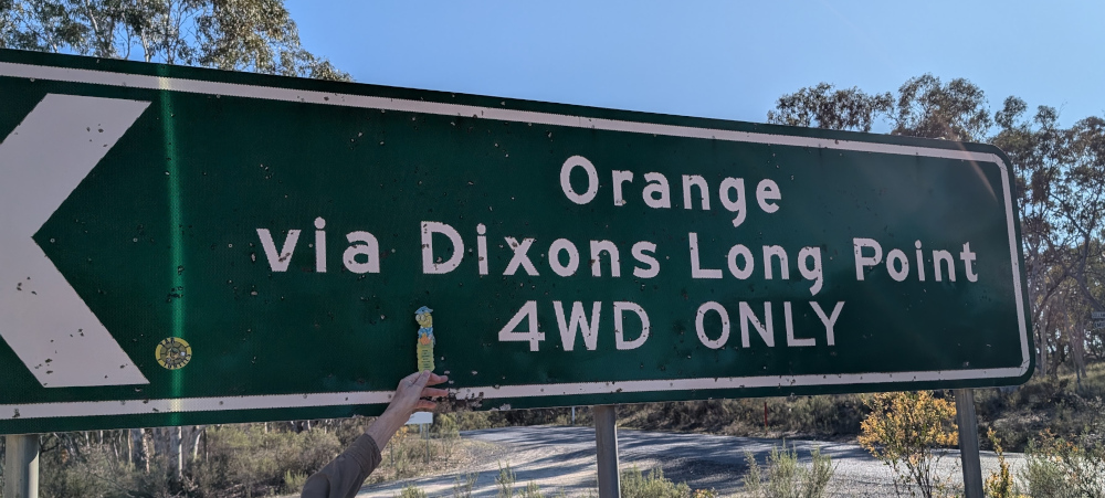
In this post: Crossing the Macquarie River at Dixons Long Point, from the Hill End side. Plus some pictures of the historic town of Hill End and the Golden Gully gold-mining area.
This is the blog of Mark Wordsworm, the travelling worm. I’m a 40-year-old bookmark (give or take a few years) and I proudly boast my own Hallmark serial number, 95 HBM 80-1. You’ll probably want to read all about me and my Travelling Companion (the TC).
Today’s travel notes
Me, the TC, and Beetle the Jeep spent a night in the historic town of Hill End, New South Wales. Early the next morning, we set out to cross the Macquarie River at the well-known Dixons Long Point Crossing.
The book I’m in
Meru, by S.B. Divya. Excellent SciFi about a human and an alloy who fall in love, and about an experiment with human life on planet Meru. Alloys are post-human beings who share human and AI genes.
Travel tips
You’ll need a 4WD vehicle to complete this trip, because of the river crossing. It’s also good to be aware that the Macquarie River is a large river that can carry a significant volume of water after rain. It can be deep and the current can be strong enough to wash away cars and caravans. Always check the conditions before attempting the crossing.
The photos
Me at Dixons Long Point Crossing:
It’s a trifle tricky to decide which line to take when crossing the river. We were driving from the Hill End side to the Bathurst side. The TC had watched several videos of other people making the crossing. The consensus of opinion seems to be that you should cross on the rougher side of the rocks, not the smooth side. Basically, follow the line between the two rows of rocks. That’s what we did. It was bumpy but fun, and the river level was low at the time we made the crossing.
On the other side, the TC, bless her cotton socks, struck up a conversation with a man who looked as if he knew the area. He said that originally, the intended line was on the smooth side of the rocks, where a causeway had been built. But then a flood moved most of the rocks down off the causeway, which resulted in a deep hole at one end. The hole is about the length of many vehicles’ wheelbase, so you can get stuck, especially if the vehicle doesn’t have much clearance. The rougher line is now the recommended route, although it’s basically bedrock.
Let’s back up, now that you’ve seen the crossing, and start at the beginning of the day’s trip…
A night in Hill End
Before starting the drive to Dixons Long Point, we spent the night at Hill End Lodge:
The photo shows the reception area and restaurant of the lodge. We stayed in one of the cabins nearby. Early the next morning, the TC went for a stroll and came across a group of kangaroos. Most of them fled, but a big male stayed to keep watch, along with couple of others, one of which was a female with a joey in her pouch:
The TC, wise soul, decided that discretion is the better part of valour, and altered direction to keep away from the roos.
After breakfast, we paid a quick visit to the town of Hill end:
The Royal Hotel is another good option for an overnight stay in the town:
Golden Gully
We headed north up Hill End Road towards Ullamulla Road, and came across the enchanting Golden Gully:
Holes small and large pepper the eroded walls of the canyon. Many of them lead to shafts and tunnels dug by hopeful gold miners in the 1850s. The gold in this area is alluvial, washed down in several creeks that feed into the gully.
You can walk down the gully to the point where a sign warns of danger:
Ullamulla Road and Dixons Long Point
Me at the junction of Hill End Road and Ullamulla Road:
A sign warns of the nature of the upcoming crossing:
The road itself is an easy drive:
A sheep with a new-born lamb greeted us:
The next video shows the descent towards Dixons Long Point Crossing, on the Hill End side. At about 30 seconds into the video, a wallaby hops across the track in front of the car:
We stopped for a photo opp when we reached the water:
Tip: To see a video of the crossing itself, go back to the top of this post.
With her usual aplomb, Beetle the Jeep arrived safely on the Bathurst side of the river:
This is the blog of Mark Wordsworm, the travelling worm. I’m a 40-year-old bookmark (give or take a few years) and I proudly boast my own Hallmark serial number, 95 HBM 80-1. You’ll probably want to read all about me and my Travelling Companion (the TC).
Today’s travel notes
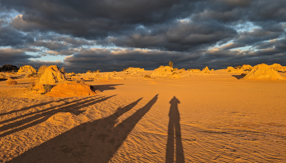
Me and the TC spent a day at Lake Mungo, deep in the Australian Outback. While there, we visited the intriguing sand dune formation named the Walls of China, or the Mungo lunette.
The book I’m in
Where Song Began, by Tim Low. A telling of the origins on the Australian continent of all the world’s songbirds, rich in detail and convincingly told.
Travel tips
Sign up for the sunset tour of the Walls of China. The evening lighting adds beauty and drama to the scene, and you’re able to walk right up onto the dunes with your guide.
Recommended accommodation
Mungo Lodge offers camping and cabins. The TC opted for a cabin, which was very comfortable. The welcome is warm and the restaurant food is good.
The photos
To reach the Walls of China, you drive across the dried-up bed of Lake Mungo. The road is good and wide. On the horizon, the Walls of China grow as you approach:
The extra width of the road is especially welcome at dawn and dusk. It gives you time to see the kangaroos that pop out of the bush at random intervals.
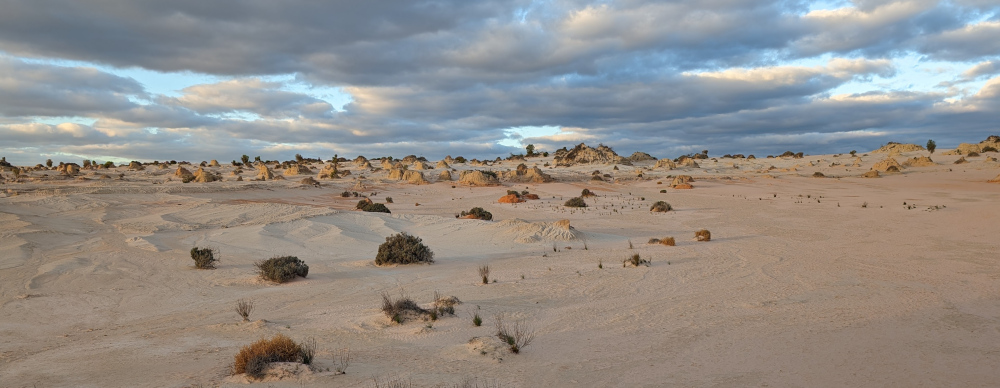
The colours are fluid, changing with the time of day, the weather, the camera settings. In the middle of the day, the sand is all silver and pale yellows. Perhaps this is where the name “Mungo lunette” comes from:
In late afternoon, the yellow of the sun exerts more influence:
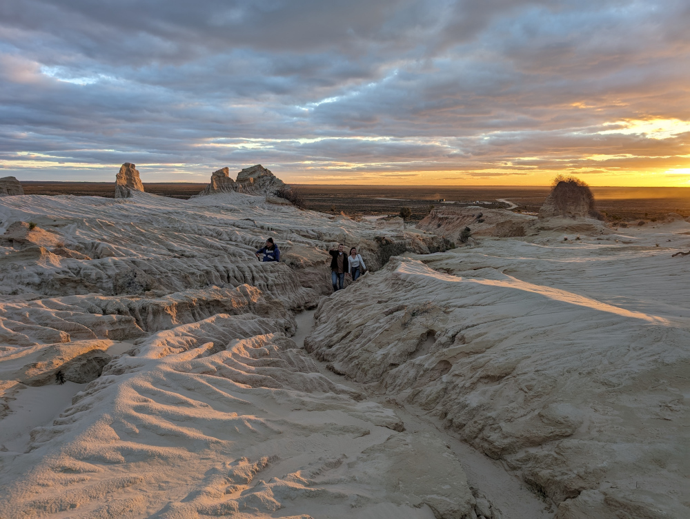
We were with a guide, which meant that we could walk onto the dunes and see the formations up close:
Wind erosion has formed narrow gullies which you can walk through, to avoid damaging the fragile dunes:
Colours deepen as the sun moves lower:
As the sun disappears, it’s time to make our way back:
Come daylight, and we’re on the road again, saying farewell to Mungo National Park:
If you’d like to see more pictures of the national park, read my post titled Lake Mungo.
This is the blog of Mark Wordsworm, the travelling worm. I’m a 40-year-old bookmark (give or take a few years) and I proudly boast my own Hallmark serial number, 95 HBM 80-1. You’ll probably want to read all about me and my Travelling Companion (the TC).
Today’s travel notes
Me and the TC drove the historic Bridle Track and the scenic Root Hog Road this weekend with a group of friends. We camped overnight at Mary Flynn Reserve on the Bridle Track.
The book I’m in
Ten Days in A Mad-House, by Nellie Bly. A somewhat horrifying true tale of a reporter in 1887, who had herself checked into an asylum for the insane and wrote a book about her experiences.
Travel tips
You need a four-wheel drive vehicle to follow the tracks mentioned in this post. If you decide not to camp nor to stop at the various reserves along the way, you can drive the Bridle Track in two to three hours.
The photos
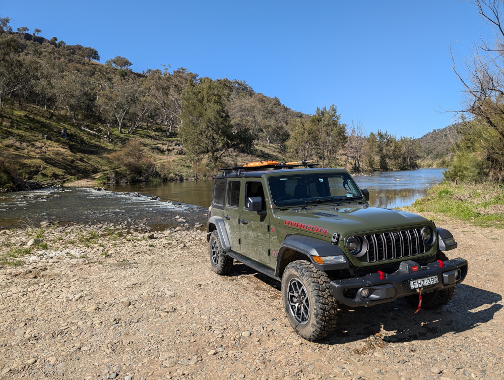
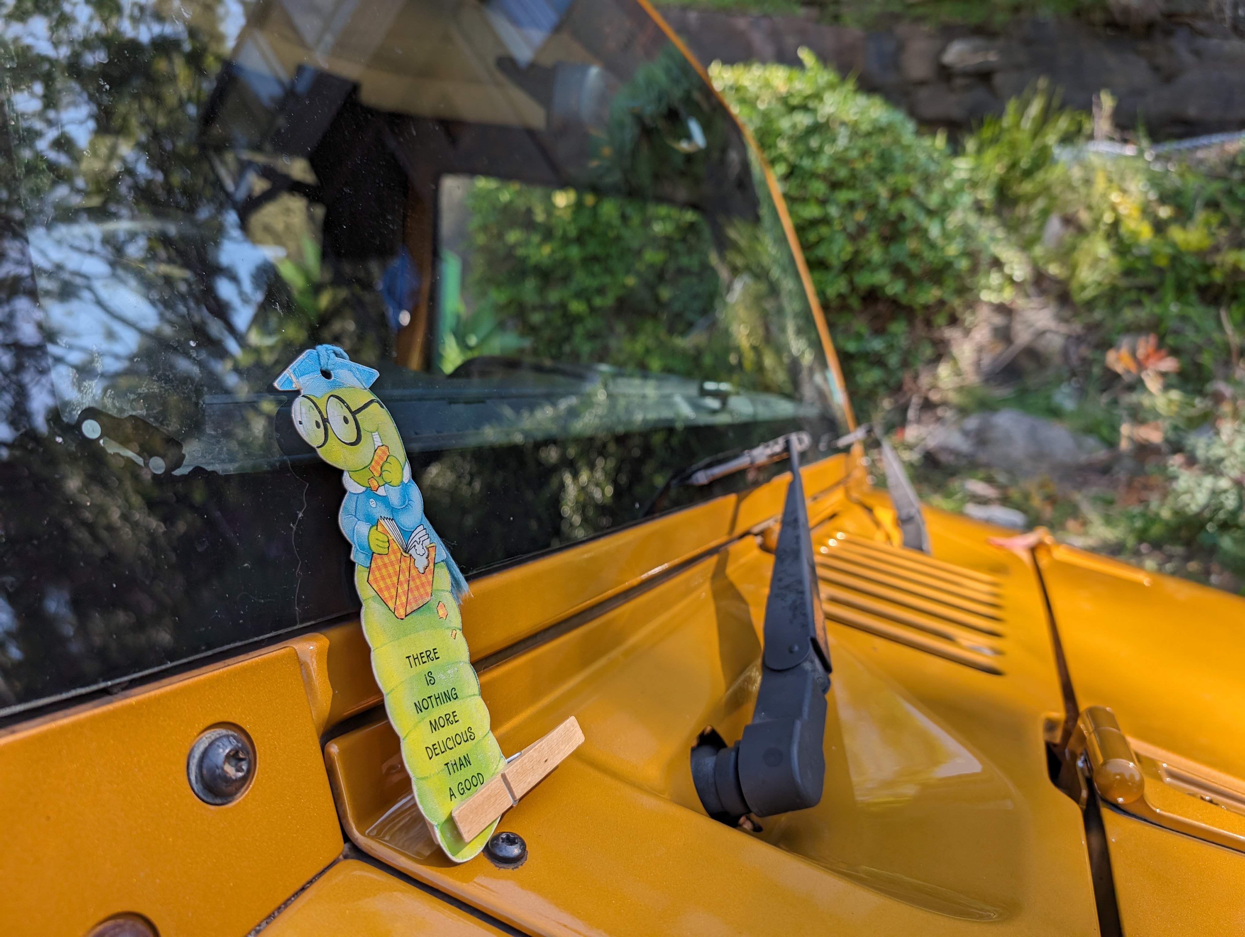
Me with Janet the Jeep and Peg:
Introducing the newest member of our merry menagerie: Janet the Jeep. She’s a 2014 Jeep JK Wrangler, manual transmission, with a 3.6 litre, 6-cylinder petrol engine. She has two side doors rather than four, and is known as a shortie because of her short wheel base. Unlike yours truly, Janet is not built for speed but she’s plucky and strong. More like Peg, in fact.
A keen-eyed reader might notice the little Jeep icon on the windscreen next to this worm. Janet is cute, and she knows it.
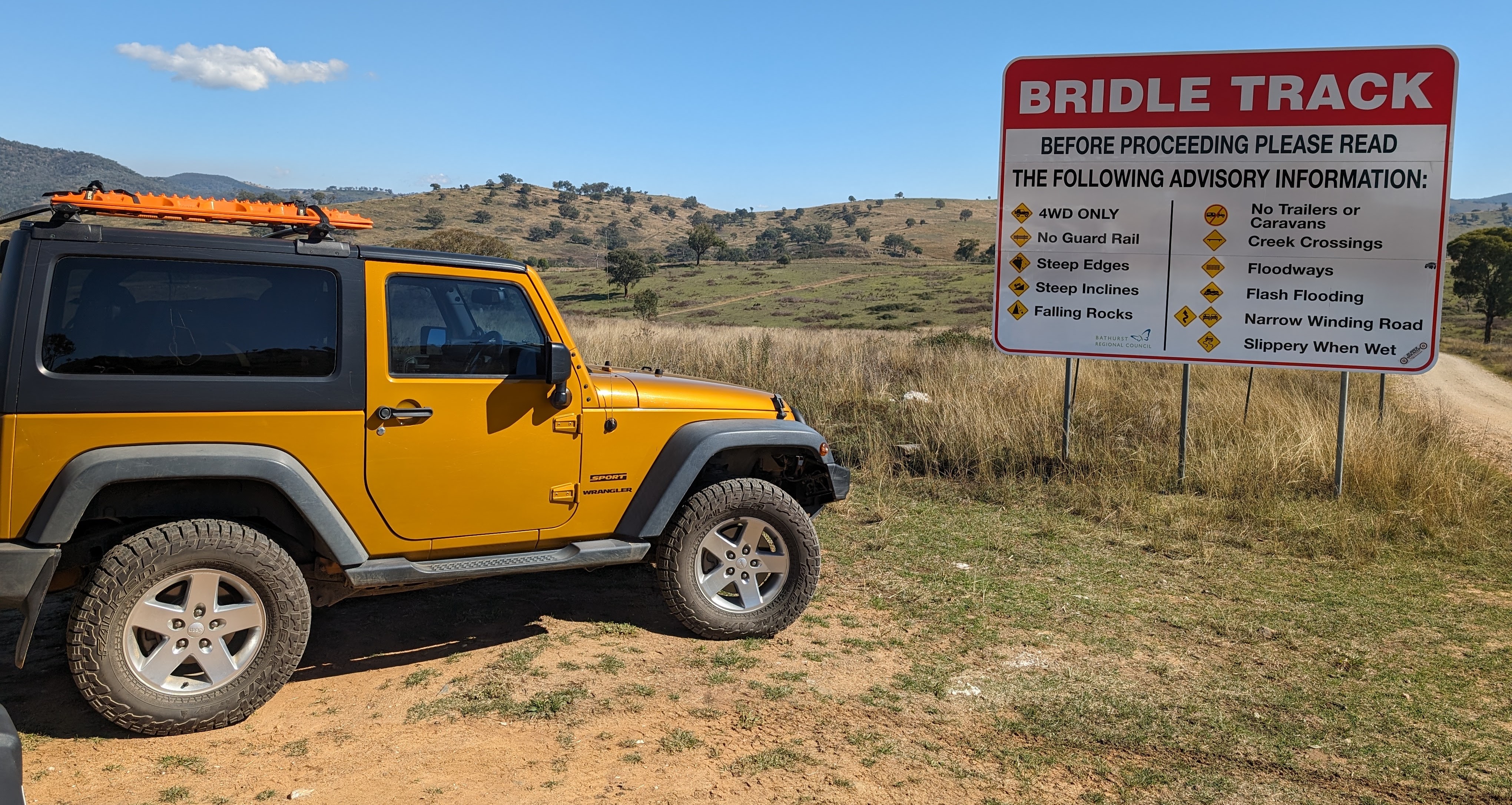
At the start of the Bridle Track, a sign explains the need for a 4WD vehicle and due care:
Most of the track is a well-graded dirt road. In some sections, there’s a high rocky wall on one side and a steep drop-off on the other. In this section, the road curved through a rocky bluff:
In years gone by, one specific section of the Bridle Track was very narrow and slippery: the infamous Monaghan’s Bluff. NSW state has since built a bypass, though a sign still greets you as you enter the area:
The Bridle Track was built in the early 1800s, to give gold miners and settlers a route from Bathurst to Hill End. Bathurst is now a thriving regional city and Hill End is a small town that welcomes visitors interested in the history of the area.
Right on the side of the Bridle Track is an abandoned mine shaft. The brave can walk into it. The TC, bless her cotton socks, counts herself as one of the brave. She found that she could stand, with head slightly bowed, in the tunnel:
We camped at the beautiful Mary Flynn Reserve. This view shows part of the campground and surrounding area, taken from the Bridle Track before descending into the valley:
The Turon River flows past the campsite:
As the sun goes down, Janet stands guard over the TC’s tent:
A rainbow campfire, thanks to minerals added by one of the campers:
In the chill of the early morning (it was 6° Centigrade), the sun warms up the rocks on the opposite side of the river, while neighbours get their campfire going down below:
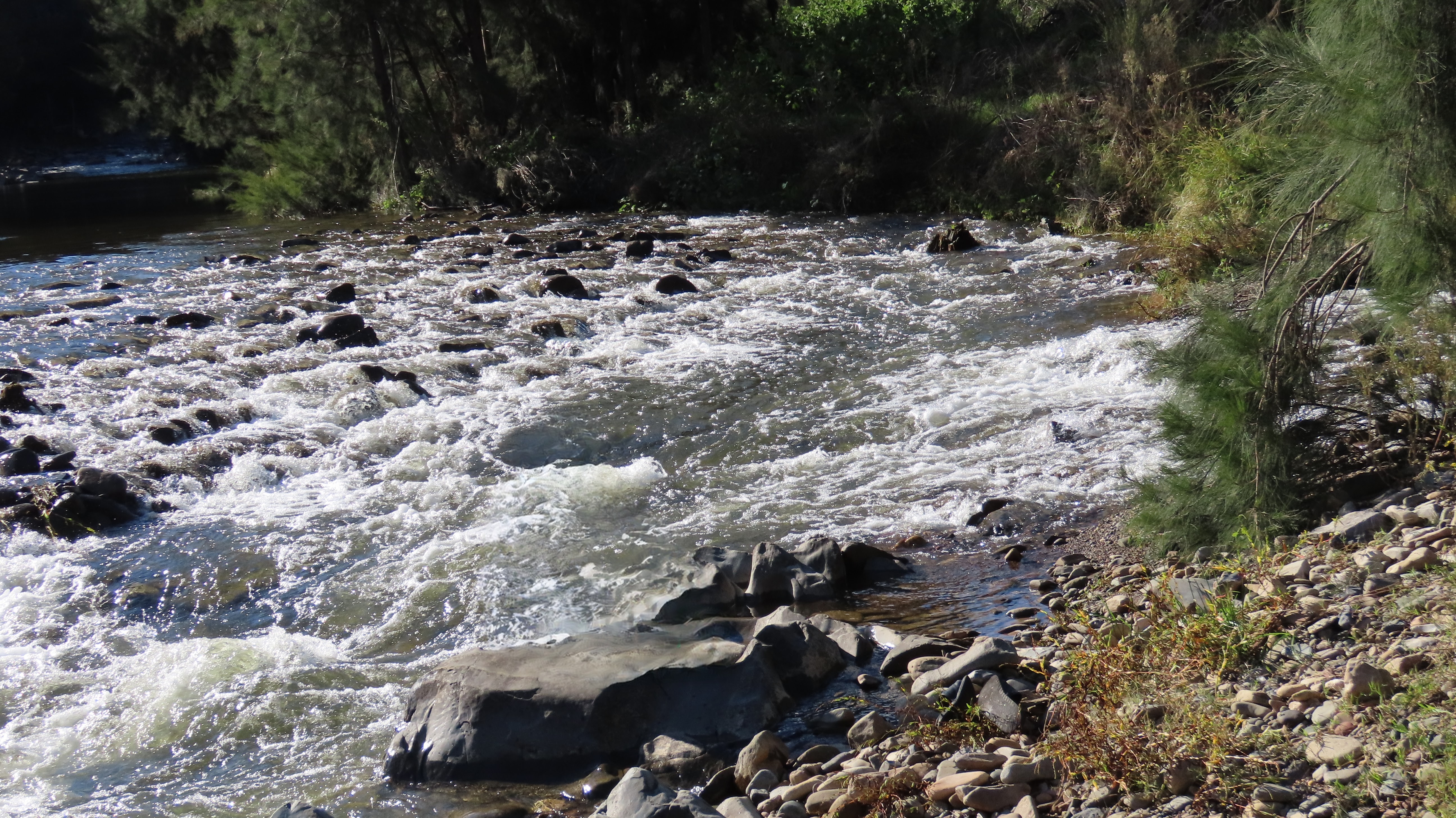
After packing up our camp, we drove back along the Bridle Track to Root Hog Crossing. This is a crossing of the Macquarie River, at the junction of the Bridle Track and Root Hog Road. The river level was on the high side (measured at about 1 metre at the Rock Forest station), and there was a reasonably strong current. Janet says that it’s the strongest current she’s tackled to date:
Thanks to our friend Matt for making the video.
Before doing a trip like this, the TC does plenty of research. She checks the river levels over a couple of weeks, to see what the river’s doing. She also monitors the fire warnings and weather forecasts. On reaching the river crossing, if it looks a bit high or strong current, she’d walk into it first. If you can’t walk the current, then the car can’t take it either. For this crossing, luckily there was a group of three cars doing the crossing when we arrived. We watched them, and judged it safe for our vehicles.
Root Hog Road is the road of views:
The next couple of photos are from a previous trip, when we traversed Root Hog Road in the opposite direction. A couple of motorbikes passed us when we stopped to take in the view:
Another road sign advised due caution:
Also from our previous trip, this video shows the last part of Root Hog Road as it drops towards the Macquarie River at the junction of Root Hog Road and the Bridle Track. The crossing is to the right, but we turned to the left to take a look at the river and campground:
Cleanup on the day after this week’s trip. Janet got her carpets wet in the Root Hog Crossing, and her paintwork was dusty. The tent was damp from the morning dew:
This is the blog of Mark Wordsworm, the travelling worm. I’m a 40-year-old bookmark (give or take a few years) and I proudly boast my own Hallmark serial number, 95 HBM 80-1. You’ll probably want to read all about me and my Travelling Companion (the TC).
Today’s travel notes
Me and the TC spent a couple of days in Dublin this week. In addition to our encounter in the park, in which Oscar Wilde got a new green carnation, we cruised around Dublin Castle and a couple of cathedrals. The TC had a go at translating some Latin, which led to predictably humorous results. And I coined a new phrase: whimsy-driven sightseeing.
The book I’m in
Darknet, by Matthew Maher. A rollicking tale of murder and mayhem in the world of high tech.
Travel tips
Instead of trying to see all the sights, it can be more enjoyable to stroll around and look at whatever catches your eye. I’m coining a new phrase to describe that way of being a tourist: Whimsy-driven sightseeing.
Recommended restaurants
Cornucopia Wholefoods Restaurant, Wicklow Street, Dublin. The bakery goods are delicious. In particular, the TC went “Mmmmm” over the gluten-free banana bread. The coffee is probably worth passing up on, though.
The photos
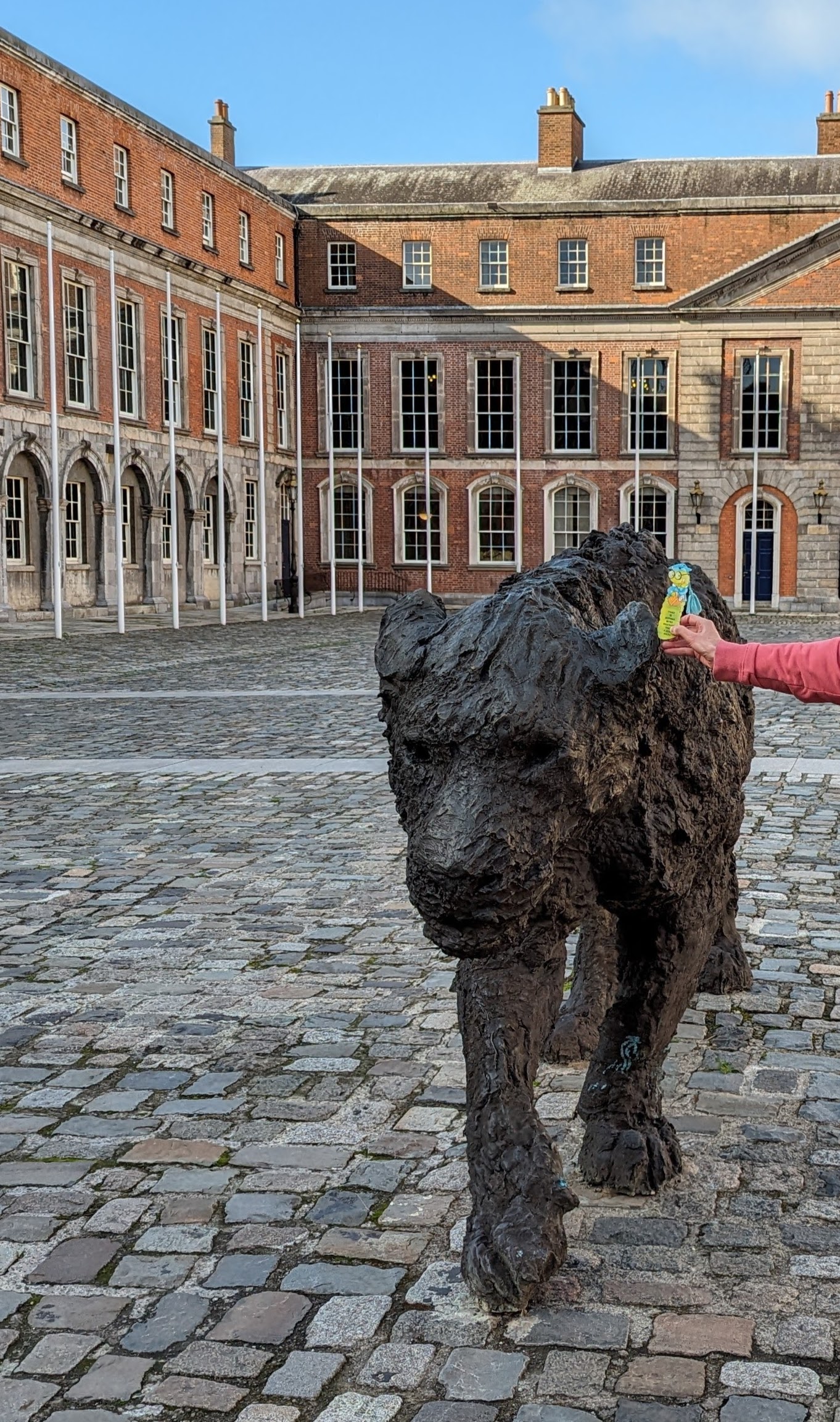
Me with Leonessa in the courtyard of Dublin Castle:
Leonessa is a bronze sculpture of a lioness by contemporary artist Davide Rivalta.
From on high, another lion peers down into the courtyard. It accompanies the soldier above the further archway in this picture:
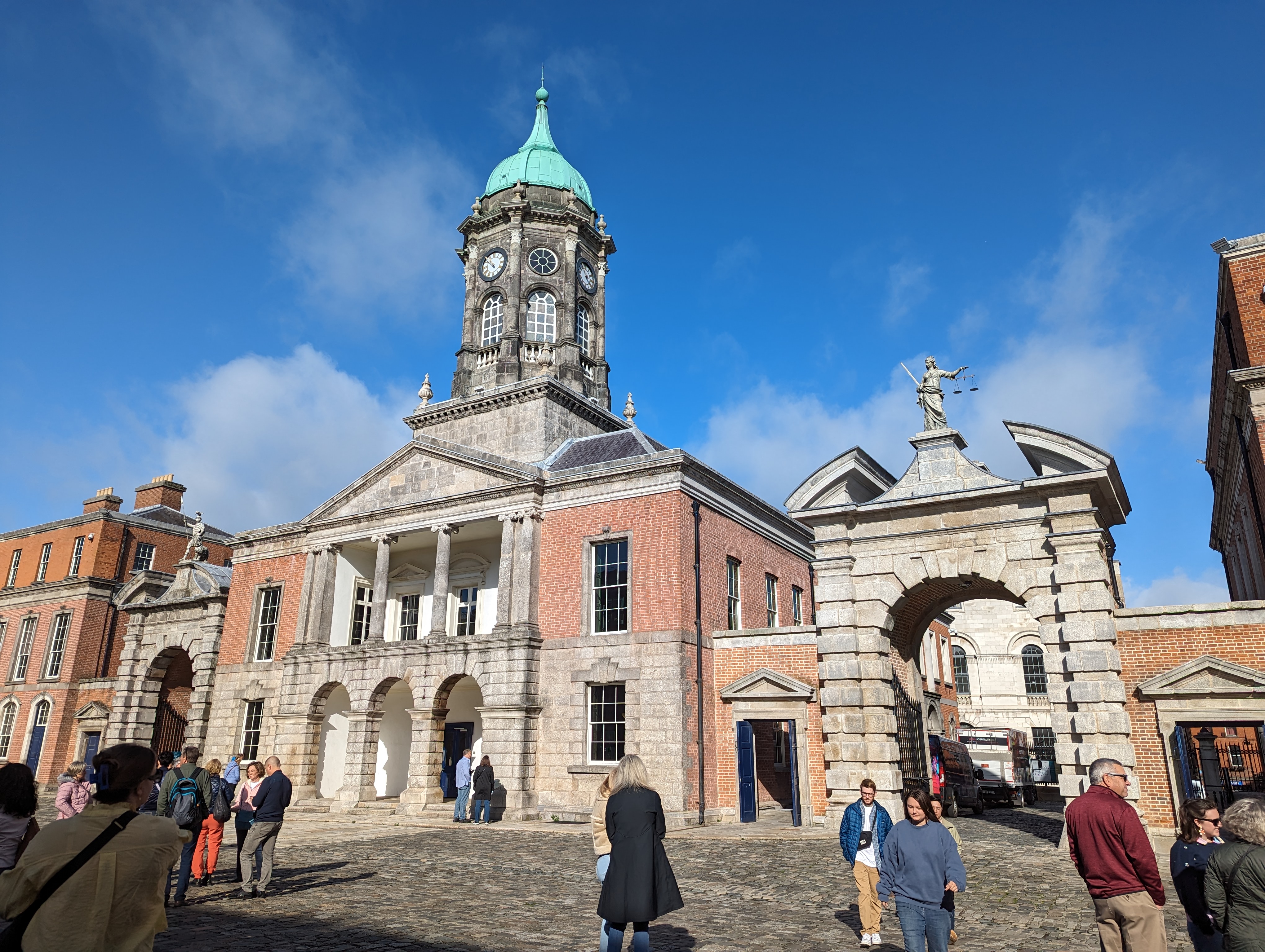
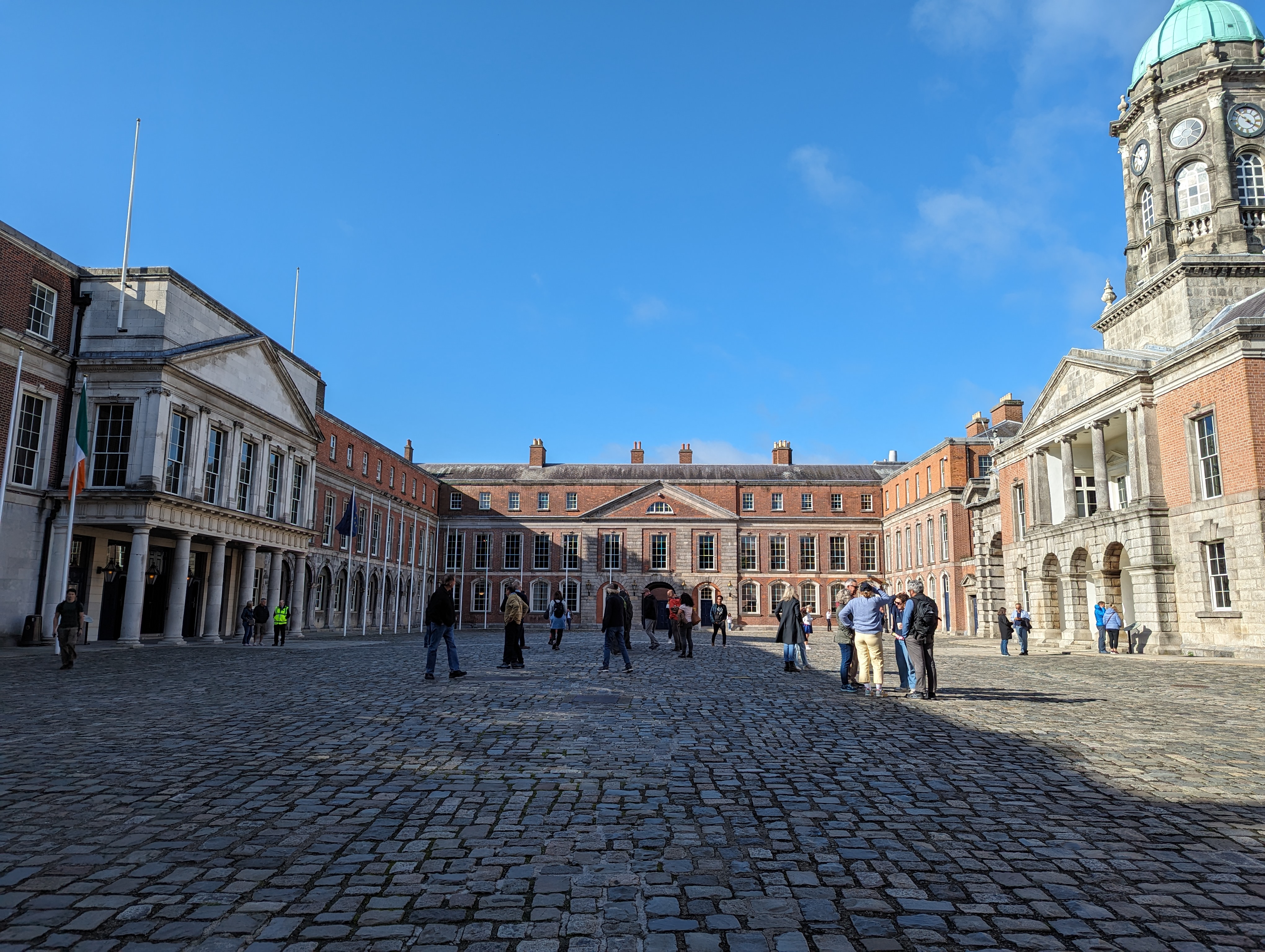
Stepping back, the full grandeur of the castle courtyard becomes visible:
This shot shows the outside wall of the castle and the Chapel Royal on the left:
On the right of the above picture are three archways. The middle one leads into the courtyard. In a room above this archway, Dublin Castle was formally handed over by the last English Lord Lieutenant of Ireland to the Provisional Government of Ireland, led by Michael Collins, on 16 January 1922.
The other side of the Chapel Royal:
Moving away from the castle, you might find yourself drawn to Christ Church Cathedral. This ancient and lovely building was founded in approximately 1030 by the Norse King of Dublin, a Viking with the romantic name of Sitriuc Silkenbeard.
Here’s a front view of Christ Church Cathedral:
If you follow the green bus down through the archway, you can examine the other side of the cathedral, which is equally striking:
Stroll a few blocks south down Patrick Street, and you’ll come across St Patrick’s Park and St Patrick’s Cathedral:
Evidently the tomb of Jonathan Swift, author of Gulliver’s Travels, lies in the nave of the church.
It’s believed that, in the fifth century AD, St Patrick baptised the first Irish Christians in a well situated where the cathedral park now lies. The first church was built on the site to commemorate the event.
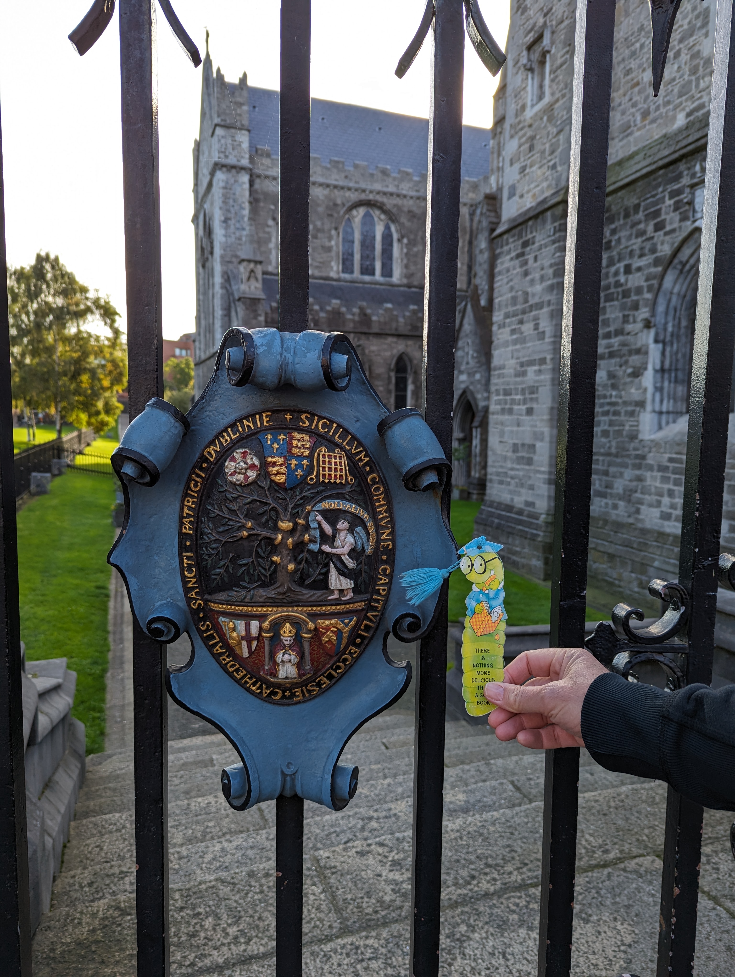
Me with the coat of arms outside St Patrick’s Cathedral:
The TC, bless her cotton socks, had a go at translating the Latin on the coat of arms.
First she tackled the wording on the light blue banner. Her initial reading was this:
noli allium sapere
Which translates to:
don’t taste the garlic
Ha! Actually, it’s “noli altum sapere“, which means “don’t be too wise“, or “don’t be high-minded“.
Now for the longer bit:
sigillum commune capituli ecclesie cathedralis sancti patricii dublinie
Translation:
the common seal of the chapter of the cathedral church of saint patrick in dublin