Travelling Worm

A bookworm's travelogue

Tag: travel

  • Billy Goat Bluff Track, VIC

    In this post: Billy Goat Bluff Track near Dargo in Victoria, Australia, plus some lovely country and a river to camp beside.

    This is the blog of Mark Wordsworm, the travelling worm. I’m a 40-year-old bookmark (give or take a few years) and I proudly boast my own Hallmark serial number, 95 HBM 80-1. You’ll probably want to read all about me and my Travelling Companion (the TC).

    Today’s travel notes

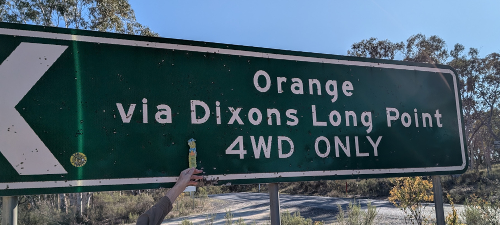
    Me and the TC recently spent a week and a half in the Victorian High Country, a landscape of mountains and valleys in the state of Victoria, Australia. On 22 February, we tackled a well-known four-wheel driving track in the area: Billy Goat Bluff Track.

    The book I’m in

    Jericho’s Dead by William Hussey. This is the second in a series about Scott Jericho, an ex police detective and member of a fairground family who seems to attract serial killers and other nasties. Highly recommended.

    Recommended accommodation

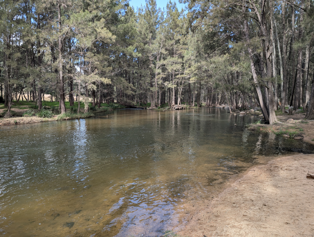
    Black Snake Creek campground on the banks of Wonangatta River.

    Travel tips

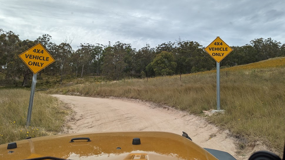
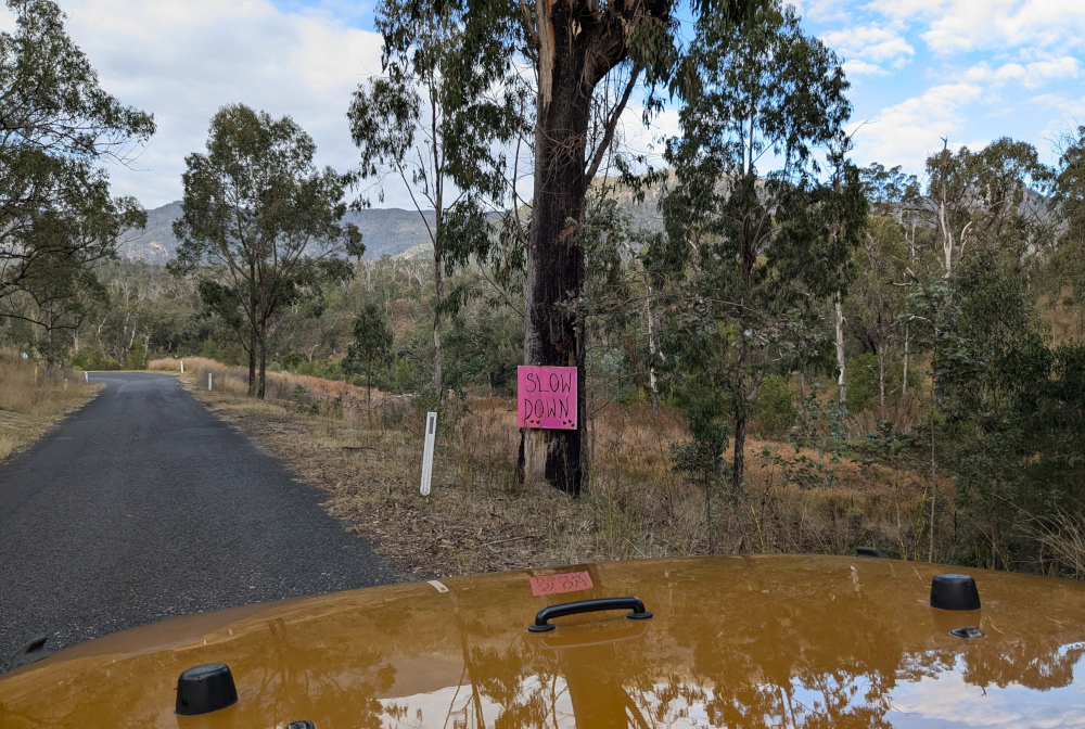
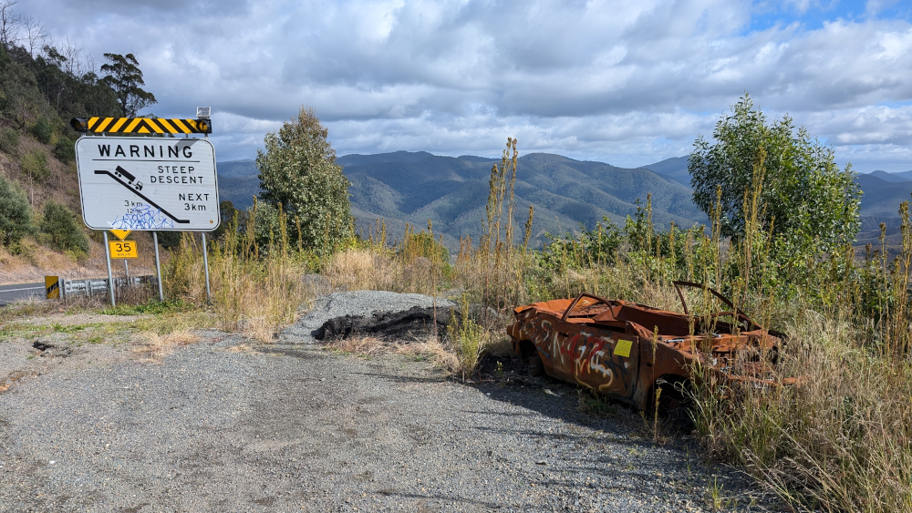
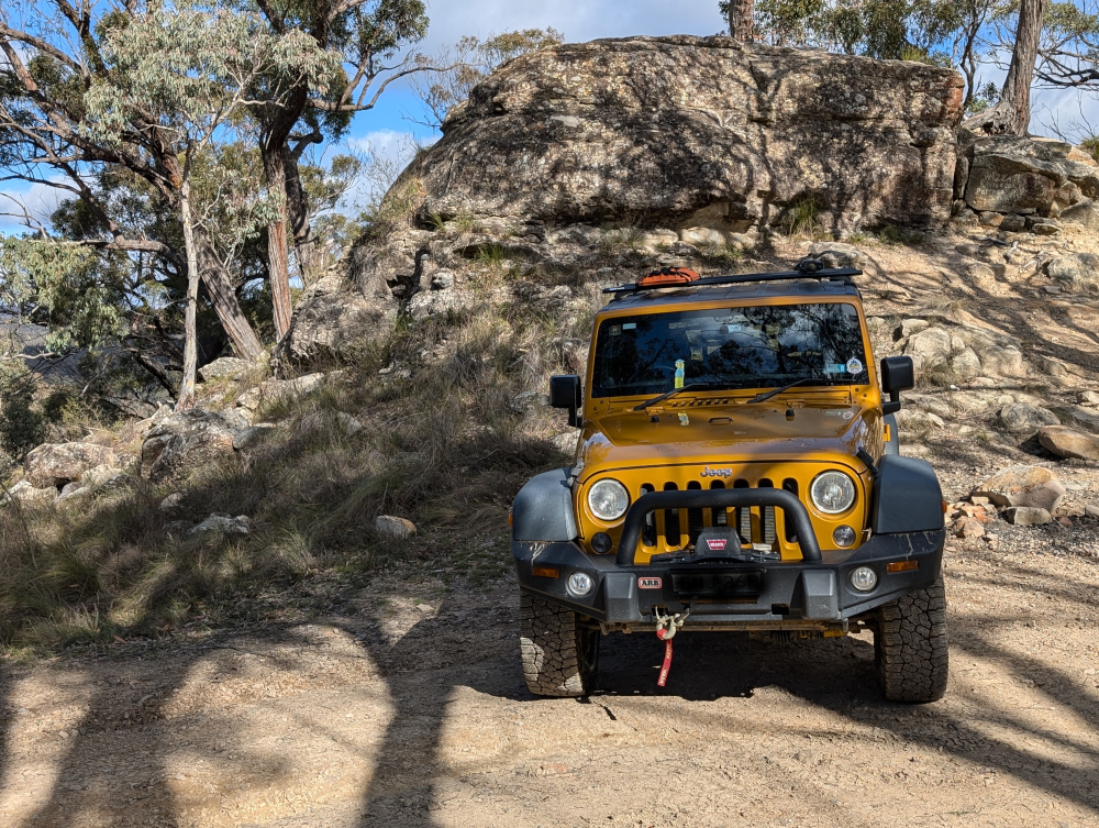
    Although Billy Goat Bluff track has been graded and is relatively easy driving, many of the tracks in the Dargo area are challenging. Pick your route to and from Billy Goat Bluff with care.

    The photos

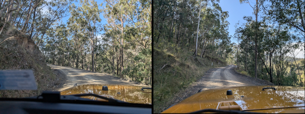
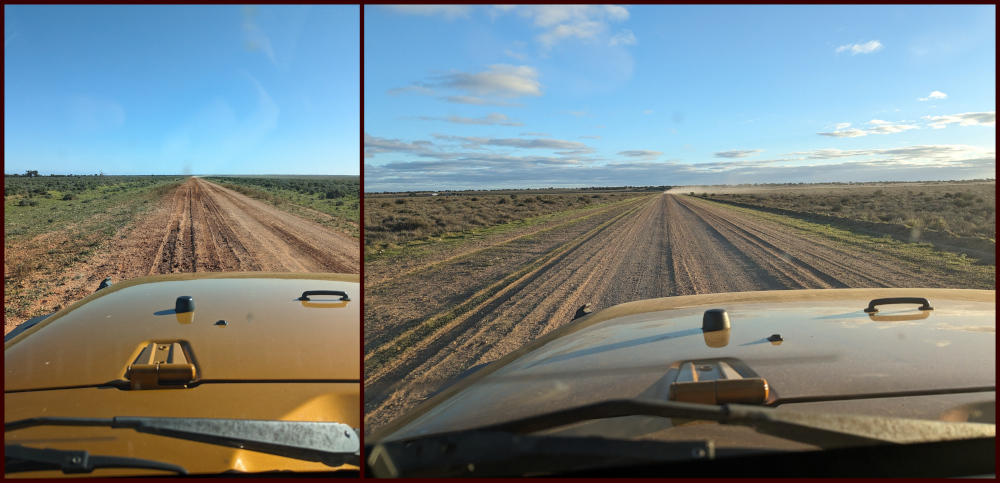
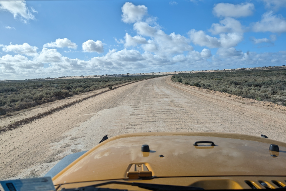
    Crawling the tracks is what yours truly does best. So, let’s start with a video of part of Billy Goat Bluff Track, to give you and idea of what it’s like. The track was graded in late 2024. When we were there in February 2025, the driving was easy. But beware the steep drop-offs on both sides!

    The TC, bless her cotton socks, talks about the Billy Goat Gruff track in the video. It’s actually Billy Goat Bluff. Rumour has it that the track got its name because to drive it, you need to be as agile as a goat.

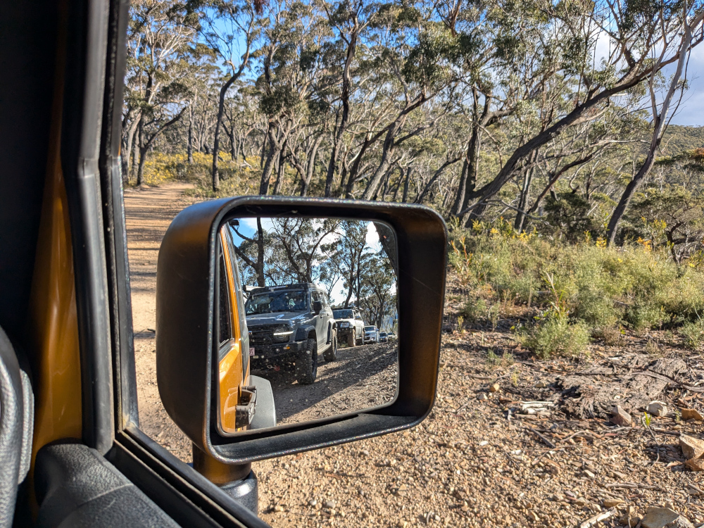
    The track features a steep gradient of 27%, climbing 1,200 metres over a distance of 7 kilometres.

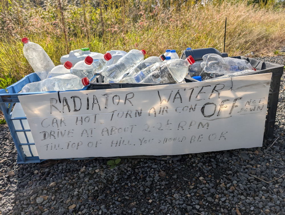
    The TC’s water bottle compressed as if it had been in a jet plane:

    How long does it take? It took us less than two hours to drive the track. We started the track itself at soon after 9am and finished before 11am, with plenty of stops for photographs.

    Here’s our convoy on the infamous ridge. Those edges give little margin for error or for passing an oncoming vehicle:

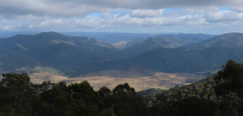
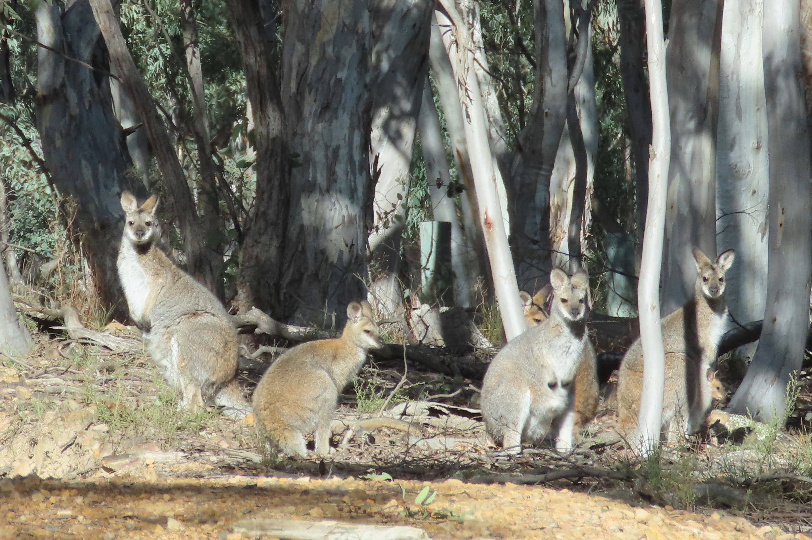
    All round us, the peaks and valleys of the high country conspired to make us feel like insignificant worms on the face of the universe (oh wait, I am a worm, and decidedly not insignificant!):

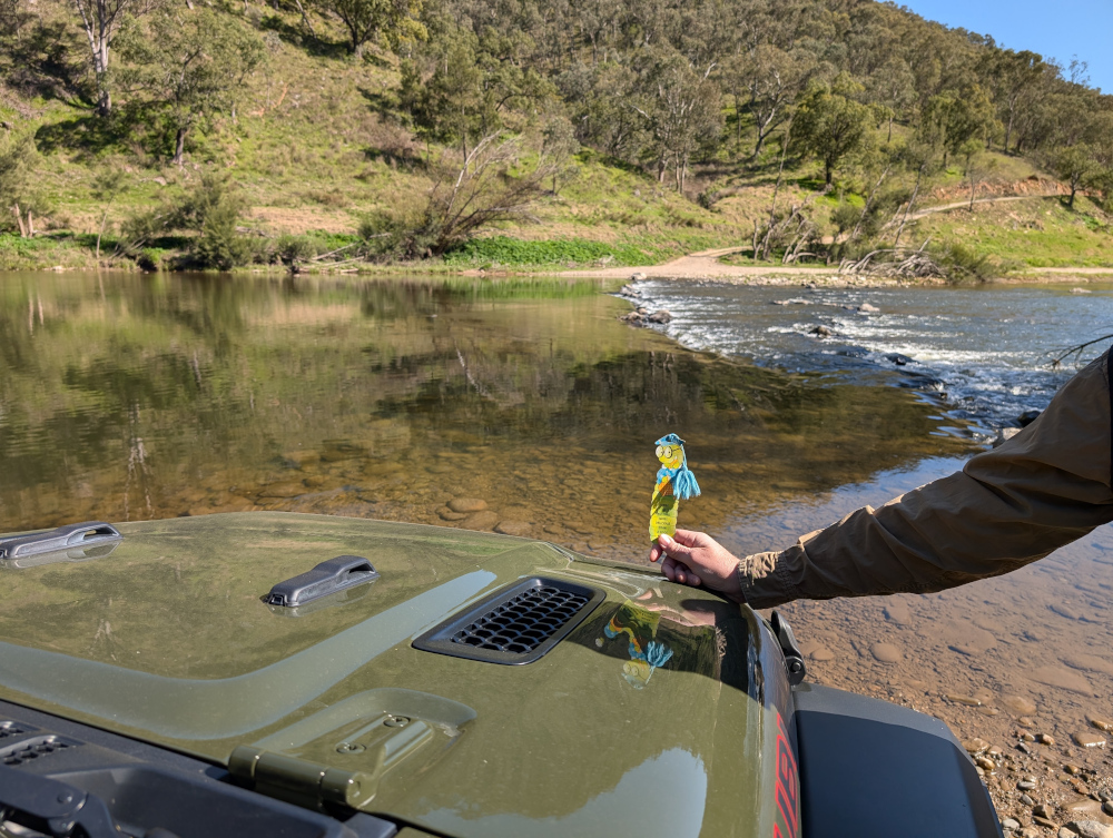
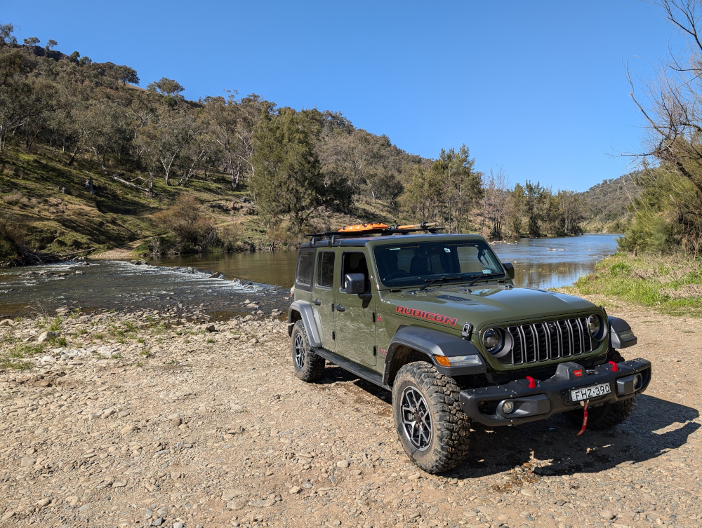
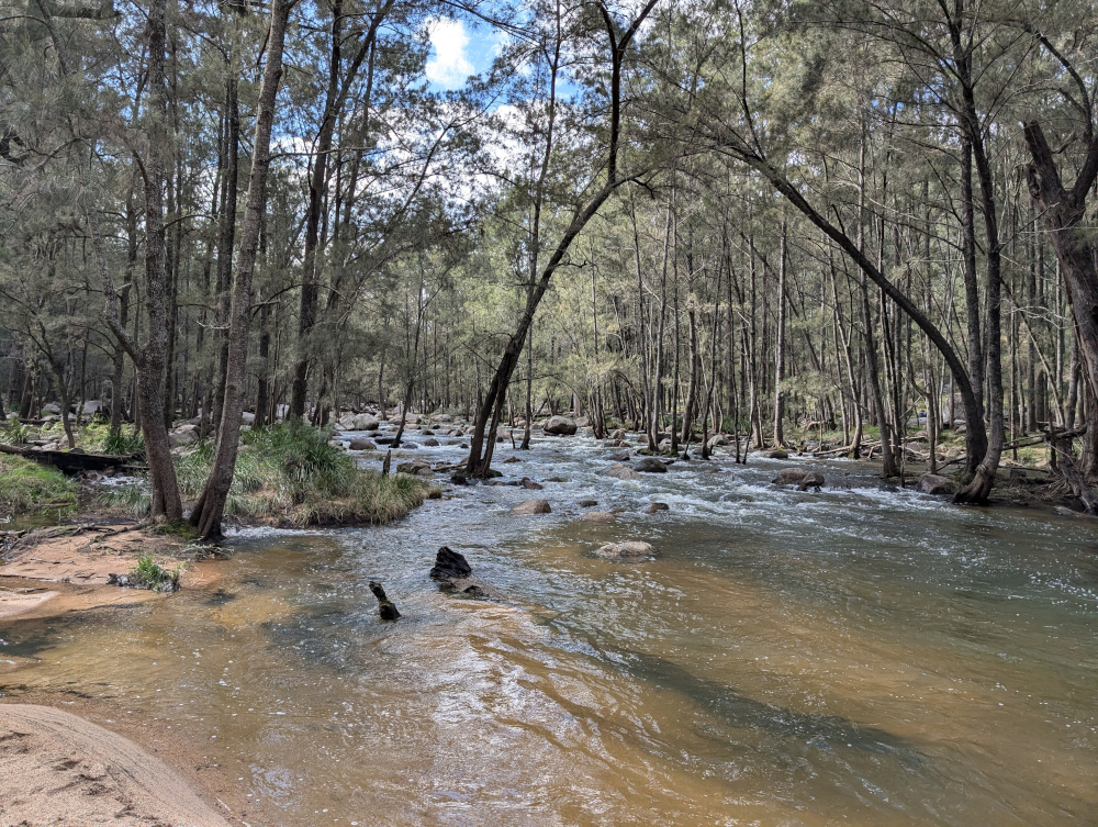
    Getting there: On the night before the trail, we camped at Black Snake Creek campground on the banks of the Wonangatta River:

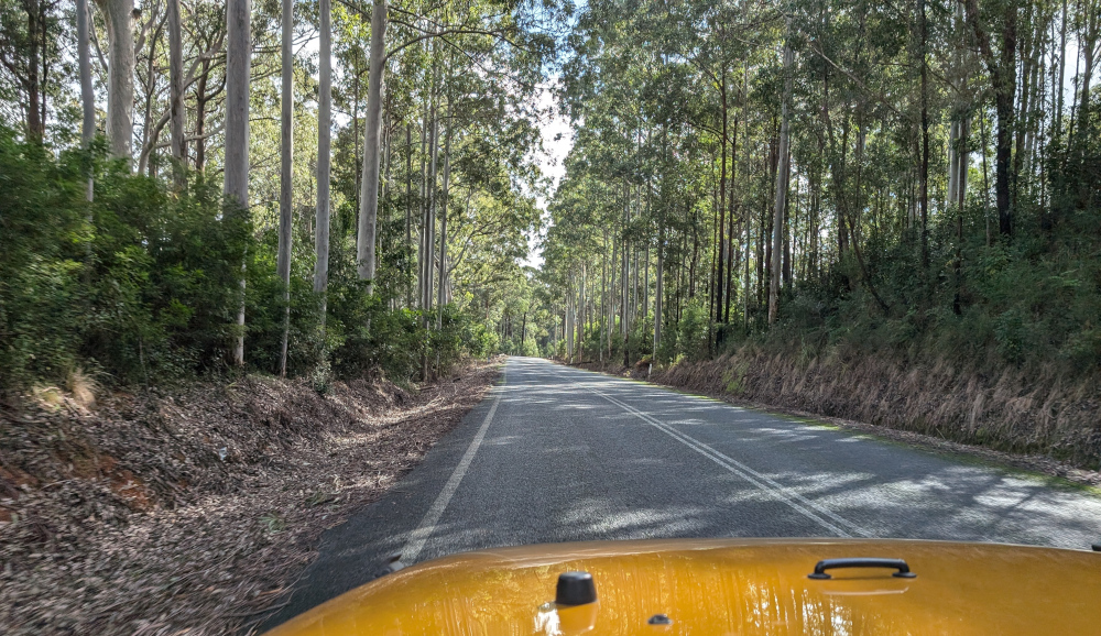
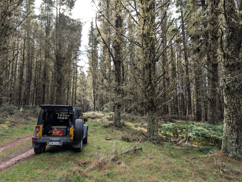
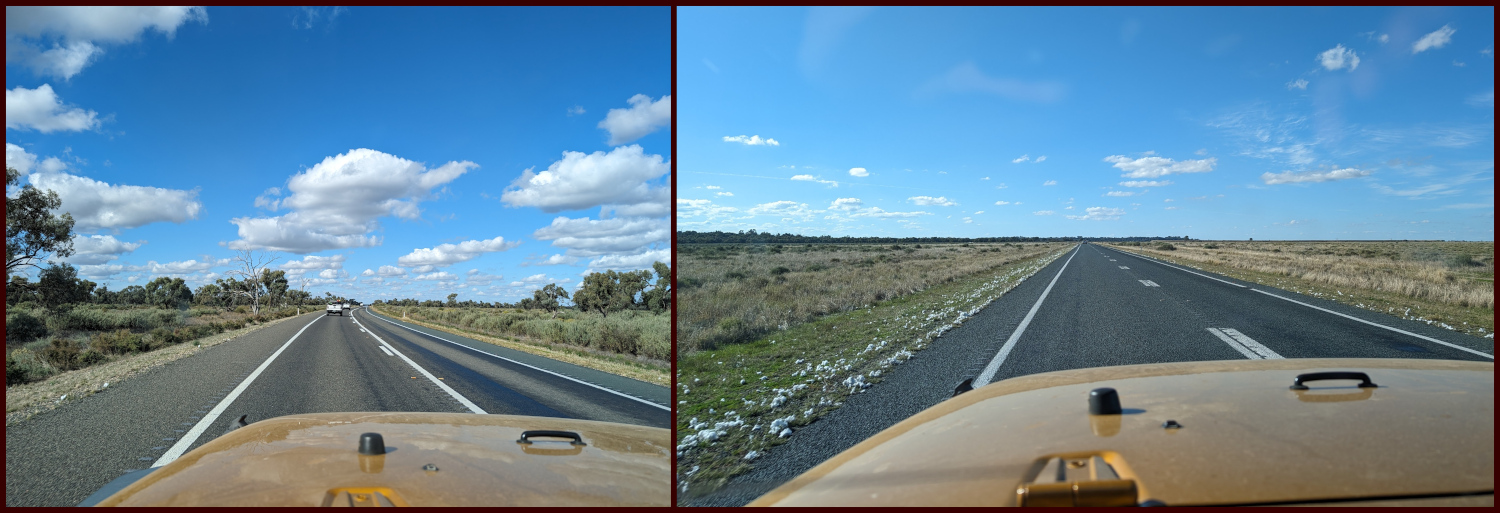
    We left the campground at around 8.30am and followed Wonangatta Road northwards for half an hour or so, winding along the banks of the Wonangatta River until we joined Billy Goat Bluff Track.

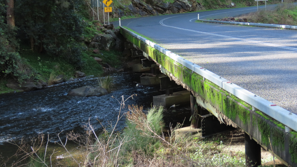
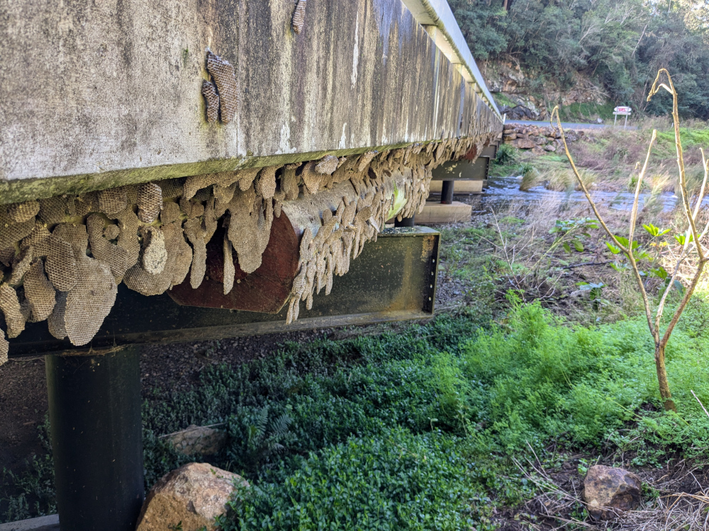
    The lovely Kingwill Bridge on Wonangatta Road:

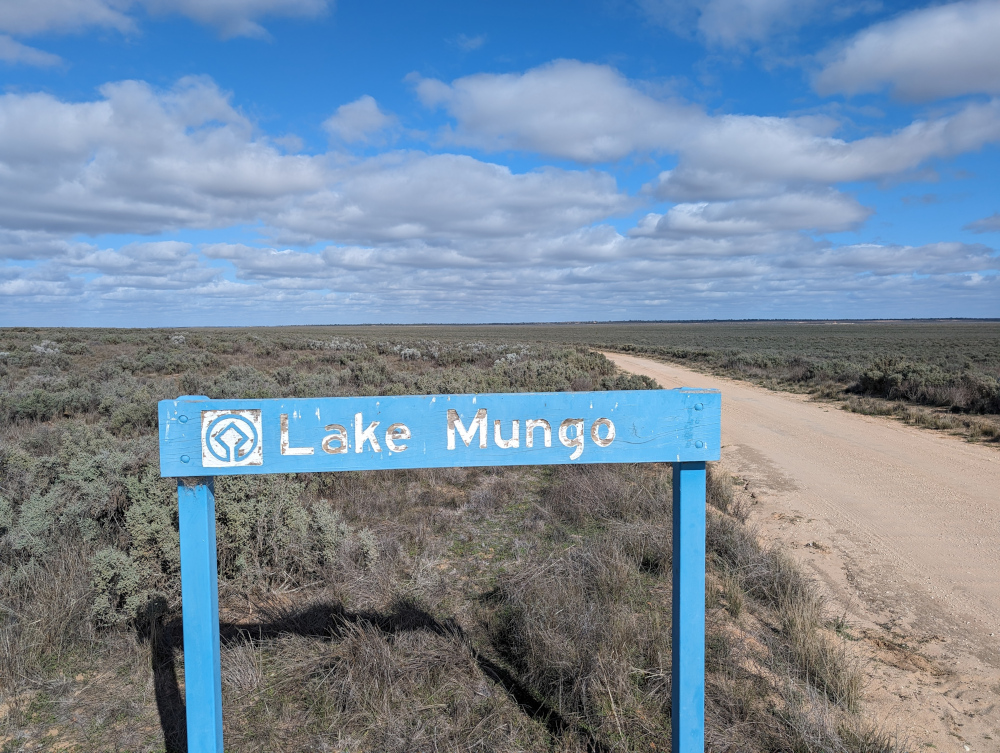
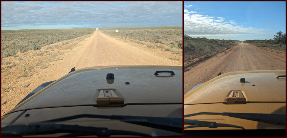
    In case your appetite for Billy Goat Bluff isn’t yet satiated:

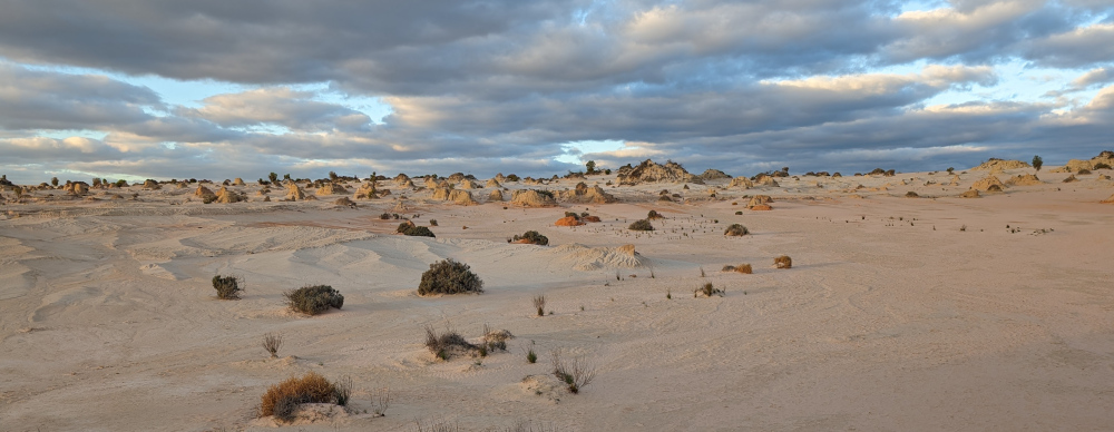
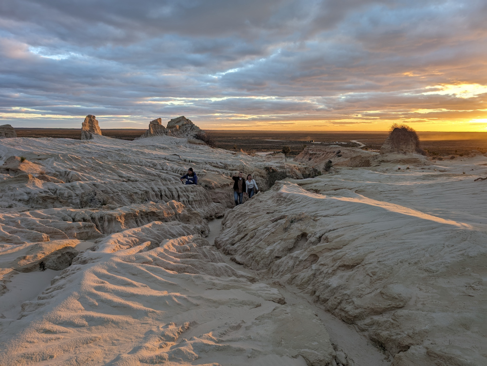
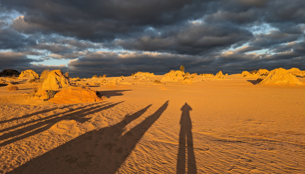
    After finishing Billy Goat Bluff, we took a short detour to visit Pinnacles Lookout in the Miowera region:

    There I met my cousin Dilly the Butterfly:

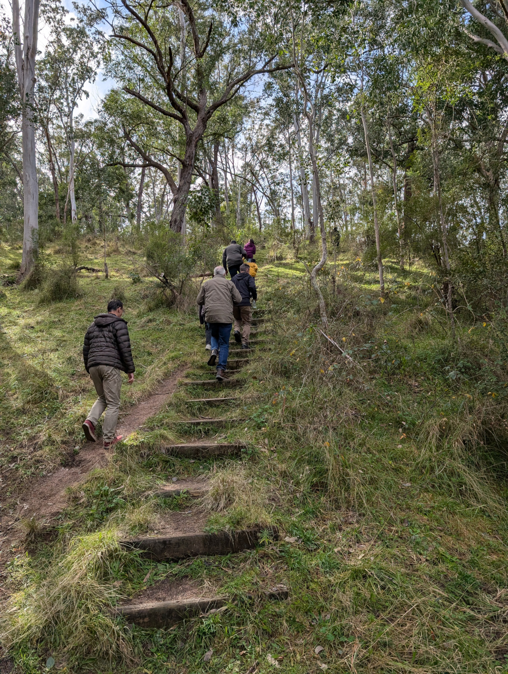
    We then explored some of the tracks around Dargo, which turned out to be much more of an adventure than planned. We helped some folks out of trouble, which meant that we were still on the tracks late at night:

    We found our way safely to Castleburn Creek campground at midnight, rounding off another day of happy travelling.

    Speaking to the locals in Dargo the next day, we heard that many people find themselves in trouble on these tracks. The maps are not up to date, and as a result people don’t know what’s in store for them. Take care out there on the tracks, make sure you’re in a capable vehicle, and travel with some mates to help if you do run into a tricky situation.

    Fediverse Reactions

  • Dixons Long Point Crossing 4WD

    This is the blog of Mark Wordsworm, the travelling worm. I’m a 40-year-old bookmark (give or take a few years) and I proudly boast my own Hallmark serial number, 95 HBM 80-1. You’ll probably want to read all about me and my Travelling Companion (the TC).

    Today’s travel notes

    Me, the TC, and Beetle the Jeep spent a night in the historic town of Hill End, New South Wales. Early the next morning, we set out to cross the Macquarie River at the well-known Dixons Long Point Crossing.

    The book I’m in

    Meru, by S.B. Divya. Excellent SciFi about a human and an alloy who fall in love, and about an experiment with human life on planet Meru. Alloys are post-human beings who share human and AI genes.

    Travel tips

    You’ll need a 4WD vehicle to complete this trip, because of the river crossing. It’s also good to be aware that the Macquarie River is a large river that can carry a significant volume of water after rain. It can be deep and the current can be strong enough to wash away cars and caravans. Always check the conditions before attempting the crossing.

    The photos

    Me at Dixons Long Point Crossing:

    It’s a trifle tricky to decide which line to take when crossing the river. We were driving from the Hill End side to the Bathurst side. The TC had watched several videos of other people making the crossing. The consensus of opinion seems to be that you should cross on the rougher side of the rocks, not the smooth side. Basically, follow the line between the two rows of rocks. That’s what we did. It was bumpy but fun, and the river level was low at the time we made the crossing.

    On the other side, the TC, bless her cotton socks, struck up a conversation with a man who looked as if he knew the area. He said that originally, the intended line was on the smooth side of the rocks, where a causeway had been built. But then a flood moved most of the rocks down off the causeway, which resulted in a deep hole at one end. The hole is about the length of many vehicles’ wheelbase, so you can get stuck, especially if the vehicle doesn’t have much clearance. The rougher line is now the recommended route, although it’s basically bedrock.

    Let’s back up, now that you’ve seen the crossing, and start at the beginning of the day’s trip…

    A night in Hill End

    Before starting the drive to Dixons Long Point, we spent the night at Hill End Lodge:

    The photo shows the reception area and restaurant of the lodge. We stayed in one of the cabins nearby. Early the next morning, the TC went for a stroll and came across a group of kangaroos. Most of them fled, but a big male stayed to keep watch, along with couple of others, one of which was a female with a joey in her pouch:

    The TC, wise soul, decided that discretion is the better part of valour, and altered direction to keep away from the roos.

    After breakfast, we paid a quick visit to the town of Hill end:

    The Royal Hotel is another good option for an overnight stay in the town:

    Golden Gully

    We headed north up Hill End Road towards Ullamulla Road, and came across the enchanting Golden Gully:

    Holes small and large pepper the eroded walls of the canyon. Many of them lead to shafts and tunnels dug by hopeful gold miners in the 1850s. The gold in this area is alluvial, washed down in several creeks that feed into the gully.

    You can walk down the gully to the point where a sign warns of danger:

    Ullamulla Road and Dixons Long Point

    Me at the junction of Hill End Road and Ullamulla Road:

    A sign warns of the nature of the upcoming crossing:

    The road itself is an easy drive:

    A sheep with a new-born lamb greeted us:

    The next video shows the descent towards Dixons Long Point Crossing, on the Hill End side. At about 30 seconds into the video, a wallaby hops across the track in front of the car:

    We stopped for a photo opp when we reached the water:


  • Coxs River & Six Foot Track 4WD

    This is the blog of Mark Wordsworm, the travelling worm. I’m a 40-year-old bookmark (give or take a few years) and I proudly boast my own Hallmark serial number, 95 HBM 80-1. You’ll probably want to read all about me and my Travelling Companion (the TC).

    Today’s travel notes

    Me, the TC, and Janet the Jeep recently drove across country in the Blue Mountains area, from Little Hartley to the Jenolan area. The trip included Coxs River Road, Ganbenang Road, Cullenbenbong Road, Glen Chee Road, Six Foot Track, and Black Range Road.

    The book I’m in

    No Time for Goodbye, by Linwood Barclay. A psychological drama packed with plot twists. Much like a 4WD road.

    Travel tips

    You’ll need a 4WD vehicle for most of this trip. The first part, before the turnoff to Coxs River camping ground, is fine for 2WD vehicles. But you’ll need a 4WD to get down to the camp site, and then back up again to follow the rest of Glen Chee Road.

    The photos

    Me at Coxs River camp ground:

    The TC, bless her woollen mittens, decided to focus on the river rather than on yours truly. Sometimes I disagree with her choices.

    We started our trip at the Little Hartley end of Coxs River road. The first hour or so is a lovely, meandering route, part sealed and part dirt. The views are of rolling hills and dales. And cows. This shot is from a trip last year:

    At the camp ground, Coxs River is wide and rippling:

    Looking in the other direction, the river widens out into tranquil pools:

    We took a walk from the camp ground towards Bowtells Swing Bridge. This is a 20-minute walk through the forest, with views of the river gorge on one side:

    Bowtells Swing Bridge is currently closed for maintenance. It’s been so for a long while: years. This worm has never seen it open. Crossing the bridge could be a wild ride, swinging over a deep river canyon:

    If you turn left when you come up the road from the camp ground, you enter the 4WD-only part of Glen Chee Road:

    See what it’s like driving Glen Chee Road near Pass Gully. This clip shows some track erosion, but it’s an easy drive when dry:

    Further along Glen Chee Road, descending towards Alum Creek Camping Ground:

    The road leads through pretty forest:

    Despite it being mid winter when we made this trip, yellow flowers were sprinkled across the bushland:

    In the next video, we cross Little River. This is one of several river crossings on the trip. They’re not hard, provided the river is low and your vehicle is a capable 4WD.


  • Maleny QLD: Views and birds

    This is the blog of Mark Wordsworm, the travelling worm. I’m a 40-year-old bookmark (give or take a few years) and I proudly boast my own Hallmark serial number, 95 HBM 80-1. You’ll probably want to read all about me and my Travelling Companion (the TC).

    Today’s travel notes

    Me and the TC recently visited the town of Maleny in Queensland. We had lunch in town, visited the chocolate factory, and spent a few hours at the botanic gardens and Bird World.

    The day was grey and drizzling. The mist only added to the views of the Glass Mountains and the architected gardens.

    The book I’m in

    Frontier, by Grace Curtis. Science fiction with flare and grace. Highly recommended.

    Travel tips

    Even if the weather is wet, Maleny is a good place to spend a few hours. Visit the Botanic Gardens and Bird World (inside the gardens). Drop in at Maleny Chocolate Co, for delicious (though pricey) chocolates.

    Recommended restaurant

    Sarah’s Unplugged in Maleny. Good food and friendly service, catering for vegan and gluten free too.

    The photos

    Where, a faithful reader will ask, is the photo of me that customarily kicks off these posts? I stayed tucked away in my travel case, viewing the sights from a handy peephole. A faithful reader might also guess the reasons why I played it safe: rain and birds. Rain isn’t good for my cardboard constitution, and when bird meets worm, it usually doesn’t go well for the worm.

    So, without further ado, let’s move on to a view:

    The Glass Mountains lurk in the clouds. In the foreground, the botanic gardens stretch towards the mist-clogged hills.

    A tree and a mountain provide structure. Pink blossoms add colour.

    At times during the day, the air was brighter and more colour shone through the mist.

    Outside Bird World, a Brush-turkey had somehow managed to find a high perch. It watched us with a superior gaze.

    Are you ready for the birds? Here they come! These are just a few of the birds we saw inside Bird World.

    A little Pitta:

    A series of pigeons:

    A plethora of parrots:

    To finish, a bashful pheasant:


  • Old Grafton Road and Dalmorton Tunnel, NSW

    This is the blog of Mark Wordsworm, the travelling worm. I’m a 40-year-old bookmark (give or take a few years) and I proudly boast my own Hallmark serial number, 95 HBM 80-1. You’ll probably want to read all about me and my Travelling Companion (the TC).

    Today’s travel notes

    Me, the TC, and Janet the Jeep took the long way round from Sydney to Brisbane, to explore a bit of the inland countryside. On the second day of our trip, we drove from Glen Innes to Grafton via Old Grafton Road and Old Glen Innes Road. This is a beautiful route. The road is partly sealed (bitumen) and partly unsealed (gravel and clay). It’s in good nick all the way from Glen Innes to Grafton.

    Read on to get a feel for this trip.

    The book I’m in

    Force of Nature, by Jane Harper. A book that starts well and gets better and better.

    Travel tips

    It’s most comfortable to travel from Glen Innes to Grafton, rather than in the opposite direction. The road is narrow, the edges unguarded, and the side falls away steeply along much of the way. If you’re on the side that drops off, it can be uncomfortable when you meet a vehicle coming towards you.

    Recommended accommodation

    Apartments on Grey in Glen Innes. Warm and cosy, with everything you need for a comfortable stay.

    The photos

    Me at the turnoff to Old Grafton Road on Gwydir Highway:

    The first part of Old Grafton Road is sealed (bitumen). But don’t be fooled! It’s scenic — meaning, it’s steep, winding, and narrow. This video gives a taste of the road. Part way through (at the time stamp of 40 seconds to 1:03), the TC stopped the Jeep to take a shot of three wallabies on the side of the road:

    The road descends swiftly to cross Diehard Creek:

    A helpful soul has posted warning signs along the road:

    Mann River Nature Reserve is a pretty spot to take a breather:

    Janet the Jeep was raring to go when Old Grafton Road changed to dirt:

    At times, you’ll come across an entrance to a family farm:

    Here’s another homestead, further along the route:

    Much of the road runs alongside Boyd River. Sometimes it’s at the level of the water, sometimes high above. It’s narrow and slippery — take care!

    Just around a corner, you’ll come across Dalmorton Tunnel. The tunnel is 20 metres long, 4 metres wide, and has a height clearance of 3.2 metres.

    Me at Dalmorton Tunnel:

    The tunnel was built in the 1860s by civilian contractors. (Some reports say that convicts built it, but that’s probably apocryphal.) The tunnel was blasted out of solid rock, then trimmed with hand tools. (Again, some reports say it was “hand hewn”, but that’s probably not completely accurate either.)

    Here’s Janet making her way through the tunnel, hogging the limelight as she does:

    Boyd River offers some picturesque spots for coffee and a photo:

    Next is a cow closeup, for people who like cows. This worm avoids them, as they’re apt to put those big feet where they’re not wanted. But the TC, bless her cotton socks, liked the way this cow was cosying up to the pink bush:

    On Old Glen Innes Road, a wide, low bridge crosses the Nymboida River:

    Scattered around, in the water and on land, are sections of a huge pipe, filled with concrete:

    Perhaps the pipes formed the scaffolding of a previous bridge? Who knows:

    The TC, bless her woollen mittens, is keen to finish off with some shots of the road. So, for those enthusiastic road-farers out there:

    See you on the road!


  • Standing stones at Glen Innes

    This is the blog of Mark Wordsworm, the travelling worm. I’m a 40-year-old bookmark (give or take a few years) and I proudly boast my own Hallmark serial number, 95 HBM 80-1. You’ll probably want to read all about me and my Travelling Companion (the TC).

    Today’s travel notes

    Me and the TC recently spent a night in Glen Innes, NSW, on our way to Brisbane. Early the next morning, we dropped in on the standing stones before continuing our journey.

    The book I’m in

    Force of Nature, by Jane Harper. The TC recently read The Dry by the same author, and enjoyed it so much that she resolved to read more of the author’s work. This worm is pleased. The book is an exciting, comfortable place to be.

    Travel tips

    The Australian Standing Stones are not to be found in the little village of Stone Henge, which is nearby. The village of Stone Henge is worth a visit too, surrounded as it is by stones and boulders, including some interesting formations of stones perched on top of others.

    The official standing stones monument is in Glen Innes.

    Visit the standing stones early in the morning if you can. They have a certain drama when the sun is low in the sky.

    Recommended accommodation

    Apartments on Grey in Glen Innes. Warm and cosy, with everything you need for a comfortable stay.

    The photos

    Me with some of the standing stones at Glen Innes:

    An early morning view of the ring of stones:

    An engraved stone in the middle of the ring describes the design of the stones, placed to catch the sun’s rays at key times of the year:

    These standing stones don’t pretend to be ancient. They were erected in the late 20th century and dedicated in 1992, as a tribute to the various Celtic nations who’ve settled in and contributed to Australia’s history.

    Near the top right of the next view of the stones, there’s a line of flag poles, one from each of the nations that has contributed to the monument:

    On the edge of the ring of stones is a rather attractive, though fake, Excalibur — complete with injunction to try to pull it out of the stone and thus gain great knowledge and wisdom:

    A wall curves round the path, embedded with gifts of stone from various sponsors of the monument:

    Here’s one of the embedded stones with its inscription. This worm likes the simple attractiveness of the stone:

    More stone dedications:


  • Thunderbolts Way, NSW

    This is the blog of Mark Wordsworm, the travelling worm. I’m a 40-year-old bookmark (give or take a few years) and I proudly boast my own Hallmark serial number, 95 HBM 80-1. You’ll probably want to read all about me and my Travelling Companion (the TC).

    Today’s travel notes

    Me, the TC, and Janet the Jeep took the long way round from Sydney to Brisbane, to explore a bit of the inland countryside. On our first day, we drove from Sydney to Gloucester and then took Thunderbolts Way to Glen Innes. Thunderbolts Way is a scenic, historic drive. The road is entirely sealed (bitumen), but includes a steep hill and some bumpy areas full of pot holes. Read on to get a feel for this trip.

    The book I’m in

    Ancillary Sword, by Ann Leckie. This is the second book in the Imperial Radch trilogy. Excellent science fiction, set in an intriguing world of AI ships and their ancillary crew.

    Travel tips

    Fill up with fuel before you start the drive. Be aware of the long, steep hill between Uralla and Gloucester. If you’re travelling towards Gloucester, you’ll be going down the hill. The descent can be tricky, especially if you’re towing a caravan.

    Take a picnic and stop at a scenic spot for lunch.

    Recommended accommodation

    Apartments on Grey in Glen Innes. Warm and cosy, with everything you need for a comfortable stay.

    The photos

    Me at Pioneer Lookout on Thunderbolts Way:

    We joined Thunderbolts Way at the picturesque NSW town of Gloucester. These two motorbikes passed us, and were probably on their way to the same road:

    A book sale on the outskirts of Gloucester:

    Thunderbolts Way is named after Captain Thunderbolt, a controversial bushranger from the early 1800s. The ranger’s real name was Frederick Ward. He managed to combine criminal activities with his legitimate bushranger tasks, in a way that led people to both fear and admire him. He’s famous for several robberies and mail coach holdups. At one stage, a reward of 400 Pounds was on offer for his capture. He was eventually shot and killed by a policeman in 1870, after a long horseback pursuit.

    The views on this route are gorgeous:

    A curious sight awaited us at Gloryvale Bridge, which crosses the Manning River:

    Look closely at the bottom of the bridge:

    Those are wasp nests, thousands of them stuck along the bottom edge of the bridge. Here’s a small piece with some dead, dried-out wasps still attached:

    We climbed a long, steep hill and stopped at the top. If you’re travelling down the hill with a caravan or trailer, beware. As the sign says, it’s steep. Evidently quite a few people have come a cropper because they didn’t have enough warning.

    The rusted-out car is perhaps an appropriate warning. Weirdly, this old carcass had a new, bright yellow sticker giving notice of the council’s intent to take possession.

    Due procedures have been followed!

    At the top of the same hill, some kind soul had left a cache of filled water bottles, for people who might find their vehicles in trouble during the ascent or descent. This worm is impressed with the kindness, including the last words in the attached notice: “You should be OK“.

    This view was our reward for making it to the top of the hill:

    The road changed character several times. This section ran through natural forest:

    Pioneer Lookout presented another spectacular view:

    We turned off into Nowendoc State Forest for a lunch break. The soundscape was epic, like being in a Jurassic forest. I captured it in the video below. The background roar is the wind in the branches. Most of the squealing and chattering sounds are made by Yellow-tailed Black Cockatoos. At about 1 minute in, a couple of ravens start cawing loudly. At about 1:36, a Sulphur-crested Cockatoo adds its screeching to the mix. You don’t see the birds, except at 2:12 (near end) when a bird makes a lightning appearance near bottom left of the frame.

    As you can see in the video, Janet the Jeep was our chariot of choice on this trip. Here she is again, hogging the scene as usual:


  • Pinnacle Rocks in Dark Corner NSW

    This is the blog of Mark Wordsworm, the travelling worm. I’m a 40-year-old bookmark (give or take a few years) and I proudly boast my own Hallmark serial number, 95 HBM 80-1. You’ll probably want to read all about me and my Travelling Companion (the TC).

    Today’s travel notes

    Me and the TC took Janet the Jeep out to the Pinnacle Rocks in the Blue Mountains area, west of Sydney, Australia. The drive takes you from Capertee down the Pinnacle Rocks Firetrail, through Turon National Park, on into the forests of Dark Corner, finishing up in Sunny Corner.

    The drive is beautiful, and not without some challenges!

    The book I’m in

    The Island of Missing Trees, by Elif Shafak. I’ve just started this book (I’m on page 20) and it’s already gripped me tight.

    Travel tips

    To do this drive, you need a capable 4WD car and preferably at least one other car on the trip. It can be useful to have someone to pull you out of a bog or help you get up a steep, rutted hill.

    Check the river levels before you go. The trail crosses the Turon River several times, and the river levels can rise significantly after heavy rain.

    Check for park closures and bush fires too. The NSW National Parks and Wildlife Service web site is useful.

    The photos

    Me with Janet the Jeep at Pinnacle Rocks:

    From the top of the Pinnacle Rocks, you have a panoramic view of the valleys and forests all round. The next shot shows just the flat area at the top of the hill, as seen from the top of the rock:

    The first part of the drive, from Capertee to the Pinnacle Rocks, is scenic and fairly easy. There’s one rubbly hill climb that can be a bit of a challenge until you find the right “line”, as seasoned four-wheel-drivers say.

    The trail winds along the beautiful Turon River. This shot is from a previous trip (July 2023), when we explored one of the camping areas next to the river:

    The Turon River was in a tranquil mood this week. Experiences vary. It’s worth checking the river levels before you go!

    Parts of the drive wind along a ridge, with valleys dropping away on both sides. At times, you’re surrounded by white-trunked gums. Depending on the time of year, yellow or white flowers cover the bush. The next photo is from another trip along the same trail, in August last year:

    Kangaroos and wallabies stopped to watch us, before bounding away. There were several youngsters in this group:

    After the Pinnacle Rocks, things get more interesting, especially if you take the longer route down to Sunny Corner rather than the short route to Portland.

    At several points along the trail, you’ll encounter bogs. Some of them are harmless, others are deep, sticky, and smelly. The trouble is, it’s hard to know which is which just by looking at them! On a previous trip, we had one vehicle completely bogged and needing to be pulled out. And Janet was very nearly bogged once too, but managed to extricate herself by some quick wheel jiggling and reversing.

    This video shows one of the bogs where we didn’t get stuck!

    Towards the end of the trail is a fun section of “wombat holes”. These are dips and humps created by water erosion, that make the car seesaw from side to side. Janet attacked the wombat holes with gusto and enjoyed the experience immensely:

    The descent into the last creek crossing in particular is quite steep and rutted. It can be very slippery when wet. We took it slowly, with someone outside the car to “spot” the way for us.

    The climb out of the same creek is quite steep too. It’s rocky and a bit tricky. Janet made it easily, after a slight adjustment in direction half way up. Other cars, those with longer wheel bases, found it a little more difficult, but everyone got up the hill without needing a winch!


  • Roads of the Outback: a collage

    This is the blog of Mark Wordsworm, the travelling worm. I’m a 40-year-old bookmark (give or take a few years) and I proudly boast my own Hallmark serial number, 95 HBM 80-1. You’ll probably want to read all about me and my Travelling Companion (the TC).

    Today’s travel notes

    Me and the TC recently took our first extended trip into the Australian Outback. My previous posts describe the sights at White Cliffs, Lake Mungo, and more. This post is slightly different: it focuses on the roads. If you’re thinking of making this trip yourself, this collage gives you an idea of what to expect.

    In total, we travelled approximately 2,850 km (1,770 miles). We started in Sydney on day one, passing through Dubbo to Nyngan. On day two, we drove from Nyngan via Cobar and Wilcannia to White Cliffs. Day three took us through the Willandra Lakes Region to Mungo National Park. On day four, we explored the park. On day five, we started our trip back towards Sydney, stopping overnight in Cowra. Day six saw us arriving back in Sydney in time for a late lunch.

    The book I’m in

    Where Song Began, by Tim Low. A telling of the origins on the Australian continent of all the world’s songbirds, rich in detail and convincingly told.

    Travel tips

    Some parts of the Outback are far from anywhere else. Take supplies of food, water, fuel for your vehicle, and warm clothes. If possible, travel in a convoy of at least two vehicles and take a personal locator beacon (PLB).

    The photos

    Heading west from Sydney towards Cobar, the roadside alternates between red dirt and silver grass:

    Opal Miner’s Way, on the way to White Cliffs:

    Garnpung Lake Road and Ivanhoe Road, Pan Ban:

    Garnpang Road, entering Mungo National Park and later with the Lake Garnpang sign:

    Mungo National Park, approaching the Walls of China:

    On the self-guided drive in Mungo National Park:

    Entering Lake Mungo, a lake bed that’s been dry for more than ten thousand years:

    More Lake Mungo road scenes:

    Leaving Mungo National Park and Arumpo:

    Sturt Highway, with cotton clouds and a cotton lining left by the road trains:

    Getting close to home, on Murrumbidgee River Road and Mid Western Highway:

    That’s all for today, folks.


  • Walls of China at Lake Mungo

    This is the blog of Mark Wordsworm, the travelling worm. I’m a 40-year-old bookmark (give or take a few years) and I proudly boast my own Hallmark serial number, 95 HBM 80-1. You’ll probably want to read all about me and my Travelling Companion (the TC).

    Today’s travel notes

    Me and the TC spent a day at Lake Mungo, deep in the Australian Outback. While there, we visited the intriguing sand dune formation named the Walls of China, or the Mungo lunette.

    The book I’m in

    Where Song Began, by Tim Low. A telling of the origins on the Australian continent of all the world’s songbirds, rich in detail and convincingly told.

    Travel tips

    Sign up for the sunset tour of the Walls of China. The evening lighting adds beauty and drama to the scene, and you’re able to walk right up onto the dunes with your guide.

    Recommended accommodation

    Mungo Lodge offers camping and cabins. The TC opted for a cabin, which was very comfortable. The welcome is warm and the restaurant food is good.

    The photos

    To reach the Walls of China, you drive across the dried-up bed of Lake Mungo. The road is good and wide. On the horizon, the Walls of China grow as you approach:

    The extra width of the road is especially welcome at dawn and dusk. It gives you time to see the kangaroos that pop out of the bush at random intervals.

    The colours are fluid, changing with the time of day, the weather, the camera settings. In the middle of the day, the sand is all silver and pale yellows. Perhaps this is where the name “Mungo lunette” comes from:

    In late afternoon, the yellow of the sun exerts more influence:

    We were with a guide, which meant that we could walk onto the dunes and see the formations up close:

    Wind erosion has formed narrow gullies which you can walk through, to avoid damaging the fragile dunes:

    Colours deepen as the sun moves lower:

    As the sun disappears, it’s time to make our way back:

    Come daylight, and we’re on the road again, saying farewell to Mungo National Park:

    If you’d like to see more pictures of the national park, read my post titled Lake Mungo.