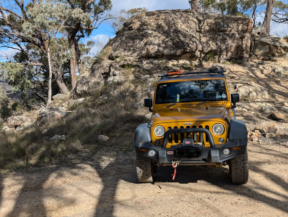
In our recent travels around the Victorian High Country, me and Beetle the Jeep drove the Sixteen Mile Jeep Track (also called the Sixteen Mile Jeep Road). Although this track can be tricky in the wet, it’s not very challenging when dry. The forest and countryside are beautiful, well worth the drive.
Here’s a taste of the track:
Would you like to explore more of the Victorian High Country? I cordially invite you to crawl around a few of the tracks that we followed:
In this post: Blue Rag Range Track near Dargo in Victoria, Australia: the track, the views, and our route to get there.
This is the blog of Mark Wordsworm, the travelling worm. I’m a 40-year-old bookmark (give or take a few years) and I proudly boast my own Hallmark serial number, 95 HBM 80-1. You’ll probably want to read all about me and my Travelling Companion (the TC).
Today’s travel notes
Me and the TC recently spent a week and a half in the Victorian High Country, a landscape of mountains and valleys in the state of Victoria, Australia. On 23 February, we tackled a bucket-list four-wheel driving track in the area: Blue Rag Range Track.
The book I’m in
Lathe of Heaven by Ursula K Le Guin. Every time this worm gets into a book by this author, I’m astounded at the cleanness of her style and the smartness of her plots. This book is no exception.
Recommended accommodation
Hinnomunjie Bridge campground in Omeo Valley, Victoria. The site is well laid out on the banks of the Mitta Mitta river, with clean toilets and clear grassy areas to pitch your tent.
Recommended restaurant
Dargo Hotel in Dargo.
Travel tips
Try to avoid pitching your tent on a slope. The TC, bless her cotton socks, kept waking up with her feet hanging over the end of the bed and a big empty space at the top of the bed. She finally worked out that she was sliding down thanks to the slope.
The photos
Me at the trig point at the top of Blue Rag Range Track (elevation 1,700 metres / 5,580 feet):
Observant readers will notice the trophies stuck to the trig tower, by people who’re proud to make it to the top. We didn’t leave a trophy, but it is indeed a great feeling to have made this trip.
Observant readers will also notice that it was windy up there! This worm strikes a jaunty pose nonetheless, with my tassel horizontal and a firm grasp from a friendly hand.
Hyper-observant readers will notice Peg skulking in the book at bottom right. Peg makes occasional appearances in my posts, her firm grip on reality keeping me grounded. But even Peg wasn’t strong enough for the gale at the Blue Rag Range trig point.
The track
It took us three and a half hours (12:30pm to 4pm) to drive the track itself, with a one-hour lunch break and stops for photographs.
At the start of the track is a steep mound with a hole at its crest, ready to trap the unwary vehicle. Most people choose to go round:
Another video shows the approach to the trig point at the top of the track:
Friendly locals in Dargo told us that it’s unwise to venture beyond the trig point. Those who do will almost certainly need help recovering their vehicles, and the Dargo police are inundated with calls for help from drivers who don’t realise the risks.
The views from the track are stunning, with mountain ranges all round:
Much of the track runs along the top of the ridge:
A sign post marks the track part-way along, surrounded by white tree skeletons and scrubby grass:
Our route
We started the day by fuelling up in Dargo. This is one of the cars in our convoy:
The Dargo Hotel offers a good feed. Here’s Beetle the Jeep, lined up and ready to go:
We left Dargo in mid-morning, following Lind Avenue along the banks of the Dargo River, then Dargo High Plains Road to the start of the track.
A sign post shows the start of the Blue Rag Range Track on Dargo High Plains Road:
After reaching the Blue Rag Range trig point, we turned round and went back to Dargo High Plains Road, continuing north to the B500.
We camped overnight at Hinnomunjie Bridge campground on the banks of the Mitta Mitta river in Omeo Valley. This beautiful fire barrel was made by one of our travelling companions:
In this post: Billy Goat Bluff Track near Dargo in Victoria, Australia, plus some lovely country and a river to camp beside.
This is the blog of Mark Wordsworm, the travelling worm. I’m a 40-year-old bookmark (give or take a few years) and I proudly boast my own Hallmark serial number, 95 HBM 80-1. You’ll probably want to read all about me and my Travelling Companion (the TC).
Today’s travel notes
Me and the TC recently spent a week and a half in the Victorian High Country, a landscape of mountains and valleys in the state of Victoria, Australia. On 22 February, we tackled a well-known four-wheel driving track in the area: Billy Goat Bluff Track.
The book I’m in
Jericho’s Dead by William Hussey. This is the second in a series about Scott Jericho, an ex police detective and member of a fairground family who seems to attract serial killers and other nasties. Highly recommended.
Recommended accommodation
Black Snake Creek campground on the banks of Wonangatta River.
Travel tips
Although Billy Goat Bluff track has been graded and is relatively easy driving, many of the tracks in the Dargo area are challenging. Pick your route to and from Billy Goat Bluff with care.
The photos
Crawling the tracks is what yours truly does best. So, let’s start with a video of part of Billy Goat Bluff Track, to give you and idea of what it’s like. The track was graded in late 2024. When we were there in February 2025, the driving was easy. But beware the steep drop-offs on both sides!
The TC, bless her cotton socks, talks about the Billy Goat Gruff track in the video. It’s actually Billy Goat Bluff. Rumour has it that the track got its name because to drive it, you need to be as agile as a goat.
The track features a steep gradient of 27%, climbing 1,200 metres over a distance of 7 kilometres.
The TC’s water bottle compressed as if it had been in a jet plane:
How long does it take? It took us less than two hours to drive the track. We started the track itself at soon after 9am and finished before 11am, with plenty of stops for photographs.
Here’s our convoy on the infamous ridge. Those edges give little margin for error or for passing an oncoming vehicle:
All round us, the peaks and valleys of the high country conspired to make us feel like insignificant worms on the face of the universe (oh wait, I am a worm, and decidedly not insignificant!):
Getting there: On the night before the trail, we camped at Black Snake Creek campground on the banks of the Wonangatta River:
We left the campground at around 8.30am and followed Wonangatta Road northwards for half an hour or so, winding along the banks of the Wonangatta River until we joined Billy Goat Bluff Track.
The lovely Kingwill Bridge on Wonangatta Road:
In case your appetite for Billy Goat Bluff isn’t yet satiated:
After finishing Billy Goat Bluff, we took a short detour to visit Pinnacles Lookout in the Miowera region:
There I met my cousin Dilly the Butterfly:
We then explored some of the tracks around Dargo, which turned out to be much more of an adventure than planned. We helped some folks out of trouble, which meant that we were still on the tracks late at night:
We found our way safely to Castleburn Creek campground at midnight, rounding off another day of happy travelling.
Speaking to the locals in Dargo the next day, we heard that many people find themselves in trouble on these tracks. The maps are not up to date, and as a result people don’t know what’s in store for them. Take care out there on the tracks, make sure you’re in a capable vehicle, and travel with some mates to help if you do run into a tricky situation.
In this post: Crossing the Macquarie River at Dixons Long Point, from the Hill End side. Plus some pictures of the historic town of Hill End and the Golden Gully gold-mining area.
This is the blog of Mark Wordsworm, the travelling worm. I’m a 40-year-old bookmark (give or take a few years) and I proudly boast my own Hallmark serial number, 95 HBM 80-1. You’ll probably want to read all about me and my Travelling Companion (the TC).
Today’s travel notes
Me, the TC, and Beetle the Jeep spent a night in the historic town of Hill End, New South Wales. Early the next morning, we set out to cross the Macquarie River at the well-known Dixons Long Point Crossing.
The book I’m in
Meru, by S.B. Divya. Excellent SciFi about a human and an alloy who fall in love, and about an experiment with human life on planet Meru. Alloys are post-human beings who share human and AI genes.
Travel tips
You’ll need a 4WD vehicle to complete this trip, because of the river crossing. It’s also good to be aware that the Macquarie River is a large river that can carry a significant volume of water after rain. It can be deep and the current can be strong enough to wash away cars and caravans. Always check the conditions before attempting the crossing.
The photos
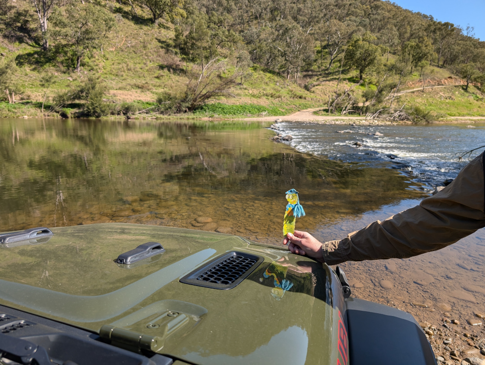
Me at Dixons Long Point Crossing:
It’s a trifle tricky to decide which line to take when crossing the river. We were driving from the Hill End side to the Bathurst side. The TC had watched several videos of other people making the crossing. The consensus of opinion seems to be that you should cross on the rougher side of the rocks, not the smooth side. Basically, follow the line between the two rows of rocks. That’s what we did. It was bumpy but fun, and the river level was low at the time we made the crossing.
On the other side, the TC, bless her cotton socks, struck up a conversation with a man who looked as if he knew the area. He said that originally, the intended line was on the smooth side of the rocks, where a causeway had been built. But then a flood moved most of the rocks down off the causeway, which resulted in a deep hole at one end. The hole is about the length of many vehicles’ wheelbase, so you can get stuck, especially if the vehicle doesn’t have much clearance. The rougher line is now the recommended route, although it’s basically bedrock.
Let’s back up, now that you’ve seen the crossing, and start at the beginning of the day’s trip…
A night in Hill End
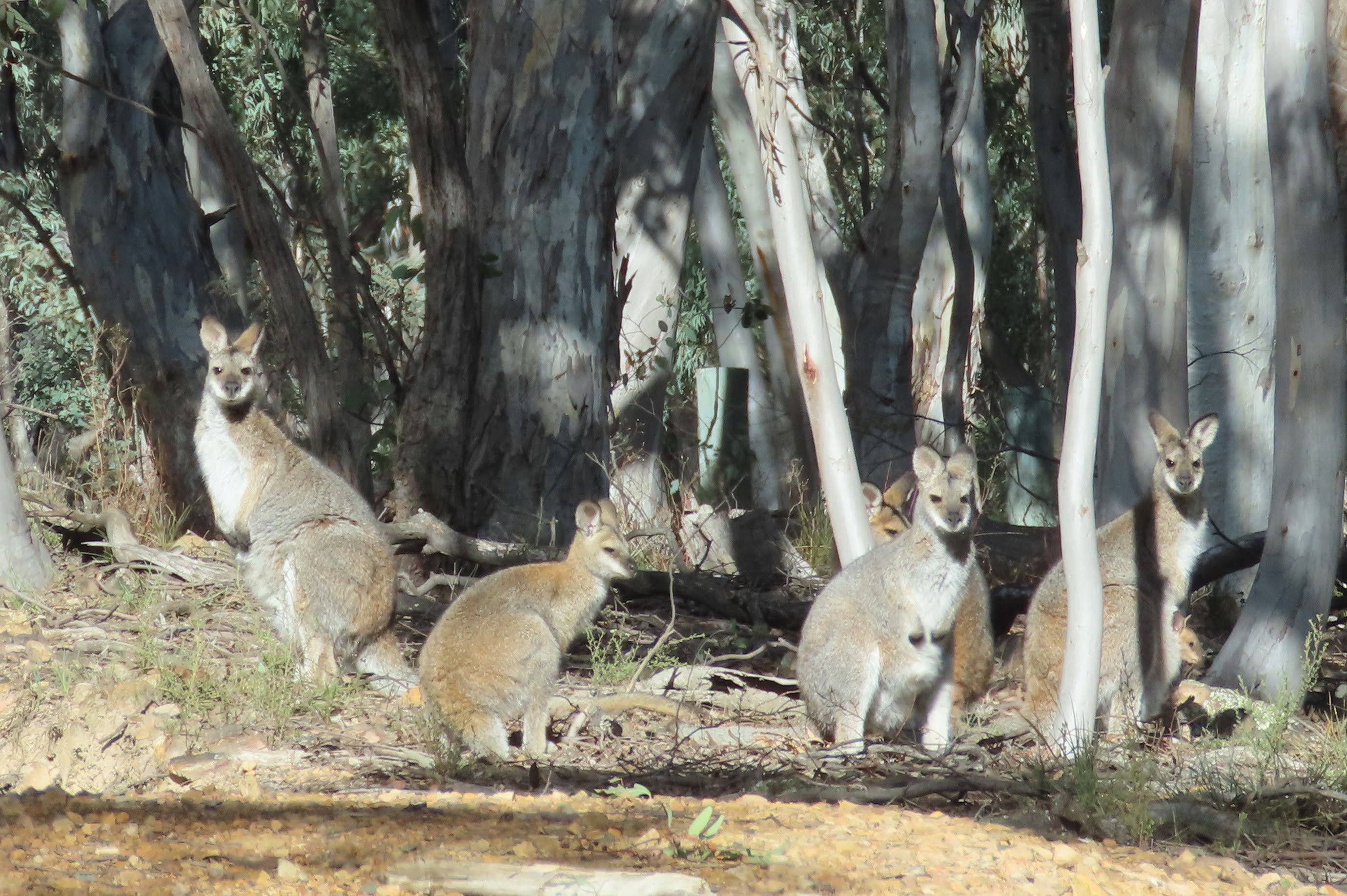
Before starting the drive to Dixons Long Point, we spent the night at Hill End Lodge:
The photo shows the reception area and restaurant of the lodge. We stayed in one of the cabins nearby. Early the next morning, the TC went for a stroll and came across a group of kangaroos. Most of them fled, but a big male stayed to keep watch, along with couple of others, one of which was a female with a joey in her pouch:
The TC, wise soul, decided that discretion is the better part of valour, and altered direction to keep away from the roos.
After breakfast, we paid a quick visit to the town of Hill end:
The Royal Hotel is another good option for an overnight stay in the town:
Golden Gully
We headed north up Hill End Road towards Ullamulla Road, and came across the enchanting Golden Gully:
Holes small and large pepper the eroded walls of the canyon. Many of them lead to shafts and tunnels dug by hopeful gold miners in the 1850s. The gold in this area is alluvial, washed down in several creeks that feed into the gully.
You can walk down the gully to the point where a sign warns of danger:
Ullamulla Road and Dixons Long Point
Me at the junction of Hill End Road and Ullamulla Road:
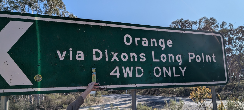
A sign warns of the nature of the upcoming crossing:
The road itself is an easy drive:
A sheep with a new-born lamb greeted us:
The next video shows the descent towards Dixons Long Point Crossing, on the Hill End side. At about 30 seconds into the video, a wallaby hops across the track in front of the car:
We stopped for a photo opp when we reached the water:
Tip: To see a video of the crossing itself, go back to the top of this post.
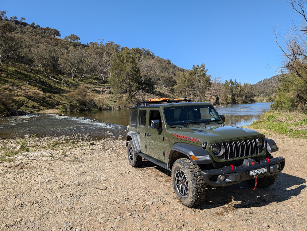
With her usual aplomb, Beetle the Jeep arrived safely on the Bathurst side of the river:
This is the blog of Mark Wordsworm, the travelling worm. I’m a 40-year-old bookmark (give or take a few years) and I proudly boast my own Hallmark serial number, 95 HBM 80-1. You’ll probably want to read all about me and my Travelling Companion (the TC).
Today’s travel notes
Me, the TC, and Janet the Jeep recently drove across country in the Blue Mountains area, from Little Hartley to the Jenolan area. The trip included Coxs River Road, Ganbenang Road, Cullenbenbong Road, Glen Chee Road, Six Foot Track, and Black Range Road.
The book I’m in
No Time for Goodbye, by Linwood Barclay. A psychological drama packed with plot twists. Much like a 4WD road.
Travel tips
You’ll need a 4WD vehicle for most of this trip. The first part, before the turnoff to Coxs River camping ground, is fine for 2WD vehicles. But you’ll need a 4WD to get down to the camp site, and then back up again to follow the rest of Glen Chee Road.
The photos
Me at Coxs River camp ground:
The TC, bless her woollen mittens, decided to focus on the river rather than on yours truly. Sometimes I disagree with her choices.
We started our trip at the Little Hartley end of Coxs River road. The first hour or so is a lovely, meandering route, part sealed and part dirt. The views are of rolling hills and dales. And cows. This shot is from a trip last year:
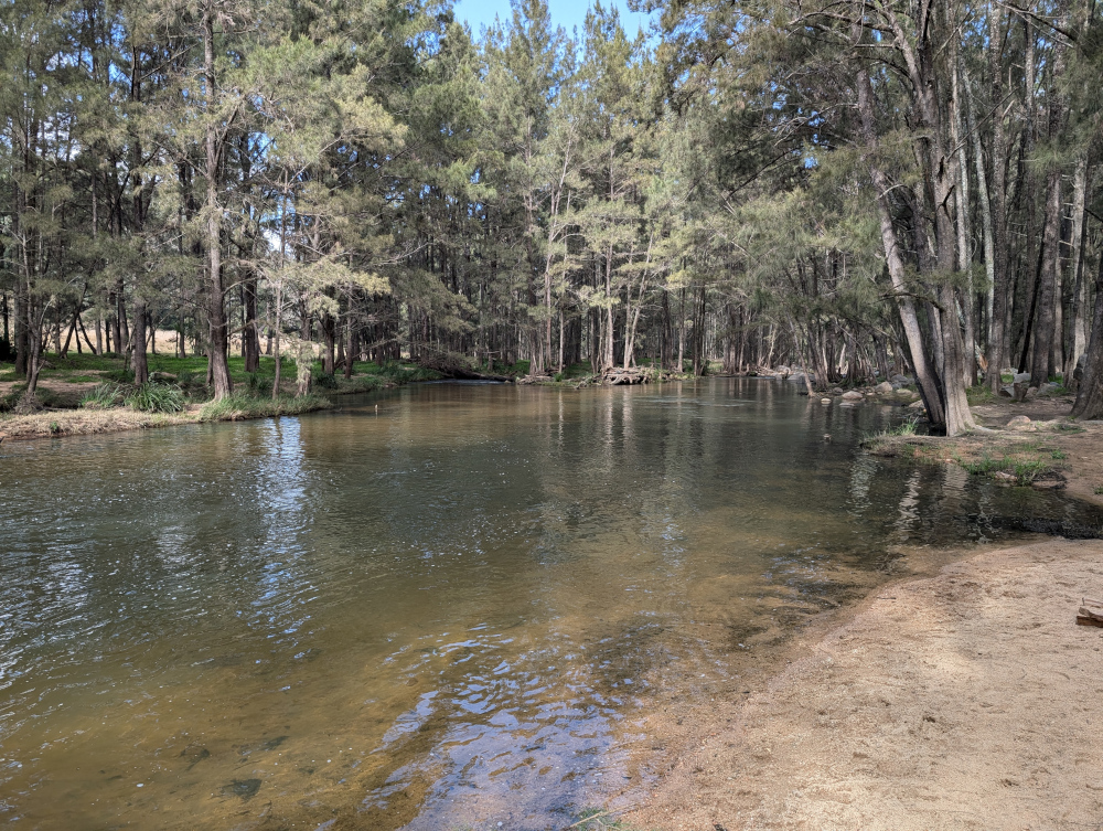
At the camp ground, Coxs River is wide and rippling:
Looking in the other direction, the river widens out into tranquil pools:
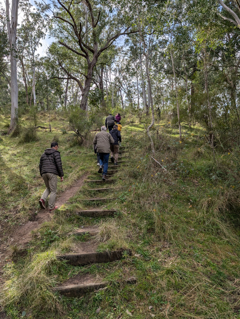
We took a walk from the camp ground towards Bowtells Swing Bridge. This is a 20-minute walk through the forest, with views of the river gorge on one side:
Bowtells Swing Bridge is currently closed for maintenance. It’s been so for a long while: years. This worm has never seen it open. Crossing the bridge could be a wild ride, swinging over a deep river canyon:
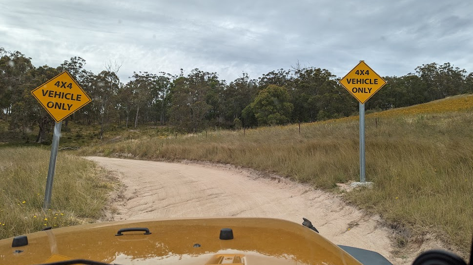
If you turn left when you come up the road from the camp ground, you enter the 4WD-only part of Glen Chee Road:
See what it’s like driving Glen Chee Road near Pass Gully. This clip shows some track erosion, but it’s an easy drive when dry:
Further along Glen Chee Road, descending towards Alum Creek Camping Ground:
The road leads through pretty forest:
Despite it being mid winter when we made this trip, yellow flowers were sprinkled across the bushland:
In the next video, we cross Little River. This is one of several river crossings on the trip. They’re not hard, provided the river is low and your vehicle is a capable 4WD.
This is the blog of Mark Wordsworm, the travelling worm. I’m a 40-year-old bookmark (give or take a few years) and I proudly boast my own Hallmark serial number, 95 HBM 80-1. You’ll probably want to read all about me and my Travelling Companion (the TC).
Today’s travel notes
Me and the TC took Janet the Jeep out to the Pinnacle Rocks in the Blue Mountains area, west of Sydney, Australia. The drive takes you from Capertee down the Pinnacle Rocks Firetrail, through Turon National Park, on into the forests of Dark Corner, finishing up in Sunny Corner.
The drive is beautiful, and not without some challenges!
The book I’m in
The Island of Missing Trees, by Elif Shafak. I’ve just started this book (I’m on page 20) and it’s already gripped me tight.
Travel tips
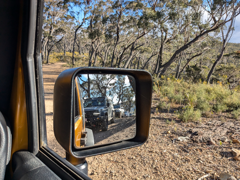
To do this drive, you need a capable 4WD car and preferably at least one other car on the trip. It can be useful to have someone to pull you out of a bog or help you get up a steep, rutted hill.
Check the river levels before you go. The trail crosses the Turon River several times, and the river levels can rise significantly after heavy rain.
From the top of the Pinnacle Rocks, you have a panoramic view of the valleys and forests all round. The next shot shows just the flat area at the top of the hill, as seen from the top of the rock:
The first part of the drive, from Capertee to the Pinnacle Rocks, is scenic and fairly easy. There’s one rubbly hill climb that can be a bit of a challenge until you find the right “line”, as seasoned four-wheel-drivers say.
The trail winds along the beautiful Turon River. This shot is from a previous trip (July 2023), when we explored one of the camping areas next to the river:
The Turon River was in a tranquil mood this week. Experiences vary. It’s worth checking the river levels before you go!
Parts of the drive wind along a ridge, with valleys dropping away on both sides. At times, you’re surrounded by white-trunked gums. Depending on the time of year, yellow or white flowers cover the bush. The next photo is from another trip along the same trail, in August last year:
Kangaroos and wallabies stopped to watch us, before bounding away. There were several youngsters in this group:
After the Pinnacle Rocks, things get more interesting, especially if you take the longer route down to Sunny Corner rather than the short route to Portland.
At several points along the trail, you’ll encounter bogs. Some of them are harmless, others are deep, sticky, and smelly. The trouble is, it’s hard to know which is which just by looking at them! On a previous trip, we had one vehicle completely bogged and needing to be pulled out. And Janet was very nearly bogged once too, but managed to extricate herself by some quick wheel jiggling and reversing.
This video shows one of the bogs where we didn’t get stuck!
Towards the end of the trail is a fun section of “wombat holes”. These are dips and humps created by water erosion, that make the car seesaw from side to side. Janet attacked the wombat holes with gusto and enjoyed the experience immensely:
The descent into the last creek crossing in particular is quite steep and rutted. It can be very slippery when wet. We took it slowly, with someone outside the car to “spot” the way for us.
The climb out of the same creek is quite steep too. It’s rocky and a bit tricky. Janet made it easily, after a slight adjustment in direction half way up. Other cars, those with longer wheel bases, found it a little more difficult, but everyone got up the hill without needing a winch!
This is the blog of Mark Wordsworm, the travelling worm. I’m a 36-year-old bookmark (give or take a few years) and I proudly boast my own Hallmark serial number, 95 HBM 80-1. You’ll probably want to read all about me and my Travelling Companion (the TC).
Today’s travel notes
Me and the TC are touring bonny Scotland this week. We spent a day exploring the tracks around Loch Lomond and Loch Long in a Land Rover Defender. Our guide from 4×4 Adventures Scotland was skilled and knowledgeable, and excellent company to boot.
The book I’m in
Robinson Crusoe by Daniel Defoe, a tale of wonder and woe. It amuses this worm to apply analytic skills to the language and norms of the day, while at the same time enjoying a good yarn.
Cautionary travel tales seem to appeal to the TC while herself travelling.
Travel tips
Come rain or shine, take a day off your busy travel schedule to soak up the beauty of the natural surrounds.
The photos
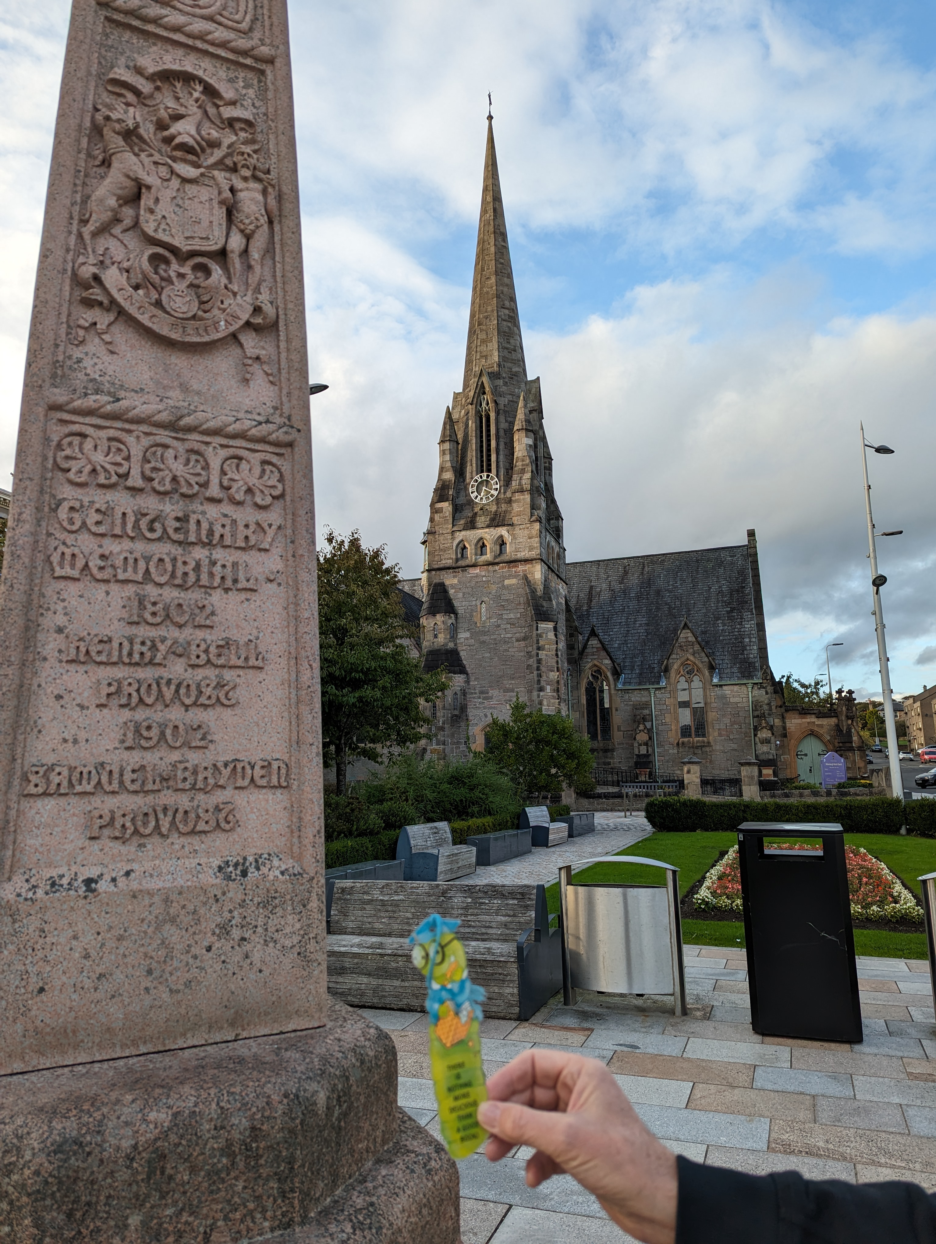
Me in Helensburgh alongside a memorial to Henry Bell, provost of the town in 1802. Helensburgh lies on the shores of Gare Loch, near Loch Lomond. Henry Bell was the first person to found a steamship business on British waters:
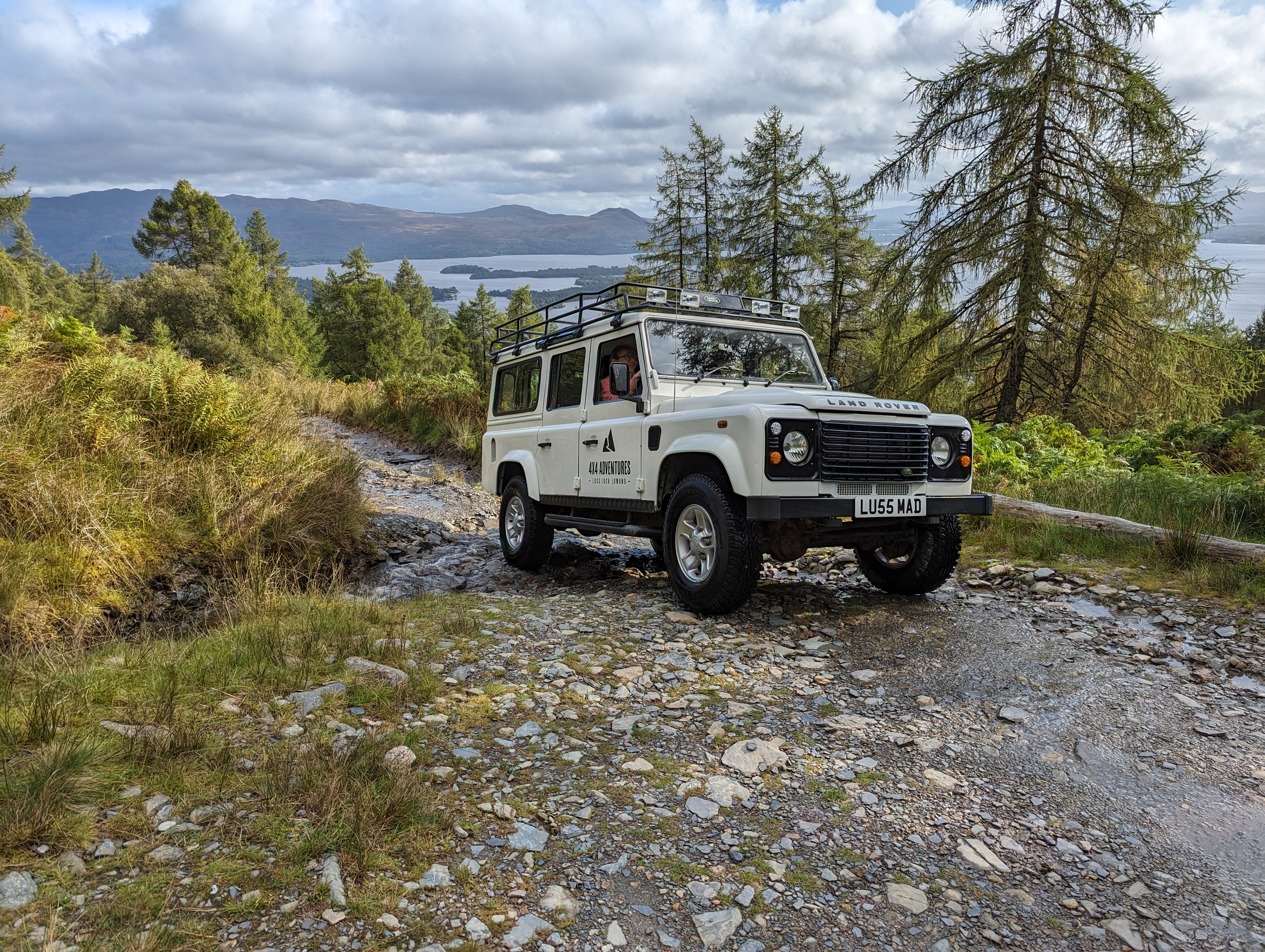
The TC organised a full-day off road adventure with 4×4 Adventures Scotland. The company provided a Land Rover Defender and a local guide named Alan, who knew the off road tracks around Loch Lomond and surrounds like the back of his hand.
The vehicle was a Land Rover Defender 110 with a 2.4 litre engine, 33″ all-terrain tyres, a manual gear box, and differential lockers front and back. Approximately ten years old, she’d earlier served as an ambulance. She bore the name LU55 MAD, of which the first part harks to her base in the town of Luss and the second part harks to her nature. Show her a steep, rocky hill with a stream of water coursing down it, and she jumped at the challenge of getting to the top:
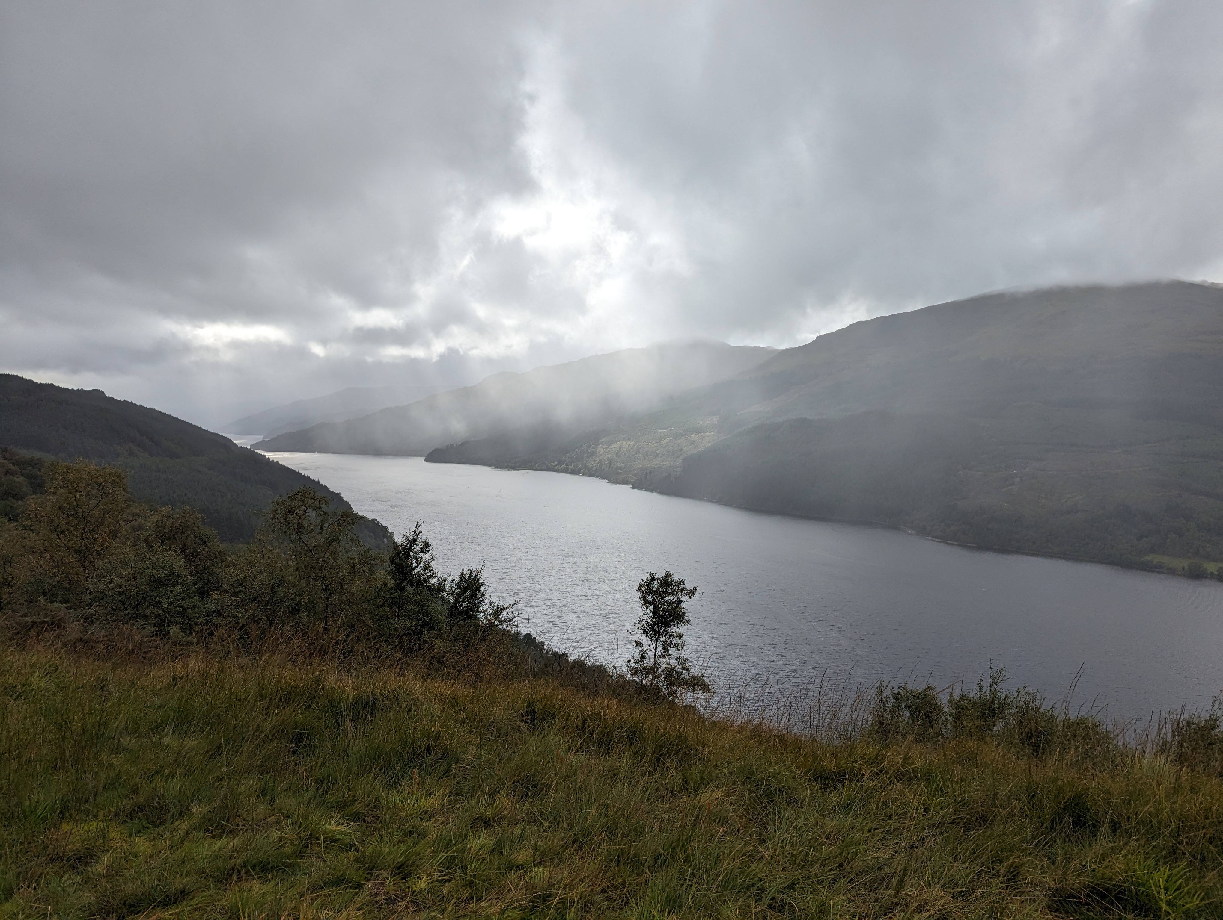
The weather did us proud, throwing us an abundance of mood-filled scenes. This is the gorgeous Loch Long:
The TC, bless her cotton socks, could not restrain the Ooohs and Aaahs. This worm concedes that there was beauty to be had. In particular, these mossy knolls appealed to my delicate body type. The hillocks rise a couple of feet in height and are entirely soft and spongy, with no hard rock or trunk beneath:
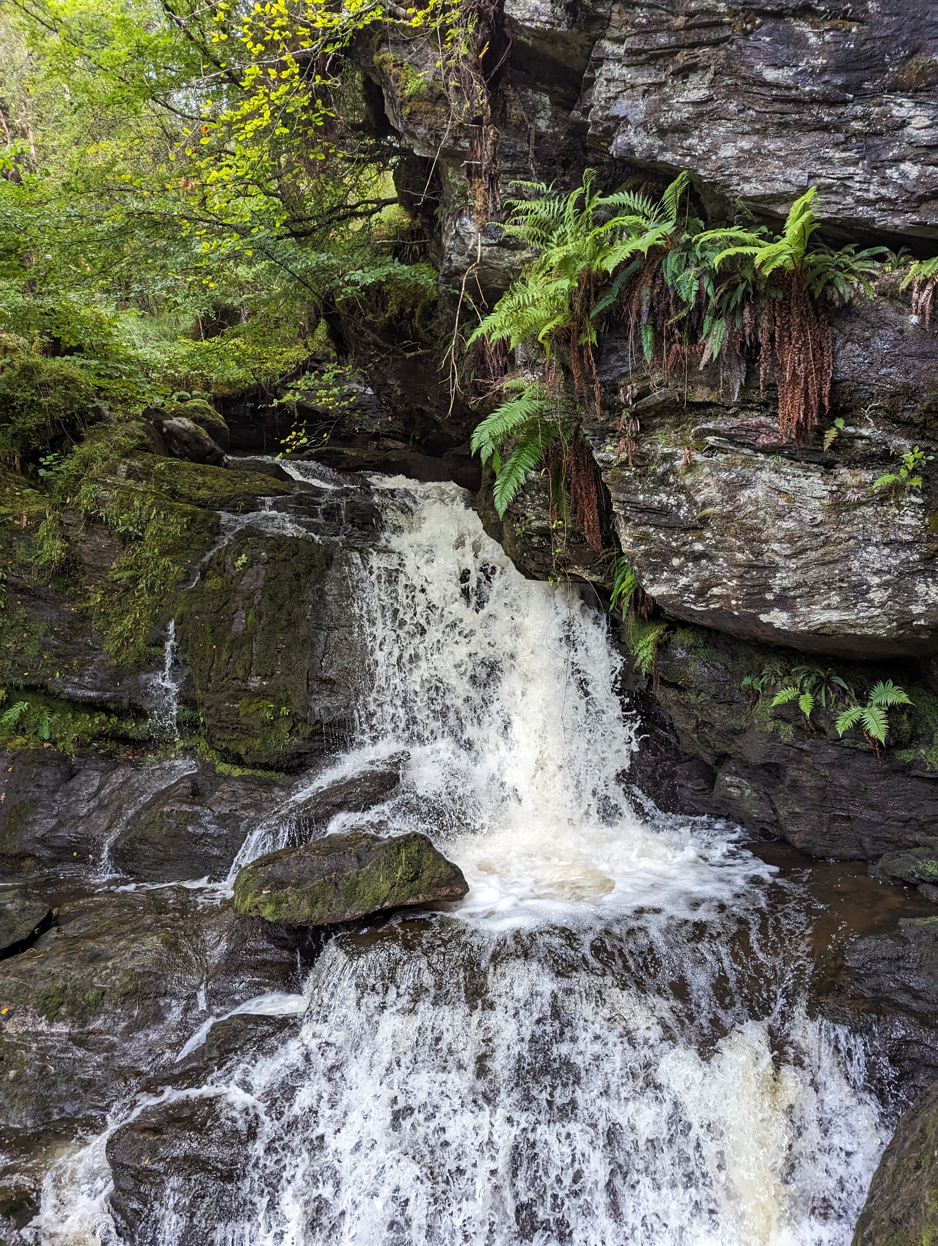
Streams gushed down the slopes, ushered by moss and fern:
More views of mount and loch that made the TC go Aaah. First, looking out over the islands in the wide part of Loch Lomond:
To finish off, here’s the track running along Loch Long:
This is the blog of a 25-year-old bookmark. I proudly boast my own Hallmark serial number, 95 HBM 80-1. You’ll probably want to read all about me and my Travelling Companion (the TC) .
Today’s travel notes
Me and the TC have been on Fraser Island for a week. I told you about it in my last post: Fraser Island – prehistoric beauty. One of the fun things about a holiday on an island is getting there, and getting about once you’re there.
Fraser Island is a bit rough and ready. To get there, you must first find your way to Hervey Bay on the mainland, in Queensland, Australia. There’s a small airport, so we flew in by Virgin Blue Airlines from Sydney.
Next you need to hire a 4wd vehicle and put it on a barge for the short crossing to the island’s west coast. Then you start driving.
My impressions? 4wd travel is fun and gets you to places you’d not see otherwise.
Travel tip
Take your comfort zone with you, be it chocolate, coffee or a friend.
Recommended 4wd rental
Aussie Trax in Hervey Bay on the mainland.
The TC hired a Land Rover Defender. A good, sturdy, feel-the-ground, low-comfort but no-nonsense vehicle. Just what the TC ordered.
Aussie Trax also supplied useful information about driving on Fraser Island, maps and a suggested itinerary. The vehicle gave no trouble whatsoever, which indicates that it is well maintained. A great 4wd experience.
The book I’m in
Creation in Death, by J.D. Robb aka Nora Roberts.
Lieutenant Eve Dallas, New York cop, investigates a series of murders. A good read.
The photos
Me at the Maheno shipwreck, on the east coast of Fraser Island:
Getting about on Fraser Island
The Maheno got into trouble during a cyclone in 1935 and was beached a couple of days later. Luckily there were very few people on board, since the ship was on its way to being scrapped:
Getting about on Fraser Island
This is the Land Rover Defender we hired, on the barge crossing from River Heads to the island:
Getting about on Fraser Island
Here’s a rare shot of the TC, not too steady on her pins in this one. This is just because the ferry ride is a bit bumpy, she’d hasten to assure me:
Getting about on Fraser Island
Driving on a sand road through the forest on Fraser Island. I have to take my hat off to the TC. She got right into the four-by-four driving thing. But I also have to add that it takes more guts to be a passenger than the driver:
Getting about on Fraser Island
We did get stuck a few times. But getting unstuck was quite easy, with some reversing and putting the vehicle into low range for the very soft sand.
On the east coast of the island is Seventy-Five Mile Beach, also called the 4wd highway:
Getting about on Fraser Island
You’re apt to be chased by a small aeroplane, landing on or taking off from the same stretch of hard sand you’re driving on. Take a closer look at the shot above. Can’t see it? Here’s a zoomed-in section of the same photo:
Getting about on Fraser Island
Bus, plane and another 4×4 all comin’ at ya. That’s a mighty narrow strip of hard sand. Take a look through our windscreen:
Getting about on Fraser Island
Yup, sometimes I was glad I was cosily tucked into my book in the TC’s travel bag, along with Peg and the Trail Bars. But it all turned out well in the end:
Getting about on Fraser Island
Here’s a movie so that you can have a full-on virtual experience of driving a Land Rover Defender on Fraser Island. We’re heading east along Cornwells Break Road and driving onto the soft sand of Seventy-Five Mile Beach. You can hear the revs rise when the vehicle starts driving through the soft sand at the top of the beach:
The TC says that driving along Seventy Five Mile Beach is fun, beautiful and just a bit scary. The soft white sand squeals as you drive over it. The darker sand looks hard, but it may just be wet and slushy. The normal rules of the road apply, but not everyone follows them. You have to be aware of the tide and cannot drive on the beach at high tide or for two hours either side of it. There’s a movie of driving along the beach itself on my YouTube playlist.
Here’s a short movie of us driving over a washout on the beach. A washout is where a creek runs down over the beach into the sea:
Driving through the forest is different and even more fun. It really is all sand:
When the TC got back home and drove her little Holden Barina again, she described it as “freaky. I can’t feel the engine rumbling. Is it even running? The clutch is too smooth. And where’s the ground? I can’t feel it at all. It’s just wrong.” That’s the TC for you. Effusive at times, but at least you know where she’s at.
Want to know more about Fraser Island? Try my YouTube playlist for more videos. And stay tuned to this blog for more posts about the island’s lakes and creeks, its creatures and the deadly dangers you are sure to encounter. And, of course, it’s all about the sand.