Travelling Worm

A bookworm's travelogue

Category: australia

  • Huts of the Victorian High Country

    In this post: Join me on a crawl around the mountain huts of the Victorian High Country in Australia.

    This is the blog of Mark Wordsworm, the travelling worm. I’m a 40-year-old bookmark (give or take a few years) and I proudly boast my own Hallmark serial number, 95 HBM 80-1. You’ll probably want to read all about me and my Travelling Companion (the TC).

    Today’s travel notes

    In our recent travels around the Victorian High Country, me and the TC visited several of the area’s well-known mountain huts. The huts vary from a basic four-walls-and-a-roof structure to quite a solid affair with furnishings. Most of them were built to offer shelter to walkers, cattle folk, and others who might be caught out by the unpredictable weather of the highlands. Some are named for the families who lived in them, like Lovick’s Hut.

    I’ve written a separate blog post about the most famous hut of all: Craig’s Hut, from the movie, The Man from Snowy River.

    The book I’m in

    The Phenomenon of Man by Pierre Teilhard de Chardin. I’m chewing my way through this momentous work, savouring it a piece at a time.

    Travel tips

    If at first you don’t spot the dunny (that’s Australian for toilet), take a walk and look again. Most campgrounds and picnic areas have a long-drop.

    From the sublime to the ridiculous… a dunny on the Paradise Falls track:

    Recommended accommodation

    Camping is the best option for a trip around the Victorian High Country. It’s hard to predict where you’ll find yourself at the end of each day. Most likely, you won’t be anywhere near a hotel.

    Luckily, the campgrounds are well laid out and most have a toilet, albeit a long-drop. Here are the campgrounds we stayed at.

    Seven (count ‘em: 7) days camping in a row. That’s a record for yours truly:

    • Day 1 (18 February): The campground near Craig’s Hut. Elevation 1,450 metres. It was cold, even in the middle of the Australian summer. This worm recommends a thick book to cuddle up in.
    • Day 2 (19 February): A camping site on Mount Howitt. Elevation 1,600 metres. It was even colder that night, due to some wind and an early morning mist. The TC, bless her thick cotton socks, wore leggings, gloves, two T shirts, two soft jackets, and a large Dutch jacket, and huddled down into her sleeping bag.
    • Day 3 (20 February): Eaglevale campground near Dargo. Those who aren’t made of cardboard had a refreshing dip in the Wonangatta river.
    • Day 4 (21 February): Black Snake Creek campground, again on the banks of the Wonangatta River. The non-cardboard folks took another swim in the river.
    • Day 5 (22 February): Castleburn Creek campground on Dargo Road.
    • Day 6 (23 February): Hinnomunjie Bridge campground, on the far side of Omeo.
    • Day 7 (24 February): Taylor’s Crossing in the Nunniong area. The TC, bless her cotton socks, spotted her first Gang-gang Cockatoos here.

    What about food? What about the pretty berries?

    This worm recommends that you bring all your supplies when travelling the lesser-known roads of the high country. People in the know can snack off bush tucker, but beware: don’t eat anything unless you’re sure it’s good for humans. Some of our party were keen to try these Dianella berries. But not all Dianellas are edible!

    The photos

    Me at the Washington Winch on Nunniong Road near Moscow Villa Hut:

    Yours truly is nicely in focus. That’s how I like it.

    Ah, you want to know about the winch too?

    The Washington Winch was powered by steam, and built in Seattle, USA, to haul timber up steep slopes.

    Here’s the winch hook, which hangs above the track a few metres from the engine:

    And now, on to those huts.

    Craig’s Hut

    If you’ve seen the movie, The Man from Snowy River, then you’ve had your breath taken away by the beauty of the mountain views from Craig’s Hut. Canny readers will spot yours truly on the window sill of the hut in the above photo. To find your breath again, read my separate blog post about Craig’s Hut and The Man from Snowy River.

    Bindaree Hut

    Pikes Flat Hut

    Pike’s Flat Hut was one of the more dilapidated structures. It had horse feed inside, and thistles (an introduced weed in Australia) outside.

    Bluff Hut

    We stopped at Bluff Hut for lunch and a stroll. The hut was quite substantial, a place I could imagine myself sheltering in if the weather got bad.

    Lovick’s Hut

    Lovick’s Hut is another substantial, liveable structure.

    Howitt Plains Hut

    Wonangatta Hut near Bryce’s station

    This hut had an attractive, sturdy sleeping platform.

    Black Snake Creek Hut

    This hut and the nearby camping area are on the banks of the Wonangatta River.

    Moscow Villa Hut

    Fediverse Reactions

  • Blue Rag Range Track, VIC

    In this post: Blue Rag Range Track near Dargo in Victoria, Australia: the track, the views, and our route to get there.

    This is the blog of Mark Wordsworm, the travelling worm. I’m a 40-year-old bookmark (give or take a few years) and I proudly boast my own Hallmark serial number, 95 HBM 80-1. You’ll probably want to read all about me and my Travelling Companion (the TC).

    Today’s travel notes

    Me and the TC recently spent a week and a half in the Victorian High Country, a landscape of mountains and valleys in the state of Victoria, Australia. On 23 February, we tackled a bucket-list four-wheel driving track in the area: Blue Rag Range Track.

    The book I’m in

    Lathe of Heaven by Ursula K Le Guin. Every time this worm gets into a book by this author, I’m astounded at the cleanness of her style and the smartness of her plots. This book is no exception.

    Recommended accommodation

    Hinnomunjie Bridge campground in Omeo Valley, Victoria. The site is well laid out on the banks of the Mitta Mitta river, with clean toilets and clear grassy areas to pitch your tent.

    Recommended restaurant

    Dargo Hotel in Dargo.

    Travel tips

    Try to avoid pitching your tent on a slope. The TC, bless her cotton socks, kept waking up with her feet hanging over the end of the bed and a big empty space at the top of the bed. She finally worked out that she was sliding down thanks to the slope.

    The photos

    Me at the trig point at the top of Blue Rag Range Track (elevation 1,700 metres / 5,580 feet):

    Observant readers will notice the trophies stuck to the trig tower, by people who’re proud to make it to the top. We didn’t leave a trophy, but it is indeed a great feeling to have made this trip.

    Observant readers will also notice that it was windy up there! This worm strikes a jaunty pose nonetheless, with my tassel horizontal and a firm grasp from a friendly hand.

    Hyper-observant readers will notice Peg skulking in the book at bottom right. Peg makes occasional appearances in my posts, her firm grip on reality keeping me grounded. But even Peg wasn’t strong enough for the gale at the Blue Rag Range trig point.

    The track

    It took us three and a half hours (12:30pm to 4pm) to drive the track itself, with a one-hour lunch break and stops for photographs.

    At the start of the track is a steep mound with a hole at its crest, ready to trap the unwary vehicle. Most people choose to go round:

    Another video shows the approach to the trig point at the top of the track:

    Friendly locals in Dargo told us that it’s unwise to venture beyond the trig point. Those who do will almost certainly need help recovering their vehicles, and the Dargo police are inundated with calls for help from drivers who don’t realise the risks.

    The views from the track are stunning, with mountain ranges all round:

    Much of the track runs along the top of the ridge:

    A sign post marks the track part-way along, surrounded by white tree skeletons and scrubby grass:

    Our route

    We started the day by fuelling up in Dargo. This is one of the cars in our convoy:

    The Dargo Hotel offers a good feed. Here’s Beetle the Jeep, lined up and ready to go:

    We left Dargo in mid-morning, following Lind Avenue along the banks of the Dargo River, then Dargo High Plains Road to the start of the track.

    A sign post shows the start of the Blue Rag Range Track on Dargo High Plains Road:

    After reaching the Blue Rag Range trig point, we turned round and went back to Dargo High Plains Road, continuing north to the B500.

    We camped overnight at Hinnomunjie Bridge campground on the banks of the Mitta Mitta river in Omeo Valley. This beautiful fire barrel was made by one of our travelling companions:

    Fediverse Reactions

  • Craig’s Hut, The Man from Snowy River

    In this post: Craig’s Hut in Mount Buller — the hut was first built as a temporary set for the movie, The Man from Snowy River, and is now a serene place to visit in the Victorian High Country.

    This is the blog of Mark Wordsworm, the travelling worm. I’m a 40-year-old bookmark (give or take a few years) and I proudly boast my own Hallmark serial number, 95 HBM 80-1. You’ll probably want to read all about me and my Travelling Companion (the TC).

    Today’s travel notes

    Craig’s Hut is one of several mountain huts that you can visit when touring the Victorian High Country, Australia. The huts are all different, some basic and some quite solid and well established. Most of them were built to offer shelter to walkers, cattle folk, and others who might be caught in the sometimes wild weather of the highlands. Some of the huts are named for the families who lived in them, like Lovick’s Hut and Fry’s Hut.

    Perhaps the most famous of them all is Craig’s Hut, named after a character in the movie, The Man from Snowy River.

    The book I’m in

    Survive to Fight, by Billy Billingham. This worm is taking refuge in a good action from time to time, while also chewing my way through The Phenomenon of Man by Pierre Teilhard de Chardin.

    Travel tips

    You need a good thick book to protect you from the elements. It was cold in the high country, even in the middle of an Australian summer.

    The photos

    Me, the Worm from Snowy River, at dawn on the window sill of Craig’s Hut:

    The hut was first built in 1981 for the movie, The Man from Snowy River, which was released in 1982. The movie is an Australian classic, based on a poem by Banjo Patterson. The poem, in turn, is based on the experiences of a real-life stockman named Jack Riley, with inspiration drawn from other mountain stockmen too. The hut was named for Jim Craig, the fictional main character of the movie.

    As a temporary replica of a cattleman’s shelter created specifically for the movie, the first version of the hut wasn’t built to last. But it became a popular destination in the Victorian High Country trails. When the structure started to fall apart, it was rebuilt by volunteers at the initiative of the four-wheel driving community: the Mansfield Alpine 4WD Club. The new version of the hut was re-opened to the public in 1993.

    In 1996, a bush fire destroyed the second version of the hut, and it was rebuilt by the local council and environmental organisations.

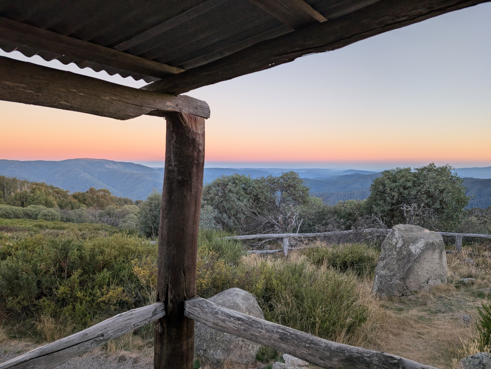
    The hut stands high on a hill top in Clear Hills, in the Mount Buller region, overlooking the Alpine Ranges. The views are pretty decent. Hues and accents change throughout the day. Sunset and sunrise are especially gorgeous. This picture was taken from the veranda of the hut at dawn:

    Inside Craig’s Hut:

    Our route

    Take note that the roads are closed for part of the year, due to snow and ice. You can’t get there by vehicle between June and November. The exact dates vary, depending on the weather. Before setting out, check the Parks Victoria web site for seasonal road closures.

    We left the small town of Whitfield in convoy shortly after 9am and followed various tracks, primarily Burnt Top Track and Black Landing Road, to Craig’s Hut. It was easy, scenic driving for four-wheel-drive enthusiasts.

    In mid morning, we took a break from driving to do the short walk (a few hundred metres) to Paradise Falls:

    The trails in the Victorian High Country are surprisingly well supplied with dunnies. Dunny? That’s what the Aussies call a toilet! This one was near the walking track to Paradise Falls:

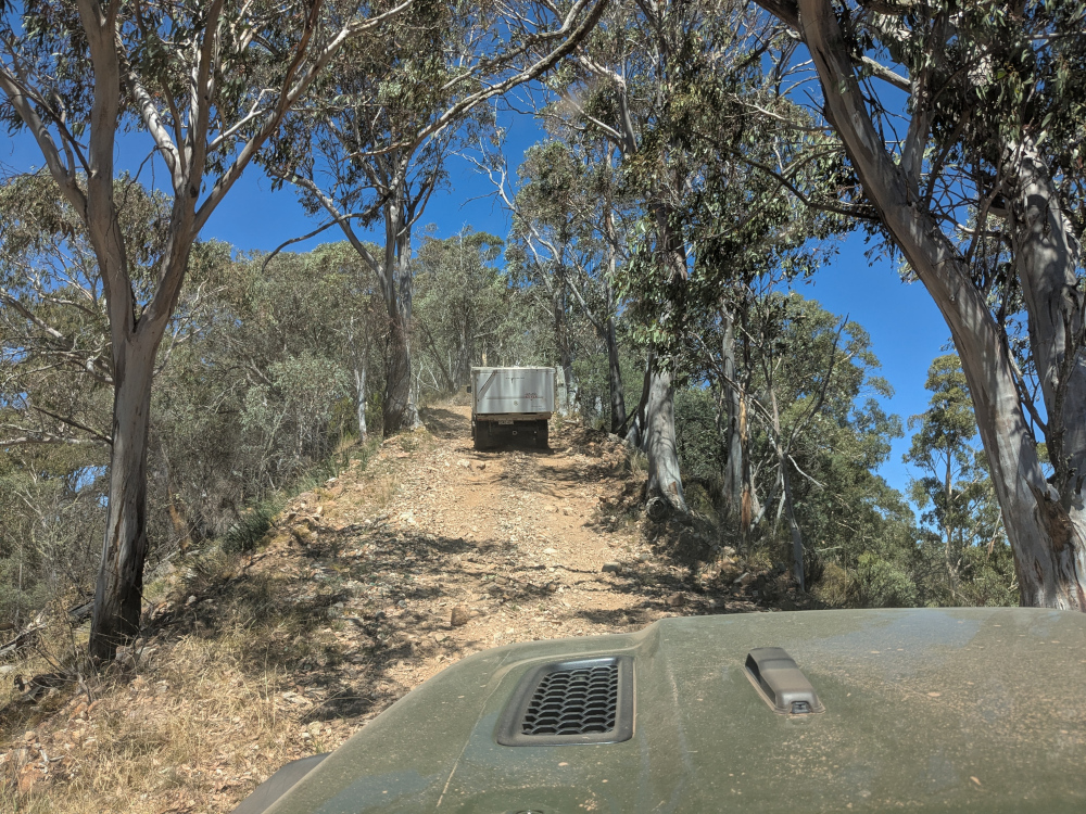
    Here’s a taste of Burnt Top Track:

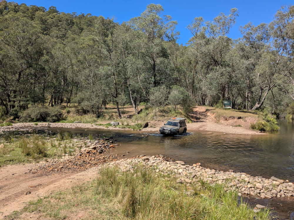
    We crossed the King River at Pineapple Flat. The water level was low and, apart from a slightly tricky entry into the gully that leads into the river, the crossing was easy:

    We reached Craig’s Hut at around 4:30pm.

    Camping

    We camped overnight in the campground near Craig’s Hut. The area was beautiful, tranquil, and, at an elevation of 1,450 metres, cold. The TC, bless her woollen socks, was shivering and shaking in her tent. Inside her sleeping bag, she wore thick socks, leggings, two shirts, two fleece jackets, a large padded jacket, and gloves.

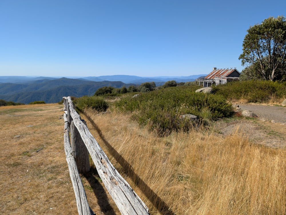
    Let’s finish off with one more photo of Craig’s Hut, taken soon after our arrival in the late afternoon:


  • The Big Koala & The Dog on the Tuckerbox

    In this post: The Big Koala, The Dog on the Tuckerbox, and a fearsome Fairy-wren, all near the New South Wales country town of Gundagai.

    This is the blog of Mark Wordsworm, the travelling worm. I’m a 40-year-old bookmark (give or take a few years) and I proudly boast my own Hallmark serial number, 95 HBM 80-1. You’ll probably want to read all about me and my Travelling Companion (the TC).

    Today’s travel notes

    On our way to the Victorian High Country, me and the TC stopped for a short break in the country town of Gundagai. The town is a popular stopping place on one of the main routes to the border between New South Wales and Victoria.

    Just outside the town, we met a big koala, a dog perched on a tucker box, and a bird that sits still for no-one.

    “What’s a tucker box,” you ask? It’s a lunch box. Nowadays, Australians carry their food around in an esky rather than a tucker box. “Esky?” That’s a cool bag or ice box, named after “eskimo”.

    The book I’m in

    The Phenomenon of Man by Pierre Teilhard de Chardin. Yes, the TC is putting me in some heavy stuff. We’ll see how this turns out.

    Travel tips

    When driving the Australian highways, take a turnoff and see where it leads.

    The photos

    Me and the Big Koala near Gundagai:

    It was, errm, interesting being so close to those claws. Yours truly survived by dint of keeping a low profile. That’s easy to do when you’re two-dimensional. Just turn sideways on.

    There are “big somethings” dotted all around Australia. This worm has already met the Big Bogan at Nyngan and the Kurri Kurri Kookaburra. Now the Big Koala. No doubt the TC, bless her itchy feet, will go in search of more big somethings.

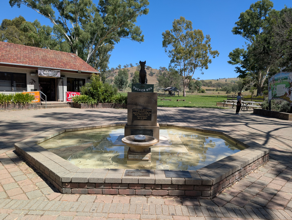
    A few million steps from the Big Koala (a few million, that is, if you’re a small worm like yours truly) is the Dog on the Tuckerbox:

    The plaque below the dog and the tucker box declares the statue to be a tribute to the pioneers of Australia, unveiled in 1932.

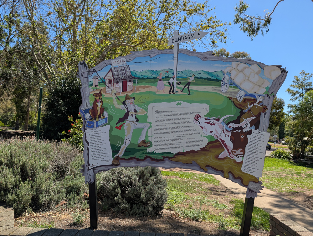
    A rustic sign post tells the story:

    Ironically, as far as I can tell, the dog that features as the hero of this monument was probably based on lyrics by Charlie ‘Bowyang’ Yorke, who wrote a far less clean poem than the two shown on the sign. In Charlie’s story, the dog did a poo on the cattleman’s tucker box.

    I’ve used a more polite word than the original poem, to protect tender ears. You can probably guess the original word: it rhymes with “sat“, which is now used as a replacement in the poem.

    What’s more, the dog chose his moment when the cattleman was battling through the hardest of times: his wagon was bogged, the axle snapped, the team of bullocks stuck, and rain starting. The unfortunate cattleman couldn’t even dry his trousers or boil a pot of tea.

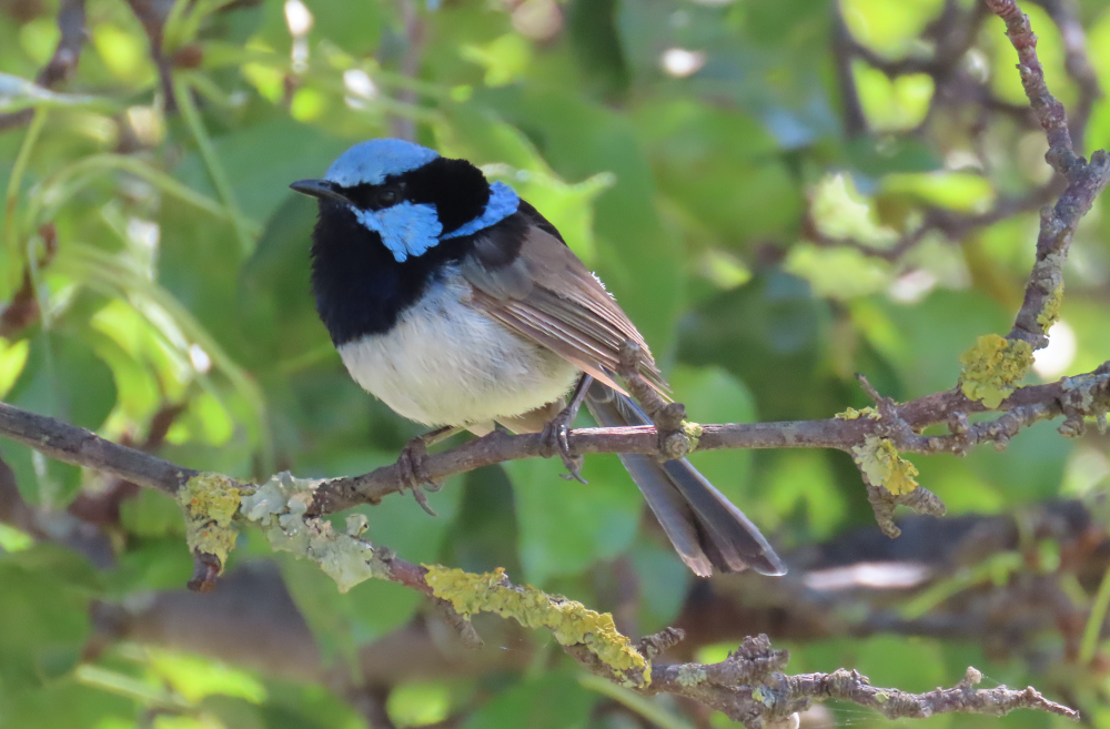
    On to prettier things:

    In using the word “pretty”, yours truly is of course referring to the lichen on the twigs, not to the beady-eyed creature perched above. That’s a baby dinosaur, known to some as a Superb Fairy-wren, and it eats people like me for breakfast. I stayed hidden in my book while the TC ooh-ed and aah-ed over the monster.

    I’ll be back soon with more news about our trip to the Victorian High Country.


  • Billy Goat Bluff Track, VIC

    In this post: Billy Goat Bluff Track near Dargo in Victoria, Australia, plus some lovely country and a river to camp beside.

    This is the blog of Mark Wordsworm, the travelling worm. I’m a 40-year-old bookmark (give or take a few years) and I proudly boast my own Hallmark serial number, 95 HBM 80-1. You’ll probably want to read all about me and my Travelling Companion (the TC).

    Today’s travel notes

    Me and the TC recently spent a week and a half in the Victorian High Country, a landscape of mountains and valleys in the state of Victoria, Australia. On 22 February, we tackled a well-known four-wheel driving track in the area: Billy Goat Bluff Track.

    The book I’m in

    Jericho’s Dead by William Hussey. This is the second in a series about Scott Jericho, an ex police detective and member of a fairground family who seems to attract serial killers and other nasties. Highly recommended.

    Recommended accommodation

    Black Snake Creek campground on the banks of Wonangatta River.

    Travel tips

    Although Billy Goat Bluff track has been graded and is relatively easy driving, many of the tracks in the Dargo area are challenging. Pick your route to and from Billy Goat Bluff with care.

    The photos

    Crawling the tracks is what yours truly does best. So, let’s start with a video of part of Billy Goat Bluff Track, to give you and idea of what it’s like. The track was graded in late 2024. When we were there in February 2025, the driving was easy. But beware the steep drop-offs on both sides!

    The TC, bless her cotton socks, talks about the Billy Goat Gruff track in the video. It’s actually Billy Goat Bluff. Rumour has it that the track got its name because to drive it, you need to be as agile as a goat.

    The track features a steep gradient of 27%, climbing 1,200 metres over a distance of 7 kilometres.

    The TC’s water bottle compressed as if it had been in a jet plane:

    How long does it take? It took us less than two hours to drive the track. We started the track itself at soon after 9am and finished before 11am, with plenty of stops for photographs.

    Here’s our convoy on the infamous ridge. Those edges give little margin for error or for passing an oncoming vehicle:

    All round us, the peaks and valleys of the high country conspired to make us feel like insignificant worms on the face of the universe (oh wait, I am a worm, and decidedly not insignificant!):

    Getting there: On the night before the trail, we camped at Black Snake Creek campground on the banks of the Wonangatta River:

    We left the campground at around 8.30am and followed Wonangatta Road northwards for half an hour or so, winding along the banks of the Wonangatta River until we joined Billy Goat Bluff Track.

    The lovely Kingwill Bridge on Wonangatta Road:

    In case your appetite for Billy Goat Bluff isn’t yet satiated:

    After finishing Billy Goat Bluff, we took a short detour to visit Pinnacles Lookout in the Miowera region:

    There I met my cousin Dilly the Butterfly:

    We then explored some of the tracks around Dargo, which turned out to be much more of an adventure than planned. We helped some folks out of trouble, which meant that we were still on the tracks late at night:

    We found our way safely to Castleburn Creek campground at midnight, rounding off another day of happy travelling.

    Speaking to the locals in Dargo the next day, we heard that many people find themselves in trouble on these tracks. The maps are not up to date, and as a result people don’t know what’s in store for them. Take care out there on the tracks, make sure you’re in a capable vehicle, and travel with some mates to help if you do run into a tricky situation.
    Fediverse Reactions

  • Fitzroy Falls and Meryla, NSW

    In this post: Meryla Flora Reserve, Morton National Park, and the Fitzroy Falls in New South Wales, Australia. Plus wombat poo, plant snot, a cicada husk, a predatory lyrebird, and a somewhat dark ending.

    This is the blog of Mark Wordsworm, the travelling worm. I’m a 40-year-old bookmark (give or take a few years) and I proudly boast my own Hallmark serial number, 95 HBM 80-1. You’ll probably want to read all about me and my Travelling Companion (the TC).

    Today’s travel notes

    Me and the TC set out to explore some 4WD tracks around Meryla. We discovered that all the dirt tracks were closed to vehicles, due to environmental concerns and track repairs. It’s a beautiful area, so we drove around on the sealed roads instead, exploring parts of Meryla Flora Reserve and the Fitzroy Falls in Morton National Park.
    The book I’m in

    Machinehood, by S.B. Divya. This is the second book by this author that the TC has put me in, and I’m enjoying it just as much as I enjoyed the first (Meru). Divya has created an interesting and exciting mix of philosophy and science, resulting in an excellent SciFi story.

    Travel tips

    Take your own picnic, so that you can stop wherever you like to enjoy the scenery and the peace.

    The photos

    Me at Fitzroy Falls:

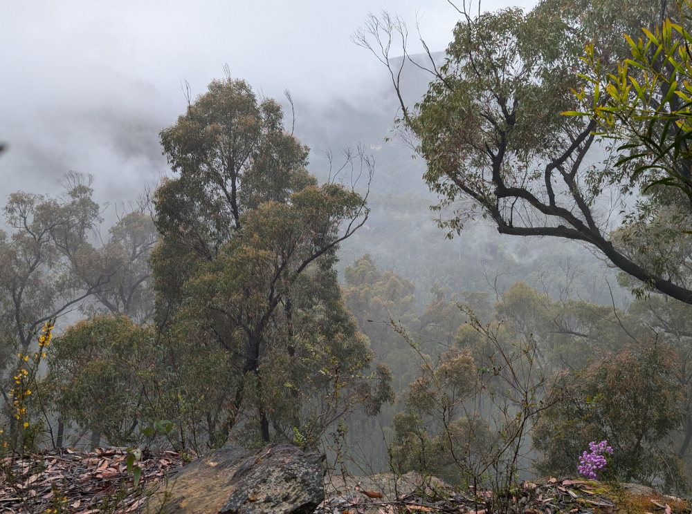
    We started our explorations in Meryla Flora Reserve on one side of Morton National Park. The day was misty, which added to the beauty of the forests and valleys.

    The TC, bless her cotton socks, was taking great care to avoid all the poo on the ground. A closer look through the camera lens revealed that it wasn’t poo:

    Nor was it seaweed. We were far from the coast. No, it’s a type of cyanobacterium (Nostoc commune), fondly known as plant snot. People also call it star jelly, witch’s butter, and mare’s eggs. It’s found world-wide. The part that you see is a sheath made of jelly. The bacteria live inside the sheath, and can form large colonies.

    So that’s what the TC was traipsing through. It’s a good thing she was careful, as plant snot is very slippery when it’s wet, as it was here. In long dry spells, it dries out and waits for rain.

    To her delight, the TC did encounter some actual poo, perched neatly on a rock:

    Poo-bearing rock is a fairly common sight in the Australian bush. Evidently wombats, the makers of these monuments, deposit their offerings on a rock as a mark of territory. He who poos highest has the most influence in terms of spreading scent and being seen.

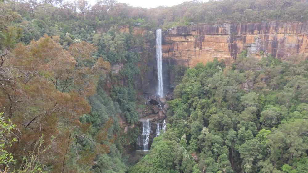
    We left Meryla Flora Reserve and made our way to Fitzroy Falls, on the other side of Morton National Park. The waterfall is 81 metres high, formed by the Yarrunga Creek dropping into Kangaroo Valley. To get an idea of the scale, notice the people on viewing platforms on the left and right of the falls in this picture:

    This is a view of the valley. The falls are off-camera on the left:

    It’s worth walking along the trails on either side of the falls. This lovely old eucalypt, nicknamed The Knobbly Tree, is on the Western Rim Walking Track:

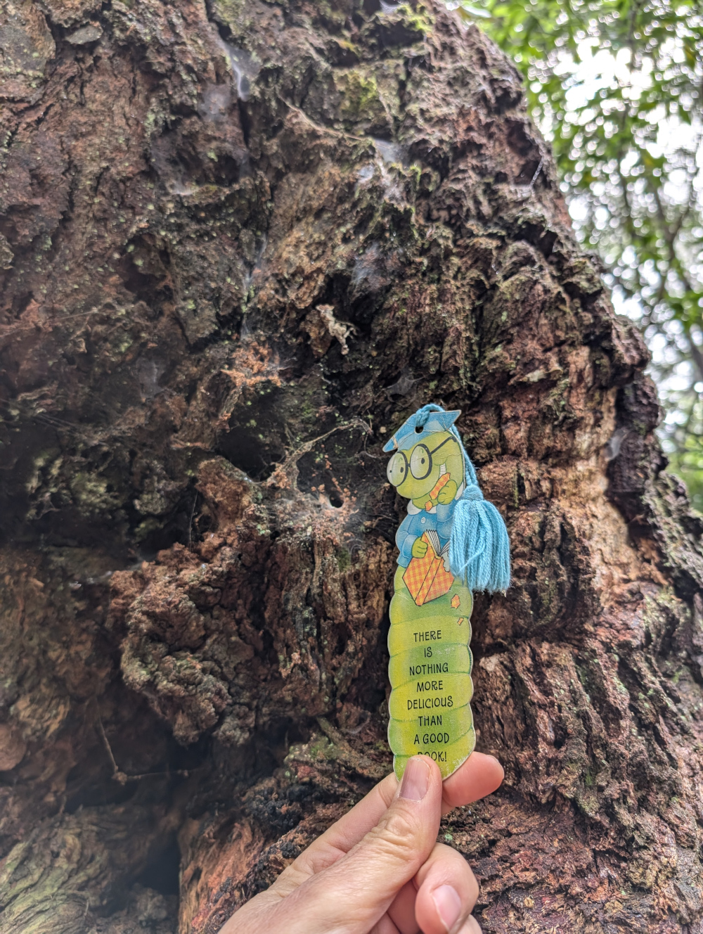
    Of course, the TC insisted on a pic of yours truly cuddling up to the tree, in spite of the scary-looking spider webs that covered the bark:

    Imagine the spider that lives in the hole sunken into that web. I’m sure this would be a case of its bite is worse than its bark.

    A tranquil view of the falls from afar restored my je ne sais quoi:

    Not far away, another peril lurked: a lyrebird scratched through the dirt looking for grubs and chatting to its friend. While the TC ooh-ed and aah-ed, this worm stayed far away from the modern-day dinosaur:

    When in natural surrounds in Australia, it’s always worth looking under the picnic table.

    Here comes the dark ending that I promised at the start of this post. The TC noticed this cicada husk under the picnic table:

    More disturbing, and a caution to an unwary worm, were the pieces of cicada lying on top of the table:

    This worm does hope that the cicada who emerged from the husk had time to enjoy life above ground, and that it was another poor insect who fell prey to a bird.


  • Maleny QLD: Views and birds

    This is the blog of Mark Wordsworm, the travelling worm. I’m a 40-year-old bookmark (give or take a few years) and I proudly boast my own Hallmark serial number, 95 HBM 80-1. You’ll probably want to read all about me and my Travelling Companion (the TC).

    Today’s travel notes

    Me and the TC recently visited the town of Maleny in Queensland. We had lunch in town, visited the chocolate factory, and spent a few hours at the botanic gardens and Bird World.

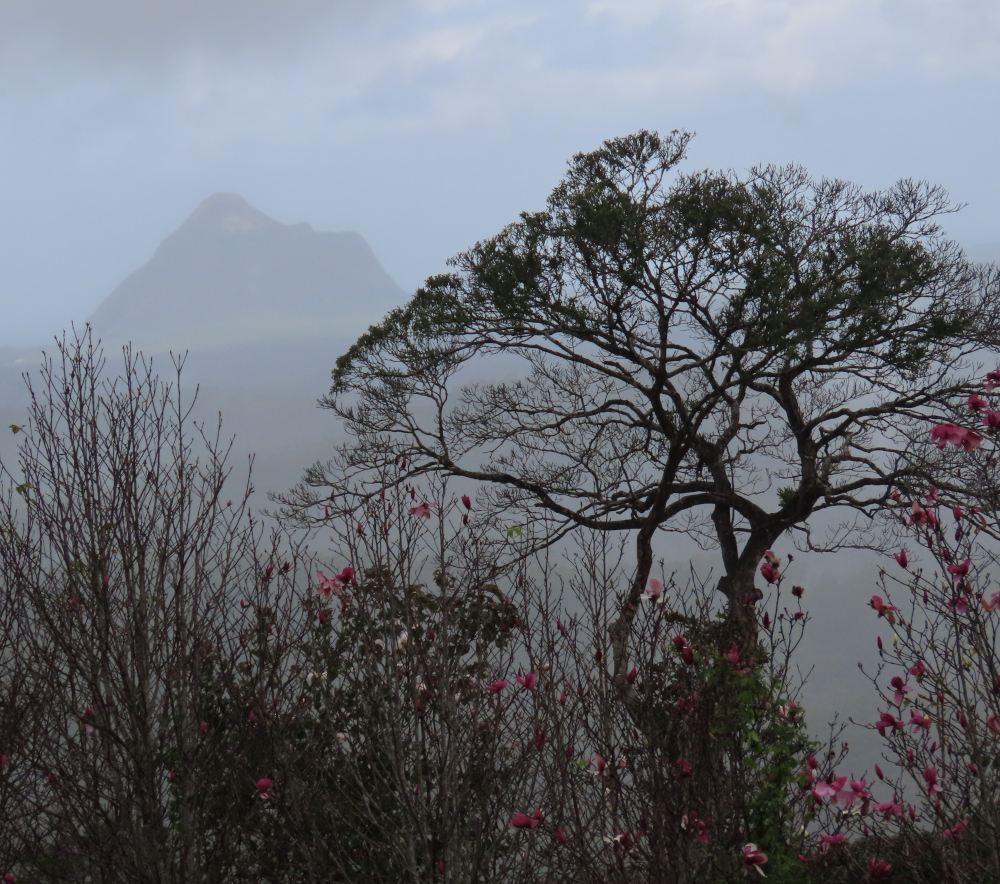
    The day was grey and drizzling. The mist only added to the views of the Glass Mountains and the architected gardens.

    The book I’m in

    Frontier, by Grace Curtis. Science fiction with flare and grace. Highly recommended.

    Travel tips

    Even if the weather is wet, Maleny is a good place to spend a few hours. Visit the Botanic Gardens and Bird World (inside the gardens). Drop in at Maleny Chocolate Co, for delicious (though pricey) chocolates.

    Recommended restaurant

    Sarah’s Unplugged in Maleny. Good food and friendly service, catering for vegan and gluten free too.

    The photos

    Where, a faithful reader will ask, is the photo of me that customarily kicks off these posts? I stayed tucked away in my travel case, viewing the sights from a handy peephole. A faithful reader might also guess the reasons why I played it safe: rain and birds. Rain isn’t good for my cardboard constitution, and when bird meets worm, it usually doesn’t go well for the worm.

    So, without further ado, let’s move on to a view:

    The Glass Mountains lurk in the clouds. In the foreground, the botanic gardens stretch towards the mist-clogged hills.

    A tree and a mountain provide structure. Pink blossoms add colour.

    At times during the day, the air was brighter and more colour shone through the mist.

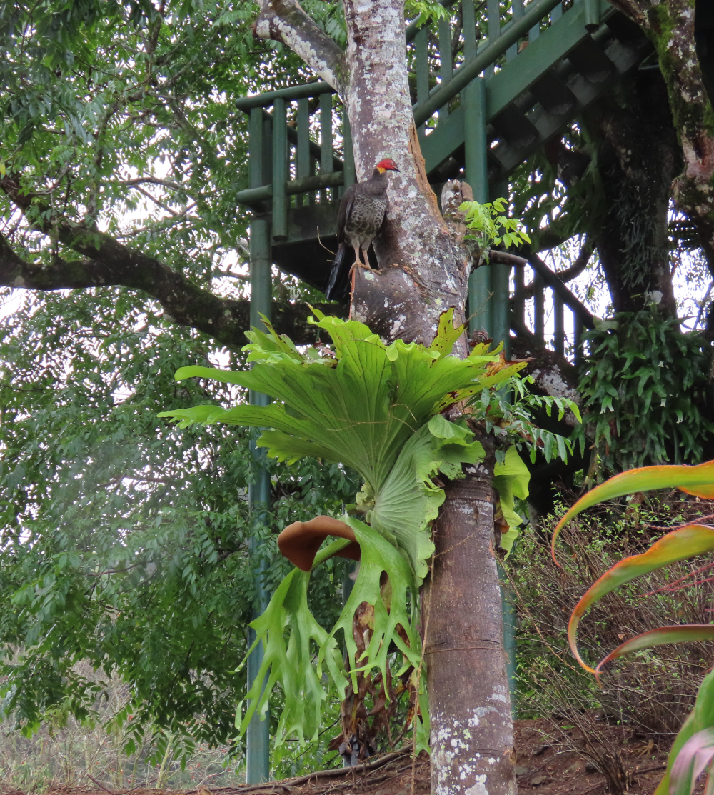
    Outside Bird World, a Brush-turkey had somehow managed to find a high perch. It watched us with a superior gaze.

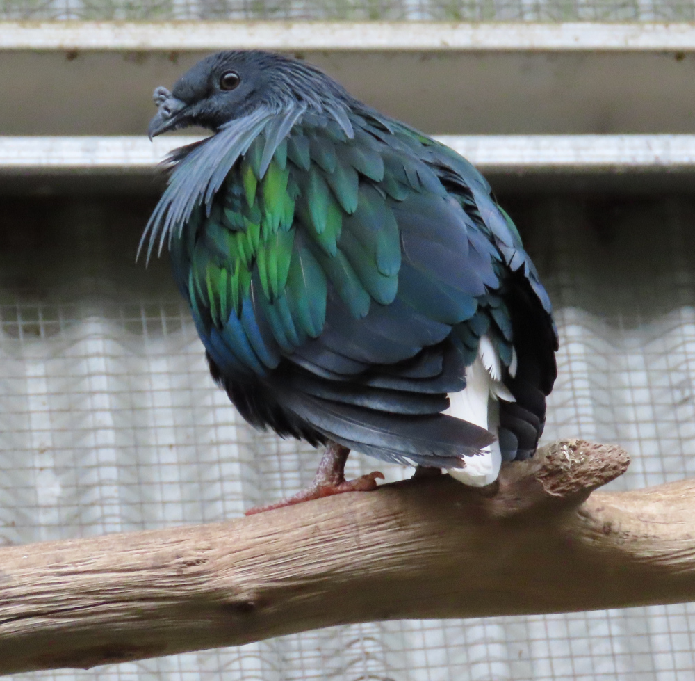
    Are you ready for the birds? Here they come! These are just a few of the birds we saw inside Bird World.

    A little Pitta:

    A series of pigeons:

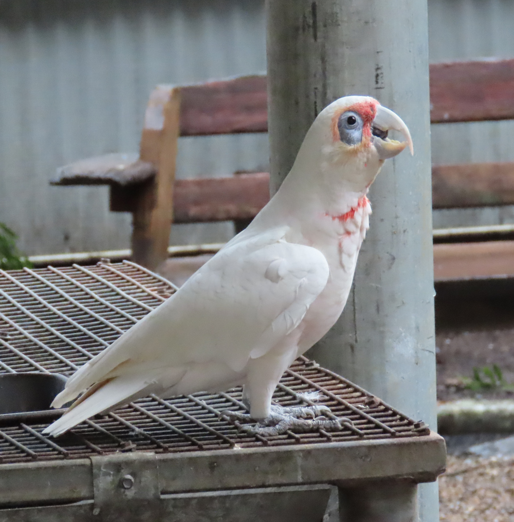
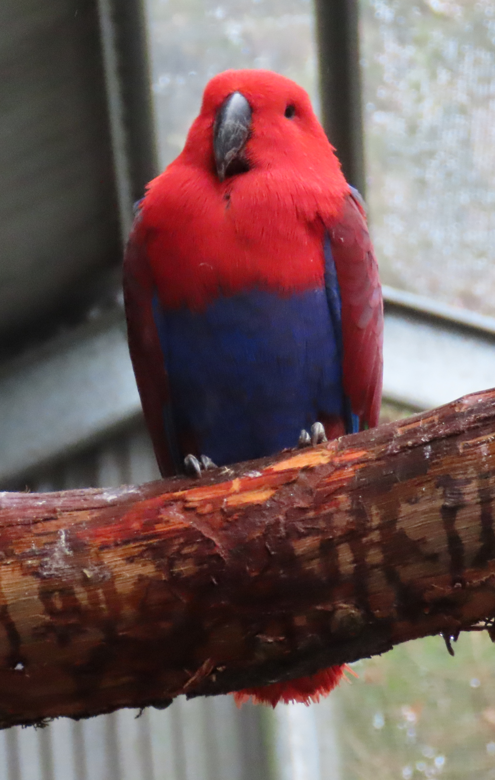
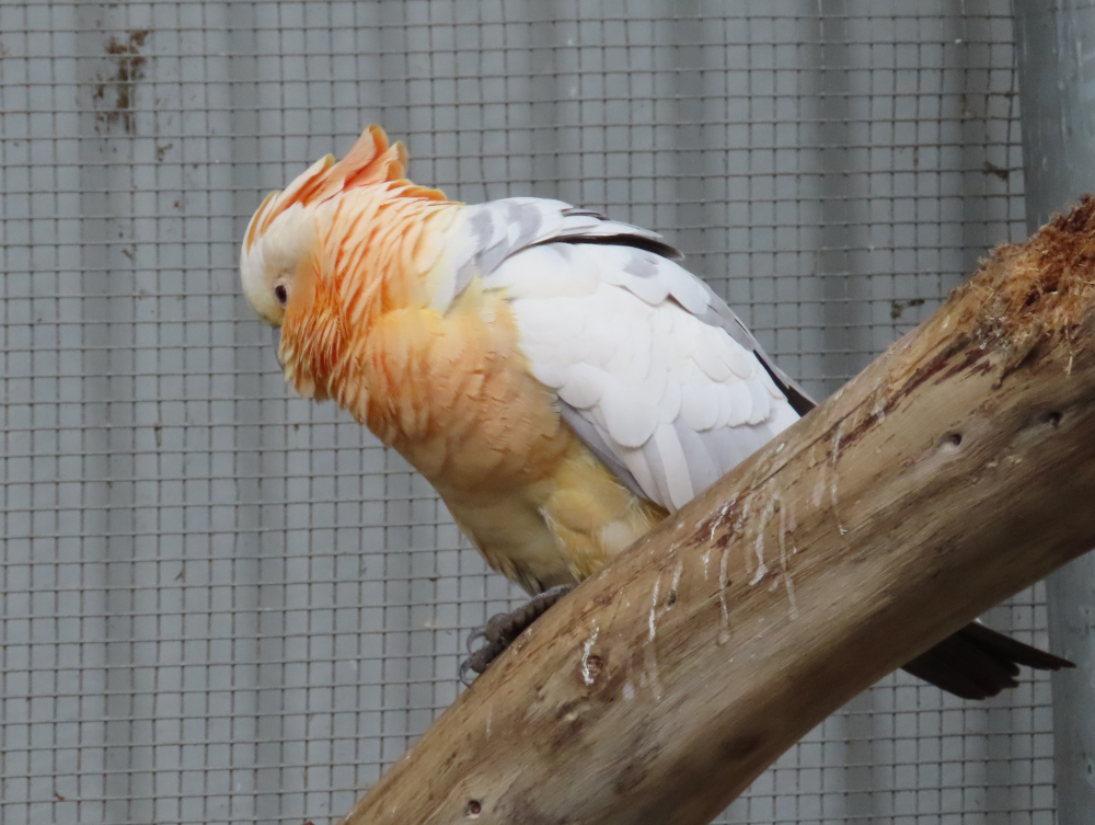
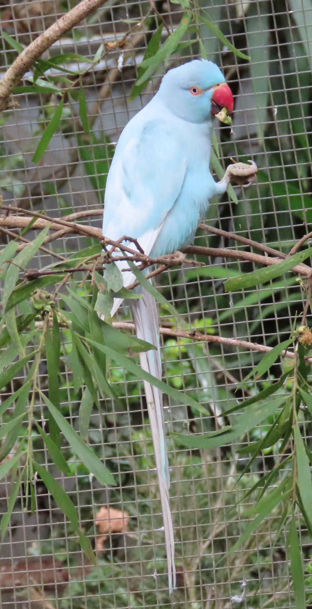
    A plethora of parrots:

    To finish, a bashful pheasant:


  • Old Grafton Road and Dalmorton Tunnel, NSW

    This is the blog of Mark Wordsworm, the travelling worm. I’m a 40-year-old bookmark (give or take a few years) and I proudly boast my own Hallmark serial number, 95 HBM 80-1. You’ll probably want to read all about me and my Travelling Companion (the TC).

    Today’s travel notes

    Me, the TC, and Janet the Jeep took the long way round from Sydney to Brisbane, to explore a bit of the inland countryside. On the second day of our trip, we drove from Glen Innes to Grafton via Old Grafton Road and Old Glen Innes Road. This is a beautiful route. The road is partly sealed (bitumen) and partly unsealed (gravel and clay). It’s in good nick all the way from Glen Innes to Grafton.

    Read on to get a feel for this trip.

    The book I’m in

    Force of Nature, by Jane Harper. A book that starts well and gets better and better.

    Travel tips

    It’s most comfortable to travel from Glen Innes to Grafton, rather than in the opposite direction. The road is narrow, the edges unguarded, and the side falls away steeply along much of the way. If you’re on the side that drops off, it can be uncomfortable when you meet a vehicle coming towards you.

    Recommended accommodation

    Apartments on Grey in Glen Innes. Warm and cosy, with everything you need for a comfortable stay.

    The photos

    Me at the turnoff to Old Grafton Road on Gwydir Highway:

    The first part of Old Grafton Road is sealed (bitumen). But don’t be fooled! It’s scenic — meaning, it’s steep, winding, and narrow. This video gives a taste of the road. Part way through (at the time stamp of 40 seconds to 1:03), the TC stopped the Jeep to take a shot of three wallabies on the side of the road:

    The road descends swiftly to cross Diehard Creek:

    A helpful soul has posted warning signs along the road:

    Mann River Nature Reserve is a pretty spot to take a breather:

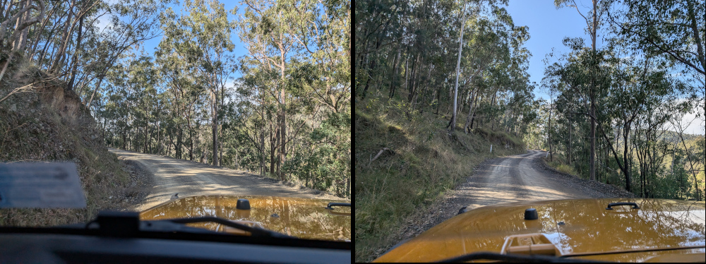
    Janet the Jeep was raring to go when Old Grafton Road changed to dirt:

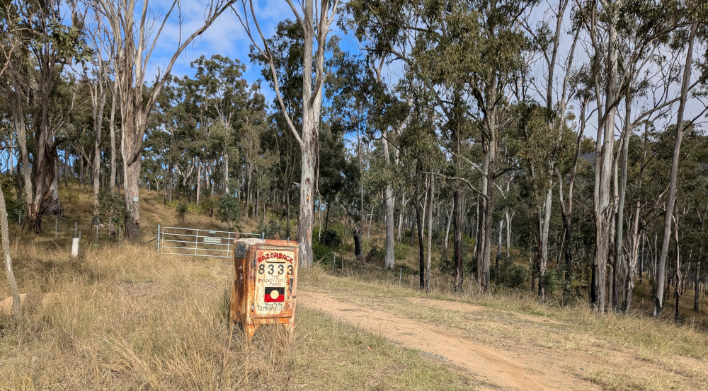
    At times, you’ll come across an entrance to a family farm:

    Here’s another homestead, further along the route:

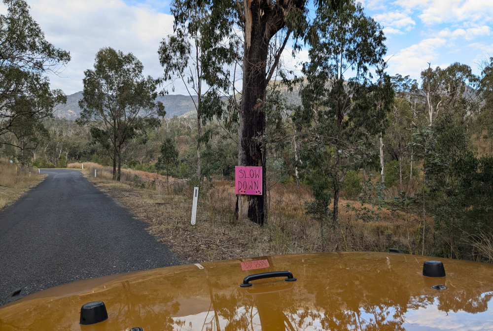
    Much of the road runs alongside Boyd River. Sometimes it’s at the level of the water, sometimes high above. It’s narrow and slippery — take care!

    Just around a corner, you’ll come across Dalmorton Tunnel. The tunnel is 20 metres long, 4 metres wide, and has a height clearance of 3.2 metres.

    Me at Dalmorton Tunnel:

    The tunnel was built in the 1860s by civilian contractors. (Some reports say that convicts built it, but that’s probably apocryphal.) The tunnel was blasted out of solid rock, then trimmed with hand tools. (Again, some reports say it was “hand hewn”, but that’s probably not completely accurate either.)

    Here’s Janet making her way through the tunnel, hogging the limelight as she does:

    Boyd River offers some picturesque spots for coffee and a photo:

    Next is a cow closeup, for people who like cows. This worm avoids them, as they’re apt to put those big feet where they’re not wanted. But the TC, bless her cotton socks, liked the way this cow was cosying up to the pink bush:

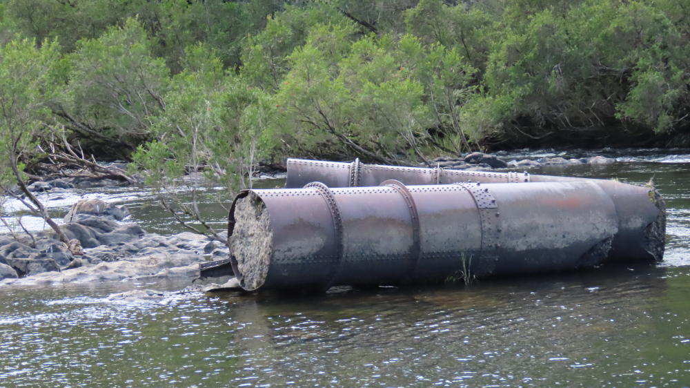
    On Old Glen Innes Road, a wide, low bridge crosses the Nymboida River:

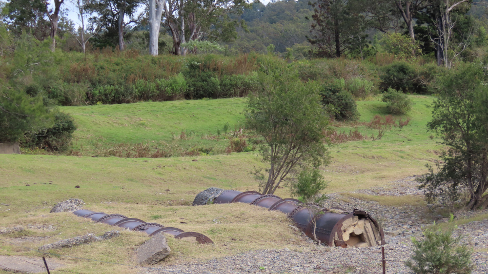
    Scattered around, in the water and on land, are sections of a huge pipe, filled with concrete:

    Perhaps the pipes formed the scaffolding of a previous bridge? Who knows:

    The TC, bless her woollen mittens, is keen to finish off with some shots of the road. So, for those enthusiastic road-farers out there:

    See you on the road!


  • Standing stones at Glen Innes

    This is the blog of Mark Wordsworm, the travelling worm. I’m a 40-year-old bookmark (give or take a few years) and I proudly boast my own Hallmark serial number, 95 HBM 80-1. You’ll probably want to read all about me and my Travelling Companion (the TC).

    Today’s travel notes

    Me and the TC recently spent a night in Glen Innes, NSW, on our way to Brisbane. Early the next morning, we dropped in on the standing stones before continuing our journey.

    The book I’m in

    Force of Nature, by Jane Harper. The TC recently read The Dry by the same author, and enjoyed it so much that she resolved to read more of the author’s work. This worm is pleased. The book is an exciting, comfortable place to be.

    Travel tips

    The Australian Standing Stones are not to be found in the little village of Stone Henge, which is nearby. The village of Stone Henge is worth a visit too, surrounded as it is by stones and boulders, including some interesting formations of stones perched on top of others.

    The official standing stones monument is in Glen Innes.

    Visit the standing stones early in the morning if you can. They have a certain drama when the sun is low in the sky.

    Recommended accommodation

    Apartments on Grey in Glen Innes. Warm and cosy, with everything you need for a comfortable stay.

    The photos

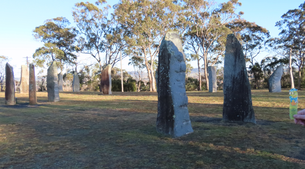
    Me with some of the standing stones at Glen Innes:

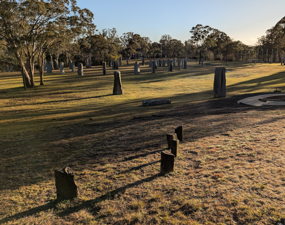
    An early morning view of the ring of stones:

    An engraved stone in the middle of the ring describes the design of the stones, placed to catch the sun’s rays at key times of the year:

    These standing stones don’t pretend to be ancient. They were erected in the late 20th century and dedicated in 1992, as a tribute to the various Celtic nations who’ve settled in and contributed to Australia’s history.

    Near the top right of the next view of the stones, there’s a line of flag poles, one from each of the nations that has contributed to the monument:

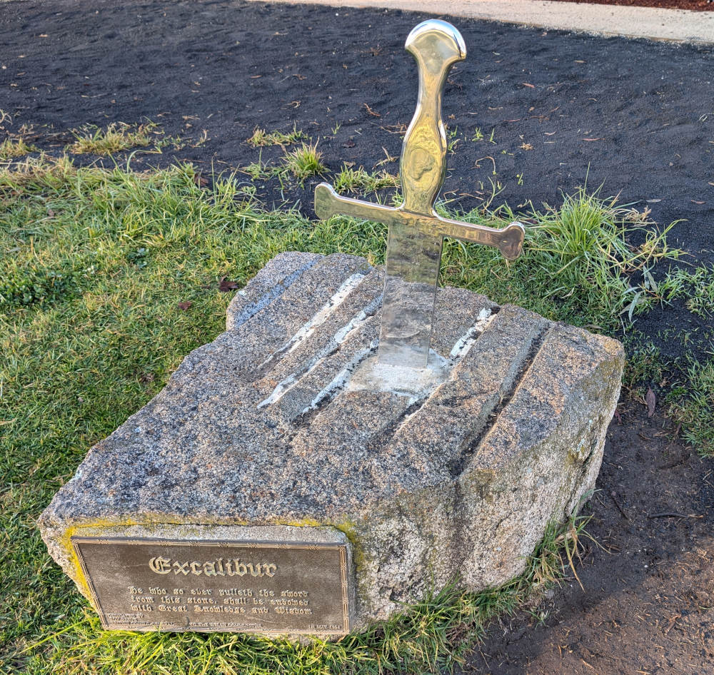
    On the edge of the ring of stones is a rather attractive, though fake, Excalibur — complete with injunction to try to pull it out of the stone and thus gain great knowledge and wisdom:

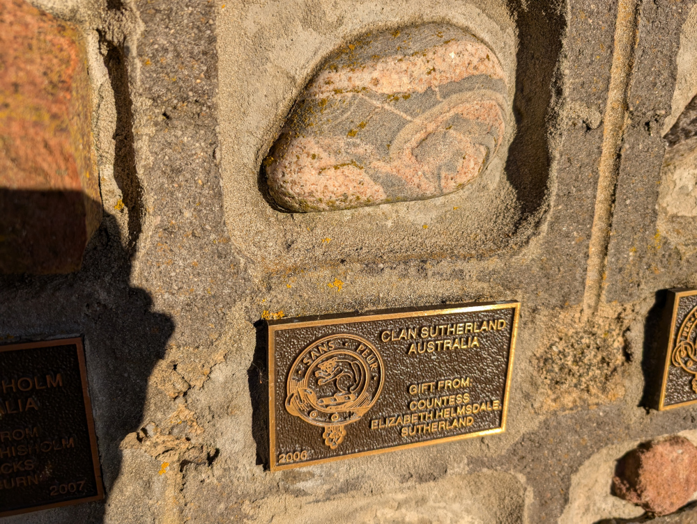
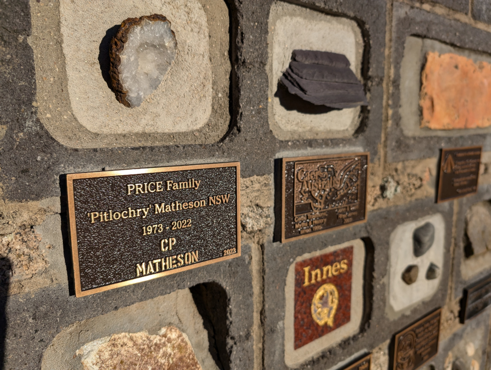
    A wall curves round the path, embedded with gifts of stone from various sponsors of the monument:

    Here’s one of the embedded stones with its inscription. This worm likes the simple attractiveness of the stone:

    More stone dedications:


  • Thunderbolts Way, NSW

    This is the blog of Mark Wordsworm, the travelling worm. I’m a 40-year-old bookmark (give or take a few years) and I proudly boast my own Hallmark serial number, 95 HBM 80-1. You’ll probably want to read all about me and my Travelling Companion (the TC).

    Today’s travel notes

    Me, the TC, and Janet the Jeep took the long way round from Sydney to Brisbane, to explore a bit of the inland countryside. On our first day, we drove from Sydney to Gloucester and then took Thunderbolts Way to Glen Innes. Thunderbolts Way is a scenic, historic drive. The road is entirely sealed (bitumen), but includes a steep hill and some bumpy areas full of pot holes. Read on to get a feel for this trip.

    The book I’m in

    Ancillary Sword, by Ann Leckie. This is the second book in the Imperial Radch trilogy. Excellent science fiction, set in an intriguing world of AI ships and their ancillary crew.

    Travel tips

    Fill up with fuel before you start the drive. Be aware of the long, steep hill between Uralla and Gloucester. If you’re travelling towards Gloucester, you’ll be going down the hill. The descent can be tricky, especially if you’re towing a caravan.

    Take a picnic and stop at a scenic spot for lunch.

    Recommended accommodation

    Apartments on Grey in Glen Innes. Warm and cosy, with everything you need for a comfortable stay.

    The photos

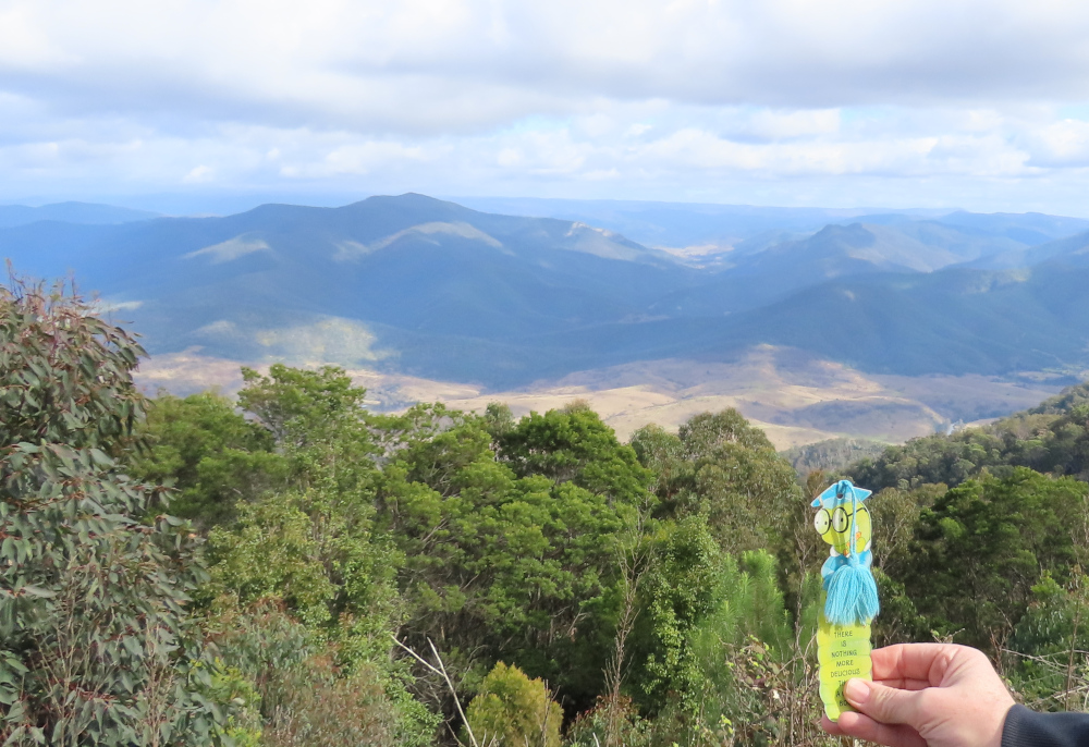
    Me at Pioneer Lookout on Thunderbolts Way:

    We joined Thunderbolts Way at the picturesque NSW town of Gloucester. These two motorbikes passed us, and were probably on their way to the same road:

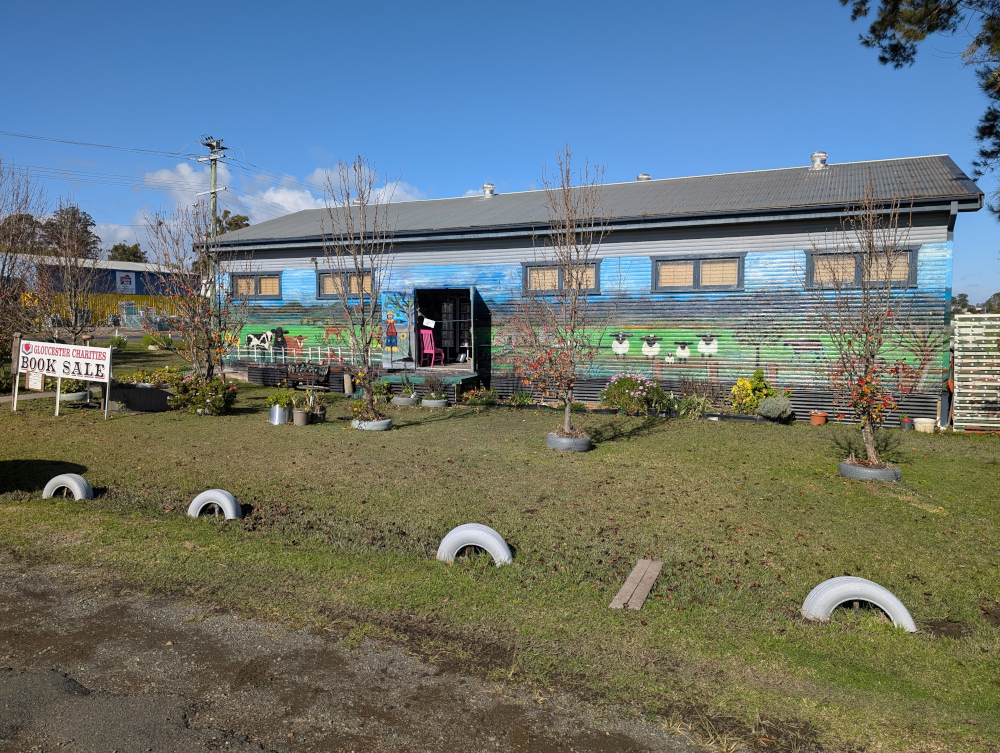
    A book sale on the outskirts of Gloucester:

    Thunderbolts Way is named after Captain Thunderbolt, a controversial bushranger from the early 1800s. The ranger’s real name was Frederick Ward. He managed to combine criminal activities with his legitimate bushranger tasks, in a way that led people to both fear and admire him. He’s famous for several robberies and mail coach holdups. At one stage, a reward of 400 Pounds was on offer for his capture. He was eventually shot and killed by a policeman in 1870, after a long horseback pursuit.

    The views on this route are gorgeous:

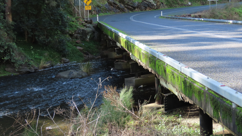
    A curious sight awaited us at Gloryvale Bridge, which crosses the Manning River:

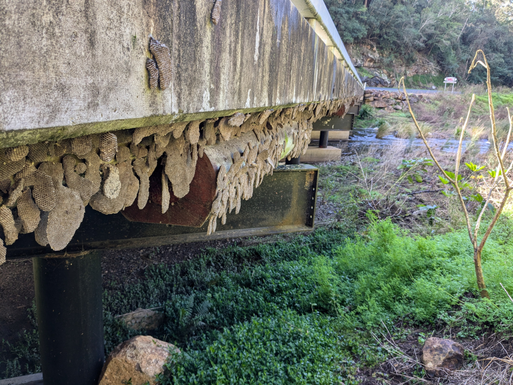
    Look closely at the bottom of the bridge:

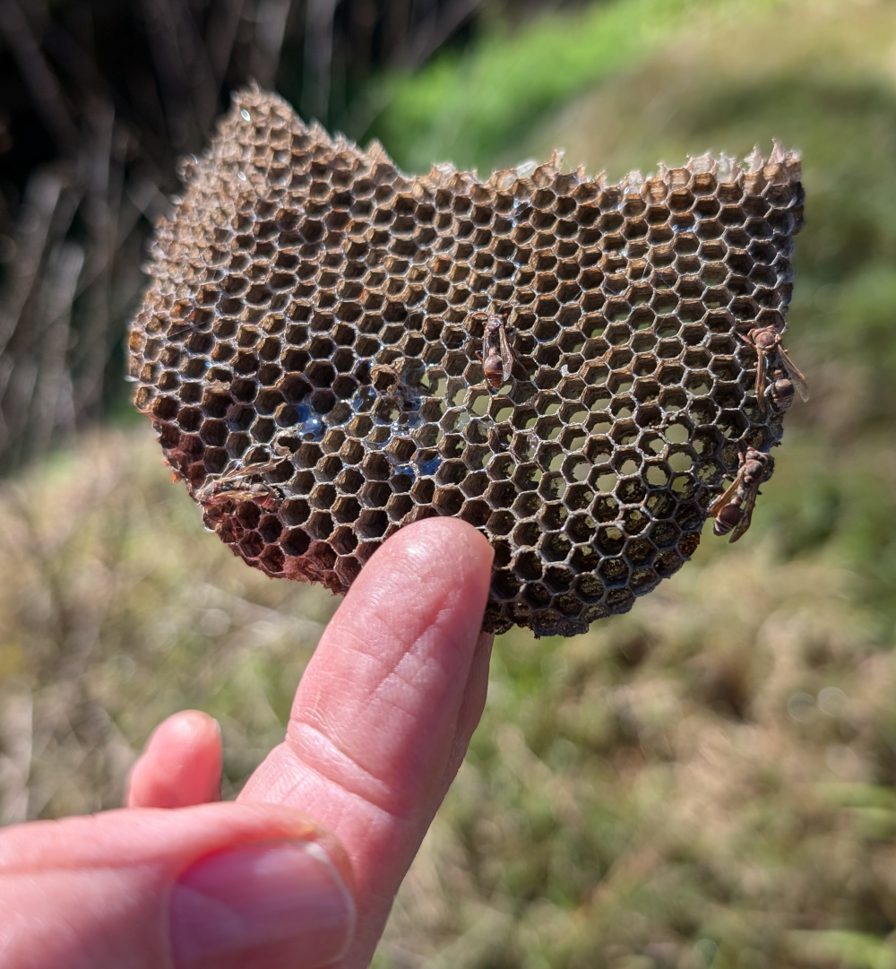
    Those are wasp nests, thousands of them stuck along the bottom edge of the bridge. Here’s a small piece with some dead, dried-out wasps still attached:

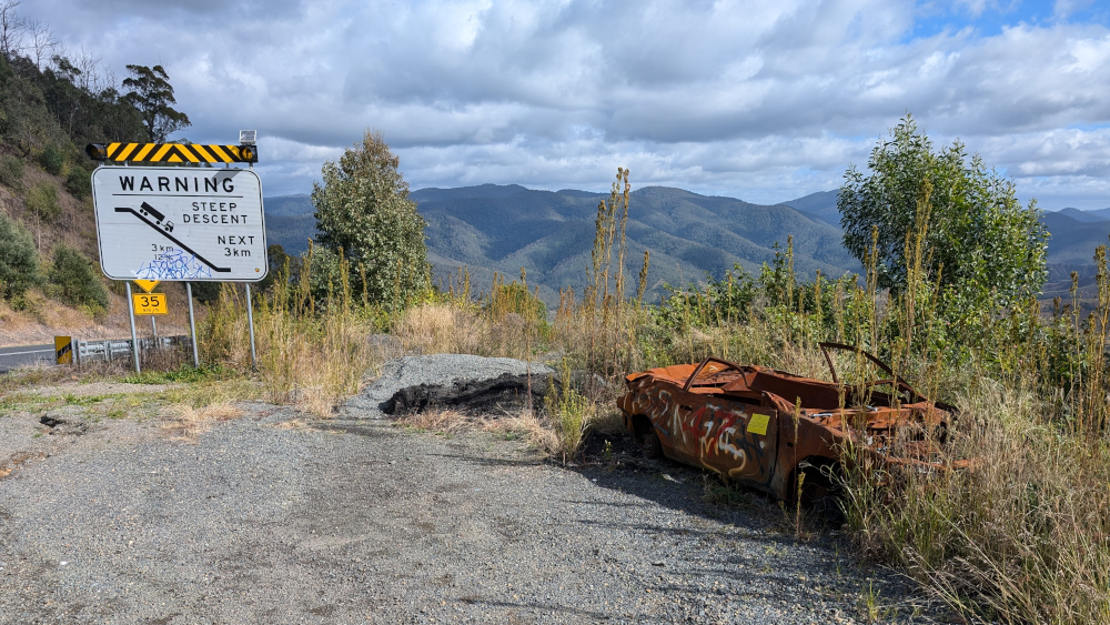
    We climbed a long, steep hill and stopped at the top. If you’re travelling down the hill with a caravan or trailer, beware. As the sign says, it’s steep. Evidently quite a few people have come a cropper because they didn’t have enough warning.

    The rusted-out car is perhaps an appropriate warning. Weirdly, this old carcass had a new, bright yellow sticker giving notice of the council’s intent to take possession.

    Due procedures have been followed!

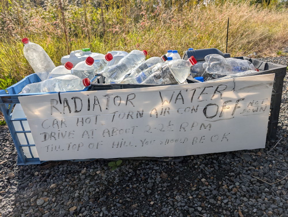
    At the top of the same hill, some kind soul had left a cache of filled water bottles, for people who might find their vehicles in trouble during the ascent or descent. This worm is impressed with the kindness, including the last words in the attached notice: “You should be OK“.

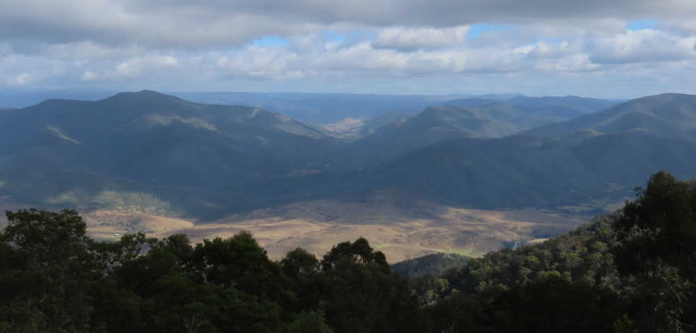
    This view was our reward for making it to the top of the hill:

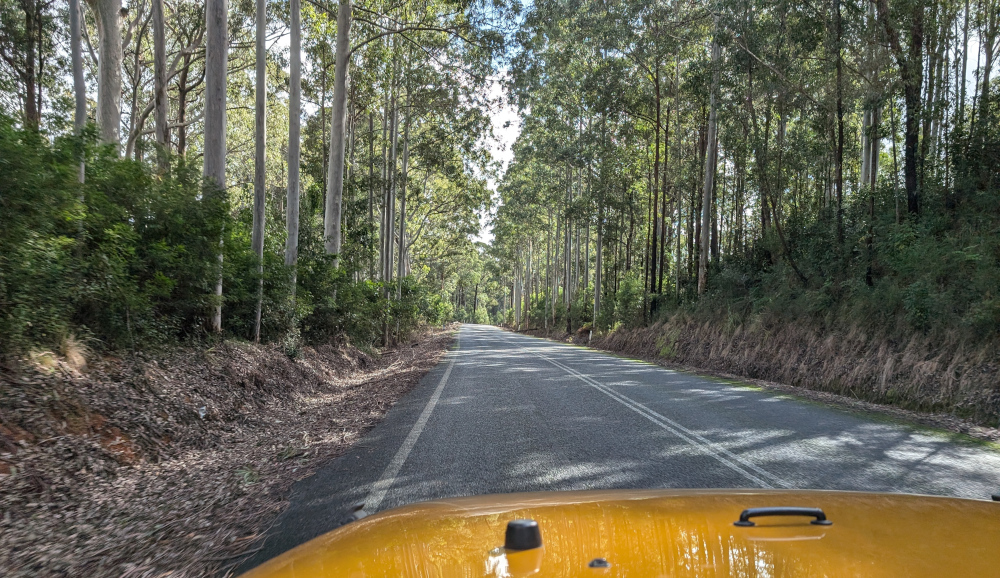
    The road changed character several times. This section ran through natural forest:

    Pioneer Lookout presented another spectacular view:

    We turned off into Nowendoc State Forest for a lunch break. The soundscape was epic, like being in a Jurassic forest. I captured it in the video below. The background roar is the wind in the branches. Most of the squealing and chattering sounds are made by Yellow-tailed Black Cockatoos. At about 1 minute in, a couple of ravens start cawing loudly. At about 1:36, a Sulphur-crested Cockatoo adds its screeching to the mix. You don’t see the birds, except at 2:12 (near end) when a bird makes a lightning appearance near bottom left of the frame.

    As you can see in the video, Janet the Jeep was our chariot of choice on this trip. Here she is again, hogging the scene as usual: