In this post: Crossing the Murray River is a 4WD milestone. The water can be deep, swift, and treacherous, or it can be a doddle. How was it for us?
This is the blog of Mark Wordsworm, the travelling worm. I’m a 40-year-old bookmark (give or take a few years) and I proudly boast my own Hallmark serial number, 95 HBM 80-1. You’ll probably want to read all about me and my Travelling Companion (the TC).
The TC, bless her adventurous cotton socks, has long wanted to cross the Murray River. Not the standard way, over a bridge. Rather, she yearned to drive across the river bed. Through the water. Over the rocks.
The Murray is Australia’s longest river, stretching for 2,500 km (1,560 miles) from the Australian Alps in the east to the Southern Ocean in the west. It spends much of its time forming the boundary between the states of New South Wales and Victoria.
When the river is in full flood, it’s fast and angry. At those times, driving across the river bed would not be a wise choice.
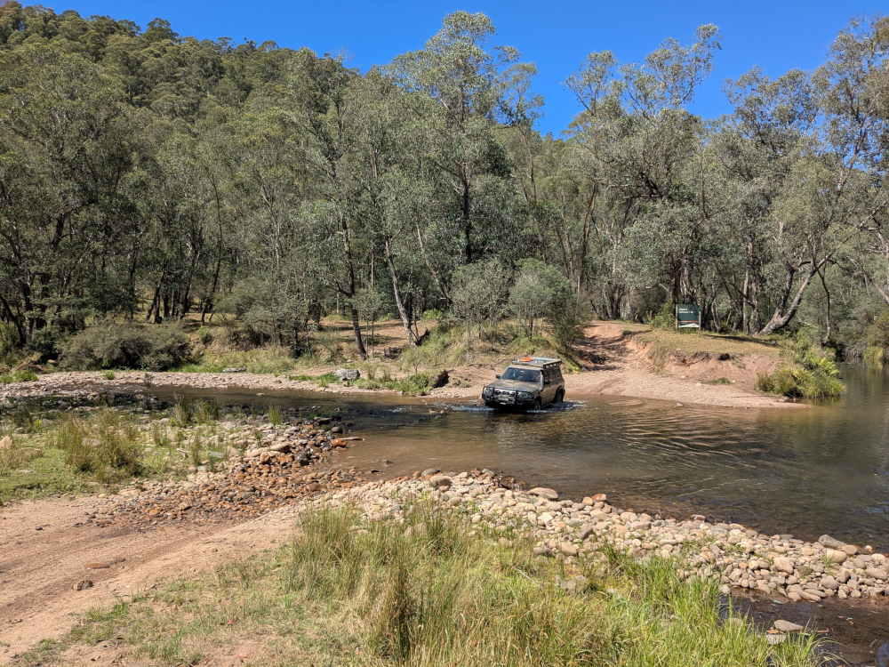
We crossed from Victoria to New South Wales. The river was low and slow-moving. The crossing was easy and beautiful — a doddle:
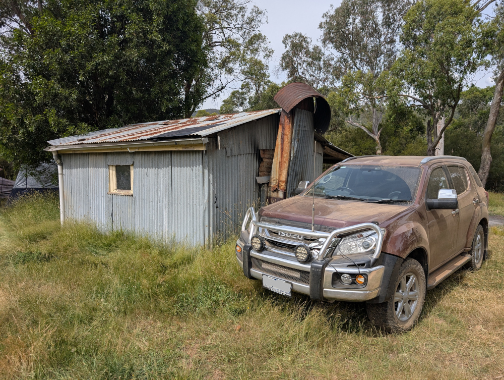
Before leaving Victoria, we took a look at the Dogman’s Hut and campground on the Victorian side of the river:
There’s a perfectly usable drop dunny (Australian bush toilet) nearby:
After exploring the site a bit, we decided to camp overnight at Tom Groggin, which is on the other side of the river.
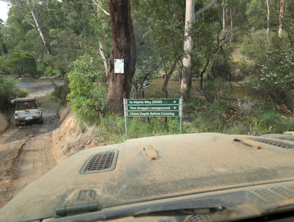
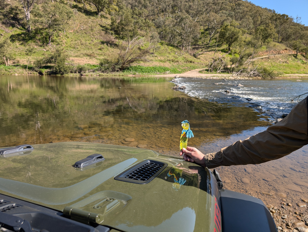
So, we crossed the Murray River, as shown in the video above. Here’s a photo of the Victorian side of the crossing, with a sign post helpfully pointing the way to New South Wales. The sign also advises us to Check Depth Before Crossing, skilfully avoiding the use of ALL CAPS but throwing in a few capital letters for good measure:
What’s it like on the other side of the river, and what delights does Tom Groggin hold in store for us? Read my next blog post to find out.
In this post: Is Mount Pinnibar the highest 4WD track in Australia? Well, there’s a bit of controversy about that claim. Whatever the answer, the view from the top is spectacular. It’s well worth the long trek to get there.
This is the blog of Mark Wordsworm, the travelling worm. I’m a 40-year-old bookmark (give or take a few years) and I proudly boast my own Hallmark serial number, 95 HBM 80-1. You’ll probably want to read all about me and my Travelling Companion (the TC).
This video shows approximately half of the 360-degree view from the summit of Mount Pinnibar, starting at the trig point:
Mount Pinnibar lies in the Alpine National Park in the Australian state of Victoria. The area is also called the Victorian High Country. It’s gorgeous country for touring, camping, hiking, swimming, skiing — whichever activity you choose to enjoy the natural beauty.
With the summit at 1,772 metres (5,814 feet), the track that leads to the top of Mount Pinnibar has a good claim to being the highest publicly-accessible 4WD-only track in Australia. However, other tracks are in fierce competition, notably Blue Rag Range Track, which is also in the Victorian High Country.
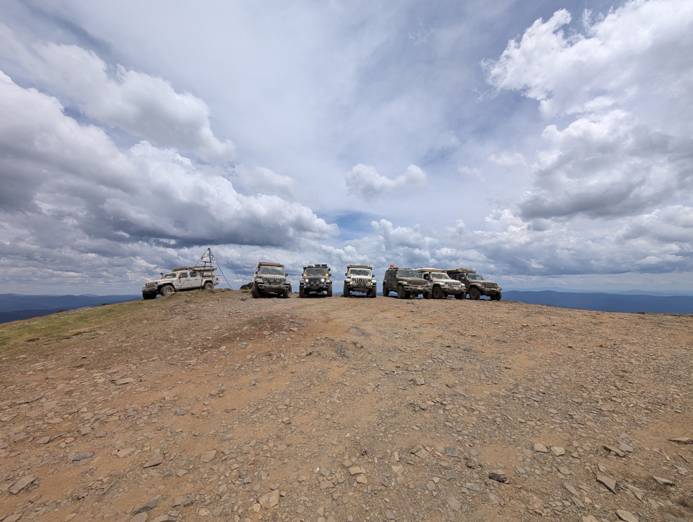
Clouds frame a group of Jeeps at the summit of Mt Pinnibar:
One thing that struck us again and again was the number of dead trees: the beautifully-named Snow Gums and Alpine Ashes. While they’re striking in their clean white and grey silhouettes, it’s sobering to see the amount of fire damage the area has suffered.
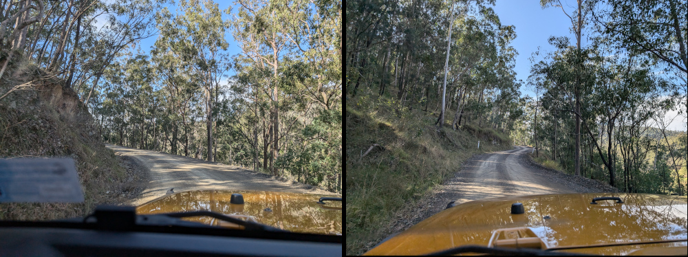
In our recent travels around the Victorian High Country, me and Beetle the Jeep drove the Sixteen Mile Jeep Track (also called the Sixteen Mile Jeep Road). Although this track can be tricky in the wet, it’s not very challenging when dry. The forest and countryside are beautiful, well worth the drive.
Here’s a taste of the track:
Would you like to explore more of the Victorian High Country? I cordially invite you to crawl around a few of the tracks that we followed:
In this post: Join me on a crawl around the mountain huts of the Victorian High Country in Australia.
This is the blog of Mark Wordsworm, the travelling worm. I’m a 40-year-old bookmark (give or take a few years) and I proudly boast my own Hallmark serial number, 95 HBM 80-1. You’ll probably want to read all about me and my Travelling Companion (the TC).
Today’s travel notes
In our recent travels around the Victorian High Country, me and the TC visited several of the area’s well-known mountain huts. The huts vary from a basic four-walls-and-a-roof structure to quite a solid affair with furnishings. Most of them were built to offer shelter to walkers, cattle folk, and others who might be caught out by the unpredictable weather of the highlands. Some are named for the families who lived in them, like Lovick’s Hut.
The Phenomenon of Man by Pierre Teilhard de Chardin. I’m chewing my way through this momentous work, savouring it a piece at a time.
Travel tips
If at first you don’t spot the dunny (that’s Australian for toilet), take a walk and look again. Most campgrounds and picnic areas have a long-drop.
From the sublime to the ridiculous… a dunny on the Paradise Falls track:
Recommended accommodation
Camping is the best option for a trip around the Victorian High Country. It’s hard to predict where you’ll find yourself at the end of each day. Most likely, you won’t be anywhere near a hotel.
Luckily, the campgrounds are well laid out and most have a toilet, albeit a long-drop. Here are the campgrounds we stayed at.
Seven (count ‘em: 7) days camping in a row. That’s a record for yours truly:
Day 1 (18 February): The campground near Craig’s Hut. Elevation 1,450 metres. It was cold, even in the middle of the Australian summer. This worm recommends a thick book to cuddle up in.
Day 2 (19 February): A camping site on Mount Howitt. Elevation 1,600 metres. It was even colder that night, due to some wind and an early morning mist. The TC, bless her thick cotton socks, wore leggings, gloves, two T shirts, two soft jackets, and a large Dutch jacket, and huddled down into her sleeping bag.
Day 3 (20 February): Eaglevale campground near Dargo. Those who aren’t made of cardboard had a refreshing dip in the Wonangatta river.
Day 4 (21 February): Black Snake Creek campground, again on the banks of the Wonangatta River. The non-cardboard folks took another swim in the river.
Day 5 (22 February): Castleburn Creek campground on Dargo Road.
Day 6 (23 February): Hinnomunjie Bridge campground, on the far side of Omeo.
This worm recommends that you bring all your supplies when travelling the lesser-known roads of the high country. People in the know can snack off bush tucker, but beware: don’t eat anything unless you’re sure it’s good for humans. Some of our party were keen to try these Dianella berries. But not all Dianellas are edible!
The photos
Me at the Washington Winch on Nunniong Road near Moscow Villa Hut:
Yours truly is nicely in focus. That’s how I like it.
Ah, you want to know about the winch too?
The Washington Winch was powered by steam, and built in Seattle, USA, to haul timber up steep slopes.
Here’s the winch hook, which hangs above the track a few metres from the engine:
And now, on to those huts.
Craig’s Hut
If you’ve seen the movie, The Man from Snowy River, then you’ve had your breath taken away by the beauty of the mountain views from Craig’s Hut. Canny readers will spot yours truly on the window sill of the hut in the above photo. To find your breath again, read my separate blog post about Craig’s Hut and The Man from Snowy River.
Bindaree Hut
Pikes Flat Hut
Pike’s Flat Hut was one of the more dilapidated structures. It had horse feed inside, and thistles (an introduced weed in Australia) outside.
Bluff Hut
We stopped at Bluff Hut for lunch and a stroll. The hut was quite substantial, a place I could imagine myself sheltering in if the weather got bad.
Lovick’s Hut
Lovick’s Hut is another substantial, liveable structure.
Howitt Plains Hut
Wonangatta Hut near Bryce’s station
This hut had an attractive, sturdy sleeping platform.
Black Snake Creek Hut
This hut and the nearby camping area are on the banks of the Wonangatta River.
In this post: Blue Rag Range Track near Dargo in Victoria, Australia: the track, the views, and our route to get there.
This is the blog of Mark Wordsworm, the travelling worm. I’m a 40-year-old bookmark (give or take a few years) and I proudly boast my own Hallmark serial number, 95 HBM 80-1. You’ll probably want to read all about me and my Travelling Companion (the TC).
Today’s travel notes
Me and the TC recently spent a week and a half in the Victorian High Country, a landscape of mountains and valleys in the state of Victoria, Australia. On 23 February, we tackled a bucket-list four-wheel driving track in the area: Blue Rag Range Track.
The book I’m in
Lathe of Heaven by Ursula K Le Guin. Every time this worm gets into a book by this author, I’m astounded at the cleanness of her style and the smartness of her plots. This book is no exception.
Recommended accommodation
Hinnomunjie Bridge campground in Omeo Valley, Victoria. The site is well laid out on the banks of the Mitta Mitta river, with clean toilets and clear grassy areas to pitch your tent.
Recommended restaurant
Dargo Hotel in Dargo.
Travel tips
Try to avoid pitching your tent on a slope. The TC, bless her cotton socks, kept waking up with her feet hanging over the end of the bed and a big empty space at the top of the bed. She finally worked out that she was sliding down thanks to the slope.
The photos
Me at the trig point at the top of Blue Rag Range Track (elevation 1,700 metres / 5,580 feet):
Observant readers will notice the trophies stuck to the trig tower, by people who’re proud to make it to the top. We didn’t leave a trophy, but it is indeed a great feeling to have made this trip.
Observant readers will also notice that it was windy up there! This worm strikes a jaunty pose nonetheless, with my tassel horizontal and a firm grasp from a friendly hand.
Hyper-observant readers will notice Peg skulking in the book at bottom right. Peg makes occasional appearances in my posts, her firm grip on reality keeping me grounded. But even Peg wasn’t strong enough for the gale at the Blue Rag Range trig point.
The track
It took us three and a half hours (12:30pm to 4pm) to drive the track itself, with a one-hour lunch break and stops for photographs.
At the start of the track is a steep mound with a hole at its crest, ready to trap the unwary vehicle. Most people choose to go round:
Another video shows the approach to the trig point at the top of the track:
Friendly locals in Dargo told us that it’s unwise to venture beyond the trig point. Those who do will almost certainly need help recovering their vehicles, and the Dargo police are inundated with calls for help from drivers who don’t realise the risks.
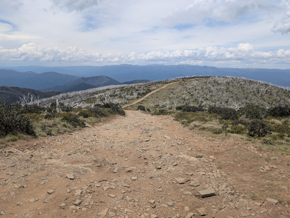
The views from the track are stunning, with mountain ranges all round:
Much of the track runs along the top of the ridge:
A sign post marks the track part-way along, surrounded by white tree skeletons and scrubby grass:
Our route
We started the day by fuelling up in Dargo. This is one of the cars in our convoy:
The Dargo Hotel offers a good feed. Here’s Beetle the Jeep, lined up and ready to go:
We left Dargo in mid-morning, following Lind Avenue along the banks of the Dargo River, then Dargo High Plains Road to the start of the track.
A sign post shows the start of the Blue Rag Range Track on Dargo High Plains Road:
After reaching the Blue Rag Range trig point, we turned round and went back to Dargo High Plains Road, continuing north to the B500.
We camped overnight at Hinnomunjie Bridge campground on the banks of the Mitta Mitta river in Omeo Valley. This beautiful fire barrel was made by one of our travelling companions:
In this post: Craig’s Hut in Mount Buller — the hut was first built as a temporary set for the movie, The Man from Snowy River, and is now a serene place to visit in the Victorian High Country.
This is the blog of Mark Wordsworm, the travelling worm. I’m a 40-year-old bookmark (give or take a few years) and I proudly boast my own Hallmark serial number, 95 HBM 80-1. You’ll probably want to read all about me and my Travelling Companion (the TC).
Today’s travel notes
Craig’s Hut is one of several mountain huts that you can visit when touring the Victorian High Country, Australia. The huts are all different, some basic and some quite solid and well established. Most of them were built to offer shelter to walkers, cattle folk, and others who might be caught in the sometimes wild weather of the highlands. Some of the huts are named for the families who lived in them, like Lovick’s Hut and Fry’s Hut.
Perhaps the most famous of them all is Craig’s Hut, named after a character in the movie, The Man from Snowy River.
The book I’m in
Survive to Fight, by Billy Billingham. This worm is taking refuge in a good action from time to time, while also chewing my way through The Phenomenon of Man by Pierre Teilhard de Chardin.
Travel tips
You need a good thick book to protect you from the elements. It was cold in the high country, even in the middle of an Australian summer.
The photos
Me, the Worm from Snowy River, at dawn on the window sill of Craig’s Hut:
The hut was first built in 1981 for the movie, The Man from Snowy River, which was released in 1982. The movie is an Australian classic, based on a poem by Banjo Patterson. The poem, in turn, is based on the experiences of a real-life stockman named Jack Riley, with inspiration drawn from other mountain stockmen too. The hut was named for Jim Craig, the fictional main character of the movie.
As a temporary replica of a cattleman’s shelter created specifically for the movie, the first version of the hut wasn’t built to last. But it became a popular destination in the Victorian High Country trails. When the structure started to fall apart, it was rebuilt by volunteers at the initiative of the four-wheel driving community: the Mansfield Alpine 4WD Club. The new version of the hut was re-opened to the public in 1993.
In 1996, a bush fire destroyed the second version of the hut, and it was rebuilt by the local council and environmental organisations.
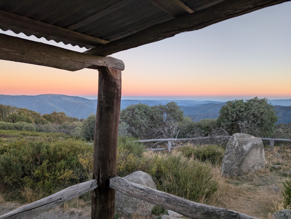
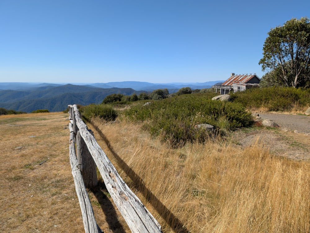
The hut stands high on a hill top in Clear Hills, in the Mount Buller region, overlooking the Alpine Ranges. The views are pretty decent. Hues and accents change throughout the day. Sunset and sunrise are especially gorgeous. This picture was taken from the veranda of the hut at dawn:
Inside Craig’s Hut:
Our route
Take note that the roads are closed for part of the year, due to snow and ice. You can’t get there by vehicle between June and November. The exact dates vary, depending on the weather. Before setting out, check the Parks Victoria web site for seasonal road closures.
We left the small town of Whitfield in convoy shortly after 9am and followed various tracks, primarily Burnt Top Track and Black Landing Road, to Craig’s Hut. It was easy, scenic driving for four-wheel-drive enthusiasts.
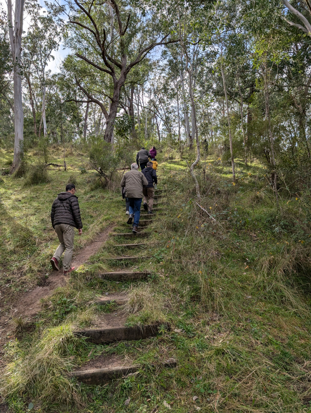
In mid morning, we took a break from driving to do the short walk (a few hundred metres) to Paradise Falls:
The trails in the Victorian High Country are surprisingly well supplied with dunnies. Dunny? That’s what the Aussies call a toilet! This one was near the walking track to Paradise Falls:
Here’s a taste of Burnt Top Track:
We crossed the King River at Pineapple Flat. The water level was low and, apart from a slightly tricky entry into the gully that leads into the river, the crossing was easy:
We reached Craig’s Hut at around 4:30pm.
Camping
We camped overnight in the campground near Craig’s Hut. The area was beautiful, tranquil, and, at an elevation of 1,450 metres, cold. The TC, bless her woollen socks, was shivering and shaking in her tent. Inside her sleeping bag, she wore thick socks, leggings, two shirts, two fleece jackets, a large padded jacket, and gloves.
Let’s finish off with one more photo of Craig’s Hut, taken soon after our arrival in the late afternoon:
In this post: Billy Goat Bluff Track near Dargo in Victoria, Australia, plus some lovely country and a river to camp beside.
This is the blog of Mark Wordsworm, the travelling worm. I’m a 40-year-old bookmark (give or take a few years) and I proudly boast my own Hallmark serial number, 95 HBM 80-1. You’ll probably want to read all about me and my Travelling Companion (the TC).
Today’s travel notes
Me and the TC recently spent a week and a half in the Victorian High Country, a landscape of mountains and valleys in the state of Victoria, Australia. On 22 February, we tackled a well-known four-wheel driving track in the area: Billy Goat Bluff Track.
The book I’m in
Jericho’s Dead by William Hussey. This is the second in a series about Scott Jericho, an ex police detective and member of a fairground family who seems to attract serial killers and other nasties. Highly recommended.
Recommended accommodation
Black Snake Creek campground on the banks of Wonangatta River.
Travel tips
Although Billy Goat Bluff track has been graded and is relatively easy driving, many of the tracks in the Dargo area are challenging. Pick your route to and from Billy Goat Bluff with care.
The photos
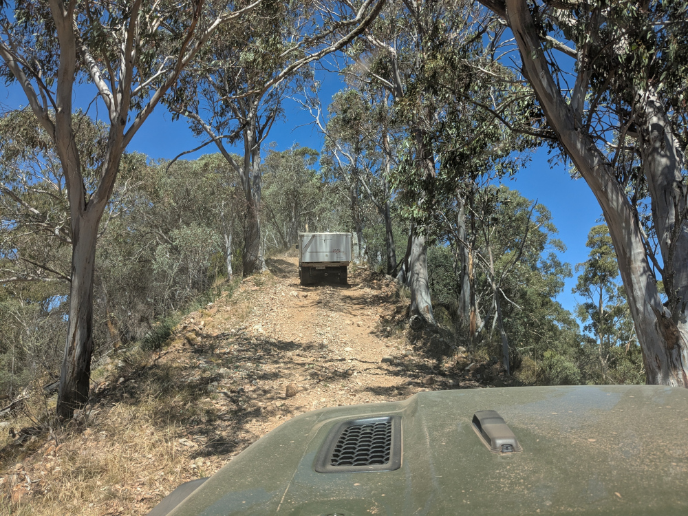
Crawling the tracks is what yours truly does best. So, let’s start with a video of part of Billy Goat Bluff Track, to give you and idea of what it’s like. The track was graded in late 2024. When we were there in February 2025, the driving was easy. But beware the steep drop-offs on both sides!
The TC, bless her cotton socks, talks about the Billy Goat Gruff track in the video. It’s actually Billy Goat Bluff. Rumour has it that the track got its name because to drive it, you need to be as agile as a goat.
The track features a steep gradient of 27%, climbing 1,200 metres over a distance of 7 kilometres.
The TC’s water bottle compressed as if it had been in a jet plane:
How long does it take? It took us less than two hours to drive the track. We started the track itself at soon after 9am and finished before 11am, with plenty of stops for photographs.
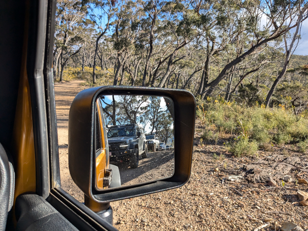
Here’s our convoy on the infamous ridge. Those edges give little margin for error or for passing an oncoming vehicle:
All round us, the peaks and valleys of the high country conspired to make us feel like insignificant worms on the face of the universe (oh wait, I am a worm, and decidedly not insignificant!):
Getting there: On the night before the trail, we camped at Black Snake Creek campground on the banks of the Wonangatta River:
We left the campground at around 8.30am and followed Wonangatta Road northwards for half an hour or so, winding along the banks of the Wonangatta River until we joined Billy Goat Bluff Track.
The lovely Kingwill Bridge on Wonangatta Road:
In case your appetite for Billy Goat Bluff isn’t yet satiated:
After finishing Billy Goat Bluff, we took a short detour to visit Pinnacles Lookout in the Miowera region:
There I met my cousin Dilly the Butterfly:
We then explored some of the tracks around Dargo, which turned out to be much more of an adventure than planned. We helped some folks out of trouble, which meant that we were still on the tracks late at night:
We found our way safely to Castleburn Creek campground at midnight, rounding off another day of happy travelling.
Speaking to the locals in Dargo the next day, we heard that many people find themselves in trouble on these tracks. The maps are not up to date, and as a result people don’t know what’s in store for them. Take care out there on the tracks, make sure you’re in a capable vehicle, and travel with some mates to help if you do run into a tricky situation.
In this post: Crossing the Macquarie River at Dixons Long Point, from the Hill End side. Plus some pictures of the historic town of Hill End and the Golden Gully gold-mining area.
This is the blog of Mark Wordsworm, the travelling worm. I’m a 40-year-old bookmark (give or take a few years) and I proudly boast my own Hallmark serial number, 95 HBM 80-1. You’ll probably want to read all about me and my Travelling Companion (the TC).
Today’s travel notes
Me, the TC, and Beetle the Jeep spent a night in the historic town of Hill End, New South Wales. Early the next morning, we set out to cross the Macquarie River at the well-known Dixons Long Point Crossing.
The book I’m in
Meru, by S.B. Divya. Excellent SciFi about a human and an alloy who fall in love, and about an experiment with human life on planet Meru. Alloys are post-human beings who share human and AI genes.
Travel tips
You’ll need a 4WD vehicle to complete this trip, because of the river crossing. It’s also good to be aware that the Macquarie River is a large river that can carry a significant volume of water after rain. It can be deep and the current can be strong enough to wash away cars and caravans. Always check the conditions before attempting the crossing.
The photos
Me at Dixons Long Point Crossing:
It’s a trifle tricky to decide which line to take when crossing the river. We were driving from the Hill End side to the Bathurst side. The TC had watched several videos of other people making the crossing. The consensus of opinion seems to be that you should cross on the rougher side of the rocks, not the smooth side. Basically, follow the line between the two rows of rocks. That’s what we did. It was bumpy but fun, and the river level was low at the time we made the crossing.
On the other side, the TC, bless her cotton socks, struck up a conversation with a man who looked as if he knew the area. He said that originally, the intended line was on the smooth side of the rocks, where a causeway had been built. But then a flood moved most of the rocks down off the causeway, which resulted in a deep hole at one end. The hole is about the length of many vehicles’ wheelbase, so you can get stuck, especially if the vehicle doesn’t have much clearance. The rougher line is now the recommended route, although it’s basically bedrock.
Let’s back up, now that you’ve seen the crossing, and start at the beginning of the day’s trip…
A night in Hill End
Before starting the drive to Dixons Long Point, we spent the night at Hill End Lodge:
The photo shows the reception area and restaurant of the lodge. We stayed in one of the cabins nearby. Early the next morning, the TC went for a stroll and came across a group of kangaroos. Most of them fled, but a big male stayed to keep watch, along with couple of others, one of which was a female with a joey in her pouch:
The TC, wise soul, decided that discretion is the better part of valour, and altered direction to keep away from the roos.
After breakfast, we paid a quick visit to the town of Hill end:
The Royal Hotel is another good option for an overnight stay in the town:
Golden Gully
We headed north up Hill End Road towards Ullamulla Road, and came across the enchanting Golden Gully:
Holes small and large pepper the eroded walls of the canyon. Many of them lead to shafts and tunnels dug by hopeful gold miners in the 1850s. The gold in this area is alluvial, washed down in several creeks that feed into the gully.
You can walk down the gully to the point where a sign warns of danger:
Ullamulla Road and Dixons Long Point
Me at the junction of Hill End Road and Ullamulla Road:
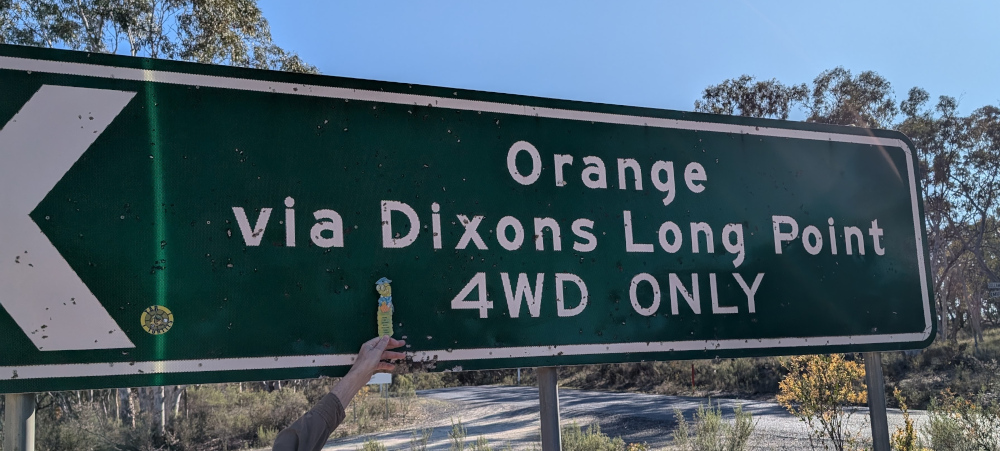
A sign warns of the nature of the upcoming crossing:
The road itself is an easy drive:
A sheep with a new-born lamb greeted us:
The next video shows the descent towards Dixons Long Point Crossing, on the Hill End side. At about 30 seconds into the video, a wallaby hops across the track in front of the car:
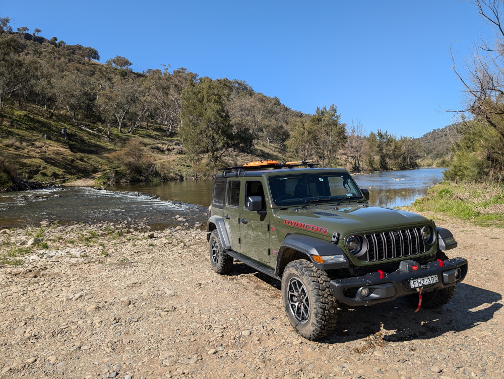
We stopped for a photo opp when we reached the water:
Tip: To see a video of the crossing itself, go back to the top of this post.
With her usual aplomb, Beetle the Jeep arrived safely on the Bathurst side of the river:
This is the blog of Mark Wordsworm, the travelling worm. I’m a 40-year-old bookmark (give or take a few years) and I proudly boast my own Hallmark serial number, 95 HBM 80-1. You’ll probably want to read all about me and my Travelling Companion (the TC).
Today’s travel notes
Me, the TC, and Janet the Jeep recently drove across country in the Blue Mountains area, from Little Hartley to the Jenolan area. The trip included Coxs River Road, Ganbenang Road, Cullenbenbong Road, Glen Chee Road, Six Foot Track, and Black Range Road.
The book I’m in
No Time for Goodbye, by Linwood Barclay. A psychological drama packed with plot twists. Much like a 4WD road.
Travel tips
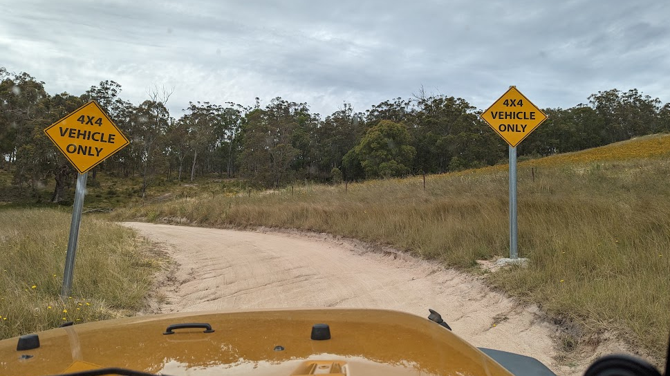
You’ll need a 4WD vehicle for most of this trip. The first part, before the turnoff to Coxs River camping ground, is fine for 2WD vehicles. But you’ll need a 4WD to get down to the camp site, and then back up again to follow the rest of Glen Chee Road.
The photos
Me at Coxs River camp ground:
The TC, bless her woollen mittens, decided to focus on the river rather than on yours truly. Sometimes I disagree with her choices.
We started our trip at the Little Hartley end of Coxs River road. The first hour or so is a lovely, meandering route, part sealed and part dirt. The views are of rolling hills and dales. And cows. This shot is from a trip last year:
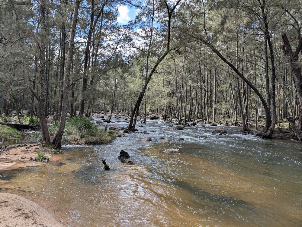
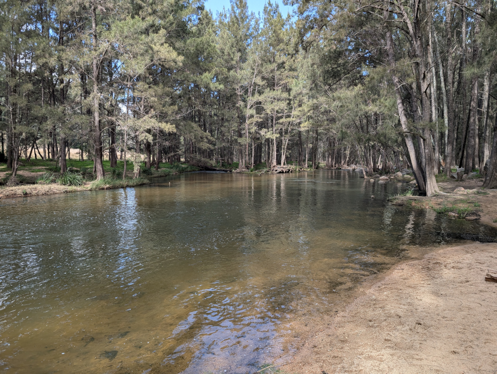
At the camp ground, Coxs River is wide and rippling:
Looking in the other direction, the river widens out into tranquil pools:
We took a walk from the camp ground towards Bowtells Swing Bridge. This is a 20-minute walk through the forest, with views of the river gorge on one side:
Bowtells Swing Bridge is currently closed for maintenance. It’s been so for a long while: years. This worm has never seen it open. Crossing the bridge could be a wild ride, swinging over a deep river canyon:
If you turn left when you come up the road from the camp ground, you enter the 4WD-only part of Glen Chee Road:
See what it’s like driving Glen Chee Road near Pass Gully. This clip shows some track erosion, but it’s an easy drive when dry:
Further along Glen Chee Road, descending towards Alum Creek Camping Ground:
The road leads through pretty forest:
Despite it being mid winter when we made this trip, yellow flowers were sprinkled across the bushland:
In the next video, we cross Little River. This is one of several river crossings on the trip. They’re not hard, provided the river is low and your vehicle is a capable 4WD.
This is the blog of Mark Wordsworm, the travelling worm. I’m a 40-year-old bookmark (give or take a few years) and I proudly boast my own Hallmark serial number, 95 HBM 80-1. You’ll probably want to read all about me and my Travelling Companion (the TC).
Today’s travel notes
Me, the TC, and Janet the Jeep took the long way round from Sydney to Brisbane, to explore a bit of the inland countryside. On the second day of our trip, we drove from Glen Innes to Grafton via Old Grafton Road and Old Glen Innes Road. This is a beautiful route. The road is partly sealed (bitumen) and partly unsealed (gravel and clay). It’s in good nick all the way from Glen Innes to Grafton.
Read on to get a feel for this trip.
The book I’m in
Force of Nature, by Jane Harper. A book that starts well and gets better and better.
Travel tips
It’s most comfortable to travel from Glen Innes to Grafton, rather than in the opposite direction. The road is narrow, the edges unguarded, and the side falls away steeply along much of the way. If you’re on the side that drops off, it can be uncomfortable when you meet a vehicle coming towards you.
Recommended accommodation
Apartments on Grey in Glen Innes. Warm and cosy, with everything you need for a comfortable stay.
The photos
Me at the turnoff to Old Grafton Road on Gwydir Highway:
The first part of Old Grafton Road is sealed (bitumen). But don’t be fooled! It’s scenic — meaning, it’s steep, winding, and narrow. This video gives a taste of the road. Part way through (at the time stamp of 40 seconds to 1:03), the TC stopped the Jeep to take a shot of three wallabies on the side of the road:
The road descends swiftly to cross Diehard Creek:
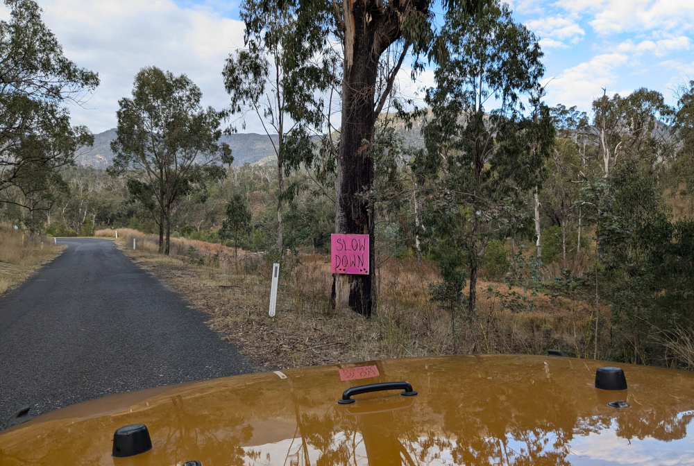
A helpful soul has posted warning signs along the road:
Mann River Nature Reserve is a pretty spot to take a breather:
Janet the Jeep was raring to go when Old Grafton Road changed to dirt:
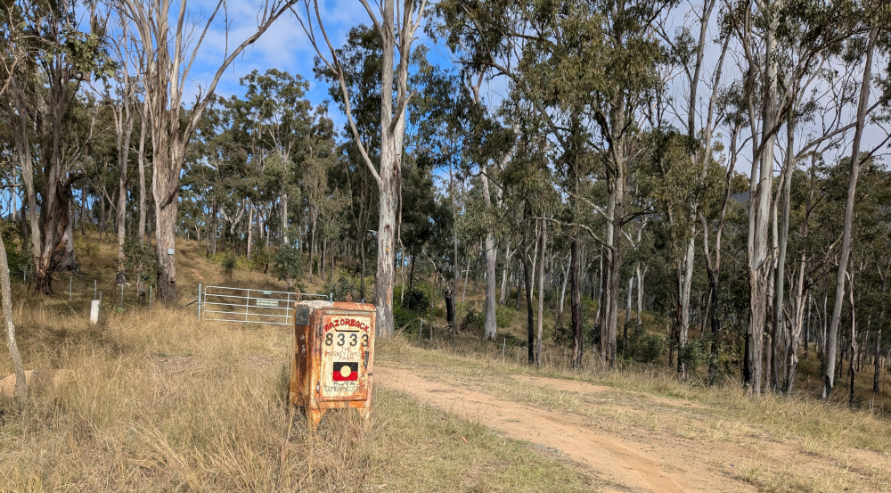
At times, you’ll come across an entrance to a family farm:
Here’s another homestead, further along the route:
Much of the road runs alongside Boyd River. Sometimes it’s at the level of the water, sometimes high above. It’s narrow and slippery — take care!
Just around a corner, you’ll come across Dalmorton Tunnel. The tunnel is 20 metres long, 4 metres wide, and has a height clearance of 3.2 metres.
Me at Dalmorton Tunnel:
The tunnel was built in the 1860s by civilian contractors. (Some reports say that convicts built it, but that’s probably apocryphal.) The tunnel was blasted out of solid rock, then trimmed with hand tools. (Again, some reports say it was “hand hewn”, but that’s probably not completely accurate either.)
Here’s Janet making her way through the tunnel, hogging the limelight as she does:
Boyd River offers some picturesque spots for coffee and a photo:
Next is a cow closeup, for people who like cows. This worm avoids them, as they’re apt to put those big feet where they’re not wanted. But the TC, bless her cotton socks, liked the way this cow was cosying up to the pink bush:
On Old Glen Innes Road, a wide, low bridge crosses the Nymboida River:
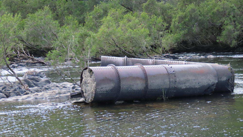
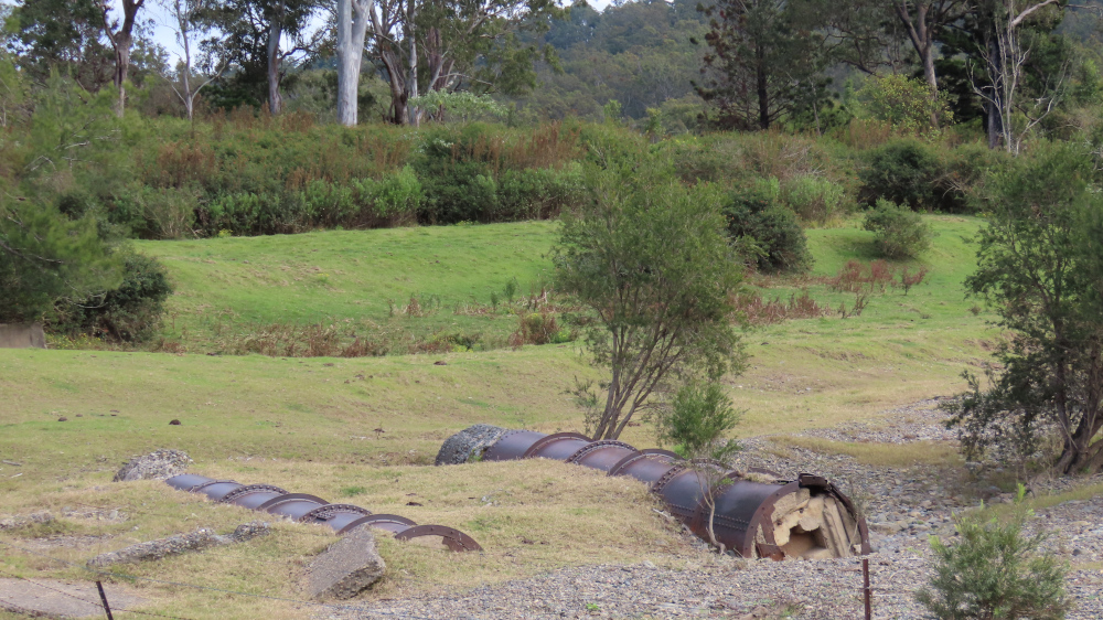
Scattered around, in the water and on land, are sections of a huge pipe, filled with concrete:
Perhaps the pipes formed the scaffolding of a previous bridge? Who knows:
The TC, bless her woollen mittens, is keen to finish off with some shots of the road. So, for those enthusiastic road-farers out there: